Last weekend I went to Dartmoor and this is the first of two posts on the walks I did. It was a joint Girlguiding Region walking weekend, the aim of which is to run a level 2 walking training but there’s room at the centre for a few extra so it’s open to leisure walkers as well. I did my level 2 training in 2014 and now I’m slowly and painfully collecting 20 logbook walks before I can do the assessment course and apparently the “supported walk”. If I haven’t mentioned it lately, level 2 means Open country – think Dartmoor, Exmoor, Peak District etc – and a logbook walk has to be at least 10km or five hours. I need 20 walks, of which minimum 10 must be in level 2 country and the remainder can be higher, one must be in bad weather and I must be leader for at least 2.

We were staying at Broadleas, recently rebranded as Dartmoor Activity Centre. It used to belong to the Boys’ Brigade but there’s no mention of that on the new website (Does the Boys’ Brigade even still exist? My grandfathers were involved with it but I can’t imagine it can compete with the Scouts in this day and age). Anyway, it’s got a largish open area where we set out tables and benches and there are a few sofas and armchairs so the training group can squish into the far end. Then there are small dorms for the “grown-up” – the ladies running the training, looking after the trainees and the – shall we say, “established” members of the leisure walking end of the weekend. The rest of us crowd into the big bunkrooms, where an astonishing number of people claim to have serious leg conditions in order to get a bottom bunk, considering we’re here to walk on Dartmoor, of all places.
Usually we spend the evening before planning our route for the next day, which involves spreading an enormous OS map across the table, planning and arguing, writing it down on a blank routecard and then waiting for some poor idiot to do all the sums before we have to adjust it all. This time, though, we were a small group – four ladies had come together, then there was Anne, one of the established members, and me. The Four had come with planned and printed routes, measured in miles, drawn out on 1:50 000 map bases and with a thick blue line that obscured half the features we’d need to navigate them. They’d planned a “mini ten tors” for Saturday, which was a little over 10 miles and I still can’t quite figure out which ten – Haytor Rocks, Saddle Tor, Rippon Tor, Top Tor, detour out to Pil Tor, Bell, Chinkwell & Honeybag Tors, across to Hound Tor and then back via the bridleway. Are they counting Greator Rocks? Smallacombe Rocks? Anyway, I wasn’t overly enthusiastic for a 16km walk and neither was Anne. Anne has done her time as a qualified Mountain Leader and has walked and adventured all over the world. If she’d written books about everything she’s done, she’d be regarded as Dervla Murphy was, I reckon. But while she’s still quite capable of strolling 10km across Dartmoor with me trailing in her wake, “if I wanted to take up tor-bagging, I should have started it years ago”, so she opted to cut out the detour to Bell, Chinkwell and Honeybag Tors, which is an out-and-back again and rather than go up to Hound Tor again, to cut across the field below, which should take it down to a more manageable 10-12km, at her own pace. So I joined her.
Now, this is basically exactly the same walk I did almost exactly two years ago on my own, only in the opposite direction. But it’s taking a slight detour to three new tors and it’s cutting out one more. I’d rather have gone somewhere else but I’m having a lazy weekend – someone else has done the planning and someone else will do the leading and most of the navigating and as I do all that when I go on my own, I’m happy to be lazy occasionally.
I misjudged the weather. I thought it was going to be a bit miserable so I wore my softshell, packed my fleece in a drybag, full waterproofs and fleece hat and mittens. Soon realised my mistake. I had to put on the fleece hat to keep my head and ears from getting sunburn and I couldn’t take off the softshell because I had nowhere to stow it.
The climb up Haytor was a bit of a rough beginning. I’m bad at climbing hills. Walking across the Saddle Tor is no great difficulty, though, and I kept up with the group pretty comfortably. But Rippon Tor is one I’ve roundly rejected at least twice before. It’s only a little bit higher than Haytor, just 16m higher, but it looks higher. Perhaps it’s more geographically prominent. Anyway, we took a bit of a zigzag up the side and although it was harder work than I’d opt to take on myself, I got up there. Then down the other side to Hemsworthy Gate. I guess if I’d really wanted to, I could have cut across the corner and met them at the car park. Top Tor was a pretty easy walk from there. Anne had considered cutting Pil Tor, since it’s another pointless out-and-back but when we looked more carefully at the map, it’s only 2m lower and the extra 2m of ascent back up to Top to continue the walk was no issue. That was three new tors to me – if only I could find a good way to track & tick them all!

Then we walked across to Bonehill Rocks. From here, Bell, Chinkwell and Honeybag loom, a great big chunk of hill with three clusters of rock on its steep slopes. I did Bell and Chinkwell two years ago so I was in no hurry to climb a massive hill and then go straight back down again to not even tick off new tors, so I was more than happy to join Anne in strolling across to the corner of Holwell Lawn. Here, we weren’t sure where we were going. We wanted to join the path that crosses through a wall just south-west of Greator Rocks but when we got through, it’s a nature reserve with marked paths. So we decided we’d make it up as we went along, see where the nature reserve threw us out. We strolled through the woods, along boardwalks, through ferns and down to Becka Brook, which runs along the bottom of quite a steep valley. I knew we wanted to cross Becka Brook further to the north-east so it was kind of frustrating that we’d encountered it now because it meant we’d have to climb all the way up the north bank and then again all the way up the south bank.
The nature reserve threw us out on a path that wasn’t marked on our map but is clearly well-known and much-used, judging by the human and canine traffic bustling along it. It’s incredibly busy considering how steep it is and the fact that the nearest road is a good kilometre and a half away. The trouble was, what with it not being on the map, and the path through the nature reserve also not being on the map, we weren’t 1000% sure either where we were or where the path was going to go. In fact, I’d been a bit shocked when Anne had produced her OS Locate app. Anne and her ilk have always been very anti-technology – we learn paper map and compass and phones, apps, GPSs and the like have always been very frowned upon. But apparently Anne is more pragmatic than that, and if you find your route going through an unmarked nature reserve on an unmarked path and you don’t know where you are, why not use your app to at least get your grid reference?

We emerged, eventually, at Greator Rocks. To be honest, given the brook, the grid reference and the massive faces of Holwell Tor and Smallacombe Rocks opposite, we’d figured out more or less where we were and knew we’d pop out at Greator sooner or later. Then it’s onto the well-marked bridleway, down the very steep hill back to Becka Brook and up the other side to Smallacombe Rocks. Which is when my knee began to misbehave.
I’m not at the age yet where I have major regular knee problems but in recent years, it does start to feel extremely uncomfortable if I go steeply downhill for long. It’s not something I’d ever have thought of happening and yet I do know it happens – I possess a knee brace of a kind, I’d packed it and by dumb luck (it didn’t fit in my first aid kit) I had it in a pocket I could reach without taking my bag off. I strapped it on, carried on to the bottom and once I’m going uphill again, my lungs and legs protest quickly but the pressure on my knees changes drastically and that particular pain vanishes.

That climb up to Smallacombe is hard work. Anne said she knew as she went up that she didn’t have another climb in her. Luckily from here it’s all downhill. Nice easy walk across towards Haytor, join the stone tramway, follow it round and then go downhill wherever convenient to get back to Broadleas. My knee did start hurting as we went down but at that point we were close enough that I could have hopped or crawled home. The one drama was the adder.
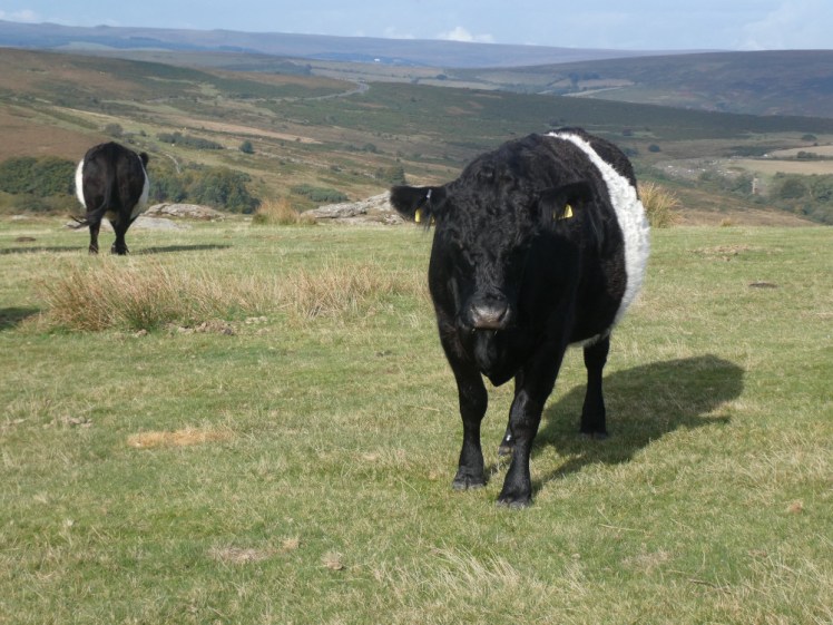
It was right on the path. Anne nearly stood on it. We both stopped dead and I breathed “Is it an adder?” – it had a quite distinctive pattern on its back and it was hissing furiously. It disappeared into the heather but continued to hiss and we continued to stand there. I wondered if Anne was going to poke the heather with her poles and I really hoped she wouldn’t. I’m not a fan of wasps, I can cope with most spiders and I love cows – the walker’s living hazard – but I hate snakes. It was so small and so secretive and so so dangerous. What do I do if Anne gets bitten? Have I got signal to call an ambulance? Do I have to run back to the visitor centre? Is there signal there? Should she limp back to somewhere accessible for the ambulance or should we stay still? Luckily Anne is far more experienced in everything than me and she’s not stupid enough to poke adders and risk a bite. We merely walked away when it stopped hissing.
That was 12.49km and it had taken us six hours and thirteen minutes. My GPS tracker says we were only actually moving for 01:39 but that’s definitely not right. The rest I’ll go for. We climbed 1223.5 in all and our highest point was 473.5m, which is the height of Rippon Tor plus the fact that it was clipped to my backpack straps, thus a little above Rippon Tor’s level. I’m less convinced that our average moving speed was 7.4km/hr – 2.0 as our total average speed sounds more accurate. I generally budget for 3km/hr when I plan a route, which includes breaks and stops, but there was quite a bit of climbing on this one so I’m ok with the average speed being lower than usual.
In the evening, the training group go out for a night nav, to practice their skills when you can’t see anything. I’m always tempted to go and I never do. Last time it was raining like it had never rained before but this time it was clear and relatively warm. I didn’t go. My knee wasn’t working properly, my feet felt a bit flattened and I was quite happy to sit in a reclining armchair with my blanket. And that was Saturday.
If you have an OS Maps subscription, by the magic of the best maps in the world, you can see my route here and you can even do a 3D Fly-through, which will give you an idea of what it looked like and what the terrain was like. If you don’t have an OS Maps subscription, it’s here as usual on Wikilocs and as a Google Map:
