Today I’m going to investigate a wood! I know, this is the second A Single Map post in a row, although I didn’t mention it beyond the title last time. Actually, I went to Tarrant Rushton Airfield twice (well, three times – we went again on Friday!). I didn’t mind. We went in November which is when I wrote the blog but I couldn’t publish it because I didn’t take the right photos, so I was quite pleased when Dad suggested we do it again. So to quickly go over A Single Map – it’s an idea I’ve shamelessly stolen from explorer and microadventurer Alastair Humphreys, to get a custom OS map of my local area and explore it, to spend our outdoors time getting to know our own home better instead of thinking that “exploring” can only be other places.
This is my fourth A Single Map and like the first and second, we’re off to a wood. We don’t always go to the woods but they tend to make interesting walkable places, usually with paths, whereas the more open countryside tends to be farming land as owned by farmers, which means we can’t really walk on most of it. Actually, funny I should mention that…
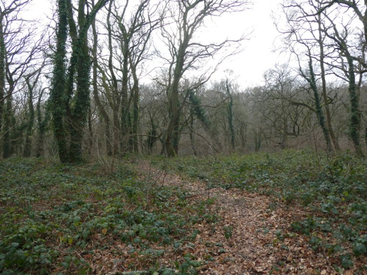
This particular bit of woodland is owned and managed by our local wildlife trust. You’d hardly notice that there’s a wood, let alone an accessible one. It’s hidden behind a garage-abandoned mess-old people’s caravan park and also behind the village. The main entrance is a track just before the houses, which is pretty much invisible and unmarked until you’ve walked into someone’s private mini-road. Not having a clue where it is, we parked in a lay-by, followed the main road up for a quarter of a mile and then went into the woods via the dogwalkers’ car park. Despite passing it every day on my way to work, back in the days when I went to work, we couldn’t seem to find this little car park but we could see a track behind a gate leading into the woods.
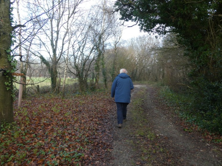
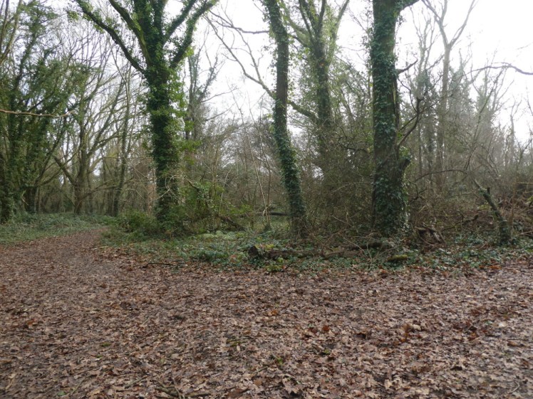
These are not welcoming woods! In episode one, we found ourselves in a proper gravel gated car park belonging to the Woodland Trust, and there was a big information board telling us what we could see and what marked trails we could follow, depending on what natural delights took our fancy. In episode two, we were in Forestry Commission land, and although there was no board and no marked trails, there were plenty of wide paths and a sense that you were welcome to enjoy the great outdoors. Here, the first thing we saw was a dilapidated sign that once said “PRIVATE LAND – TRESPASSERS [something short but unreadable]”. As we were 99% sure it was separating us from a wood we were allowed in, by only about ten metres, we ventured past it, went round a corner and immediately found ourselves face to face with a sign declaring that this was wildlife trust land. We were ok here.
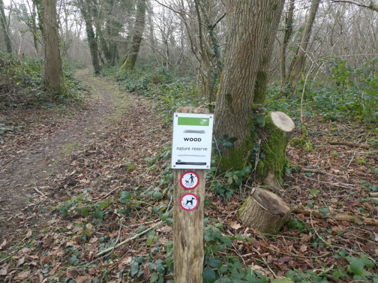
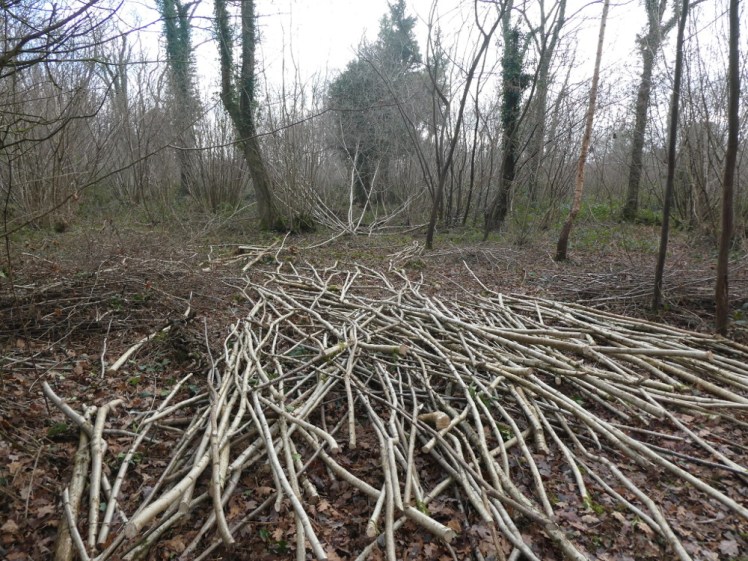
Fifteen or twenty minutes later, Dad remarked “Well, it does seem to be… just a wood”. And it is. It’s supposed to be absolutely carpeted with bluebells in the spring and it describes itself as an “incredible wild wood”. But in January, it’s just a wood. It’s clear they’ve been managing the woods – there’s piles of coppiced hazel and cut-down trees – but this isn’t a wood that’s really emphasising the enjoyment and appreciation of nature for the general public. It might have been nice to see some discreet signposts marking a route and it might have been nice to see some information about the birds and animals. I spied a squirrel in the distance and some small songbirds flittering about, too quick for me to figure out anything more than “wings”.
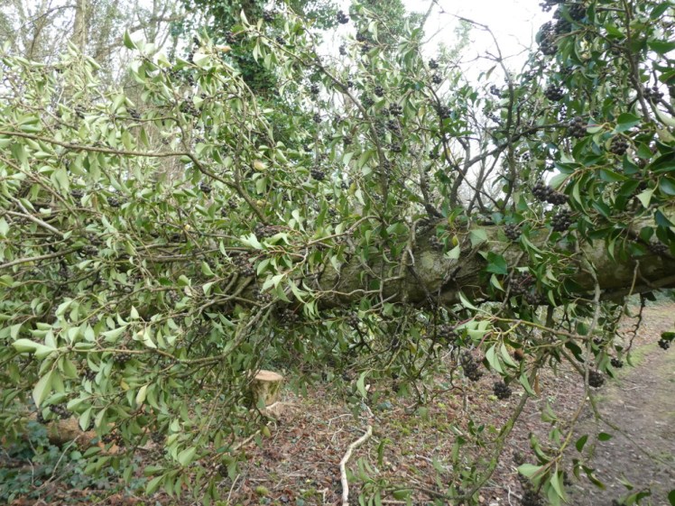
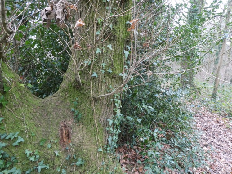
A tree had fallen across the path. It looked like it had split into two trunks six or ten feet up and one of the trunks had broke off. I’m still very new to tree identification so I haven’t got a clue what it is but Dad thought it was very well wrapped in some kind of parasite. Google has not helped and neither has my British Tree Guide. I’m pretty sure it’s not mistletoe, because doesn’t that grow in clumps rather than long ropes? Also, this had clusters of berries that seemed to be dark green and in the process of turning black. It might be elder. It might be dogwood. It might be privet. Or more likely, it isn’t any of them.
Before long, we’d made our way around the back of the caravan park to the information board at the main entrance. We hadn’t quite taken the direct path from the end we’d entered down to here so we’d added a little distance but the woods are only about six hundred metres long, so it hadn’t taken long. At its widest point, it’s about six hundred metres wide too. There’s a big clearing in the middle, which turned out to be a bit of golf course. That’s not entirely surprising but the fact that it’s surrounded by woodland on all sides is a bit surprising.
What we discovered from the board is that only half the woods, the area roughly on our side of the golf club area, belongs to the wildlife trust. So we decided we’d walk through the woods and up to the public bridleway on the other side. I’m not entirely sure whether we’re supposed to. It’s not access land and it’s not on green dotted or dashed public rights of way but it was on marked black dotted paths and there was nothing stopping us, or warning us, from going up through the trees, trying to match the paths in the wood with the paths on the maps.
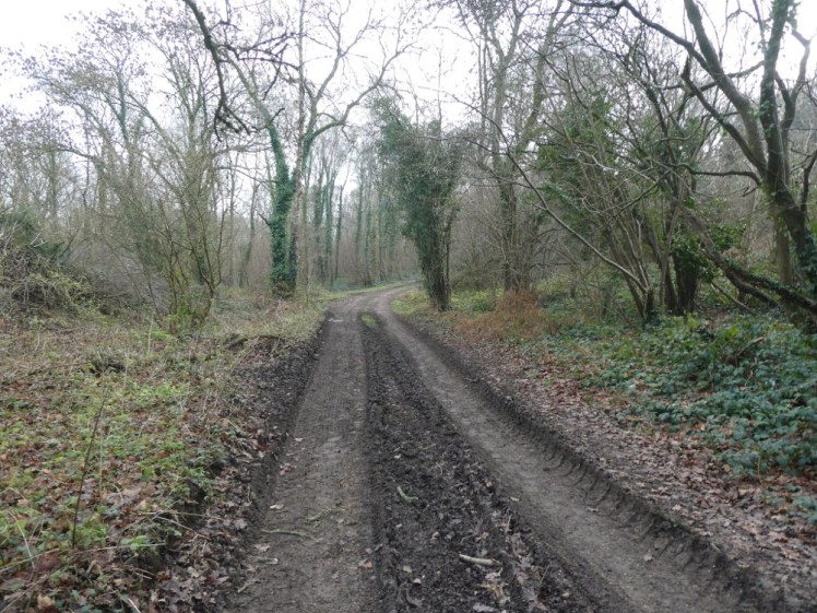
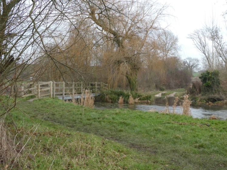
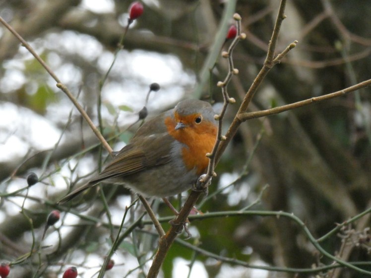
Four hundred metres later, we were on the public bridleway and rather than follow it round the edge of the woods and back to the way we’d gone in, we went in the other direction, down a gentle, slightly muddy hill, towards what was marked on the map as a ford. As we went, Dad commented that it didn’t seem many horses went along the bridleway. Five minutes later, I spied a deep arc in the mud – the remains of a hoofprint! Just ahead, there was another bit of hoofprint and we kept seeing them as we went along. We met a robin – fiendish things, they wait until I’ve got my camera focused on them and then they flutter off before I can press the button. On the horizon right in front of us, there was a line of leafless trees, which looked like they’d been sketched in with a fine-tipped pen and underfoot, you’d occasionally spot a bit of something flinty. There was more of that unidentifiable tree/tree parasite with the dark berries. There seemed to be flint half-buried in the mud. This is chalk landscape but I’ve done some hillforts within the scope of my single map and I found pieces of flint in them so I think it’s almost definitely possible to find it around here in other places.. Which reminds me, I brought back a big chunk in the summer, washed it in the kitchen sink and haven’t seen it since.
At the bottom of the hill was a road. It’s quite a small road, the sort where you’d probably prefer not to meet another car coming the other way. The “main road” it comes off is only a four-digit B-road, for an idea of how small and quiet these roads are. We’d been sceptical about the so-called ford but it turns out that’s exactly what it was. There’s a tiny village here and technically, this is a way in. There’s a very small road on the other side of the river. My little car would be swept away trying to drive into the river, up the river and then out onto the road. I’ve been into glacial rivers in Iceland in expedition trucks and modified monster trucks and they’d treat this as if it was an ordinary tarmac road. Anything smaller than that would probably struggle, up to and including big ordinary 4x4s.
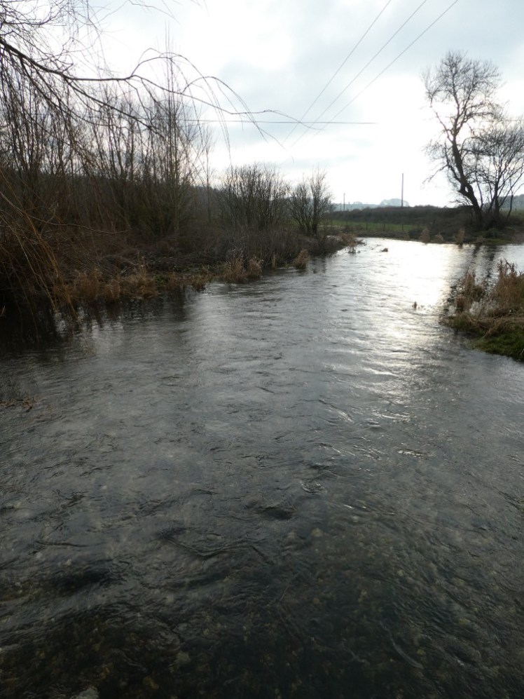
There were two kids with their parents and as far as I could tell, they were measuring the depth of the river. They were prodding it with sticks and they also had long red ropes with weights at the end and I could hear “Seventy-two!” being yelled as we approached. It doesn’t look nearly two and a half feet deep, if 72cm was what I was hearing. It’s absolutely crystal clear, give or take the muddy bits at each side of the road going into it. It’s pretty as well, although my photos aren’t very convincing about that.
We turned round and walked back up the slightly muddy bridleway. This time I managed to get some photos of the robin. At the top of the hill, back in the woods, there was a narrow track leading away. To follow the bridleway back to the proper path and then walk back down where we went or to take the narrow woodsy track? We took the track. It went up and down a bit and it was narrow but it was definitely a path. Perhaps in the spring or summer, it might start to get a bit overgrown but it’s fine in January.
Then we reached a wider path, a proper path. We looked at the map and figured out where we were and as we did, two figures approached from the tongue of wood sticking out into the field. This was a landowner if ever I saw one. He had two muddy spaniels but was dressed head to toe in pristine green tweed and was carrying a long stick. He was walking up a field but he could have been walking out of a Jermyn Street clothiers. I only have to walk to the top of my street and back to start looking muddy and crumpled and he looked like he was doing a Country Life magazine shoot. He absolutely stank of old money.
He’d seen us consulting the map and looking for the path marked on it that should lead down the side of the woodland back to the signpost and called “Are you looking for the footpath?” We replied that we thought the path in front of us should take us where we were trying to go. He told us two or three times that there had been no path where we’d come from. We knew that – we’d gone off the path to follow that rough track and… yeah, ok, we were out of the nature reserve area. I tried enthusiastically adding “It looked like an interesting track to explore”, to which he said “Hmm… it’s private”. That’s a disapproving hmm. He didn’t tell us we shouldn’t be there, or to get off his land – I assume it’s his land, given that the bit of field he was walking up isn’t nature reserve and the way he was dressed – but I think he disapproved of us being off the path and I just got the feeling that he’d have the path closed off if he could. We scurried off down the woodland edge path and two hundred metres later, we were slipping through a gap in the trees onto another narrow up-and-down path that was firmly within the nature reserve and which definitely counts as permissive path where we’re allowed to be.
I’ve googled and double-checked and it’s absolutely impossible to know whether we’re allowed on those paths without going to the council office and consulting the local Definitive Map. Ok, we probably shouldn’t have cut through the woods on the track but I have no idea where we stand legally on the paths. Technically they’re “road, other” but it seems access or not is down to the individual road and you just have to know. I will say that despite his tone and his pristine tweed, the wealthy landowner was quite tolerant of us, directing us back to the next path rather than yelling at us but he was disapproving and I genuinely have no idea whether we were allowed to be where we were at the time or not. Access and permission can be thorny, especially in a wood where no one’s put any signs to differentiate between nature reserve and private land.
Anyway, five or ten minutes later we were back at the information board at the official entrance to the nature reserve and we decided to go out of the gate and into the village and then walk back up to the car. On the other side of the gate there were two houses. If we’d approached from here in the first place, we’d have taken this for a “private road, no turning” type of place. There was a huge barn-style house and a smaller bungalow-style house that’s probably supposed to look like the old stables. To our left was a big patch of well-tended grass with a bench on it. Were we allowed there or not? We still don’t know but given that it was well-tended, given the thick hedge separating it from the road and given the proximity of the huge house, it seemed reasonable to assume that’s their back garden.
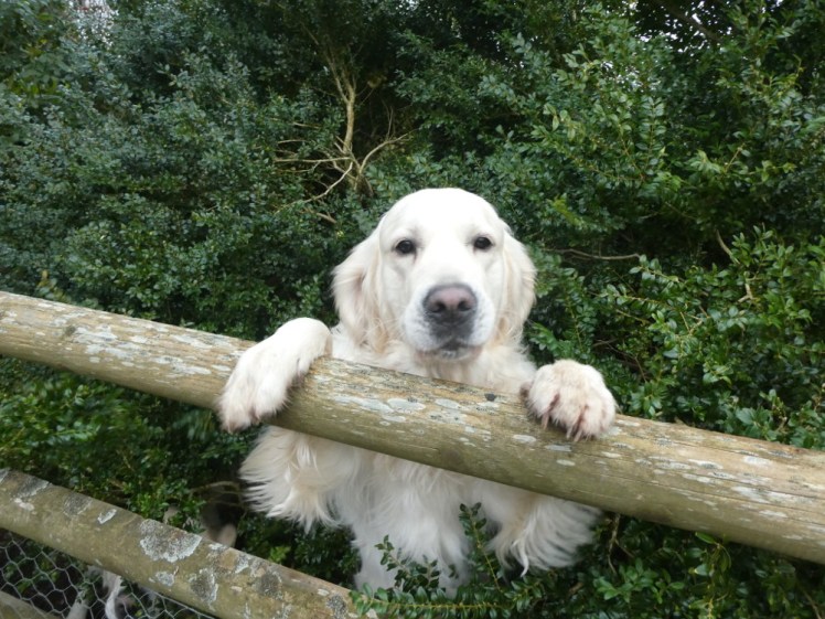
We were still debating this when I heard a rustle in the bushes behind me. I turned round. Behind us was the smaller back garden that’s clearly attached to the huge house, with a wooden fence around it and blocked from view by large rodis, and underneath the rodis, climbing the fence and frantic for attention, were two large and loud and licky golden retrievers, both barking fearsomely but also clearly very friendly and mostly desperate for us to say hi. Their owner appeared at the back door to call them off and they followed us along the fence as we walked back out of the not-private road and onto the main road (well, the four-digit B road). A surprisingly stiff walk up the grass verge and we were back to the car.
Back home, I finally gave in to sense and ordered a duplicate of my custom map so I could draw on it and get a better idea of how much of it I’ve actually explored. I’m looking forward to discovering that I’ve hardly touched my local area and have plenty more to do in 2021.
