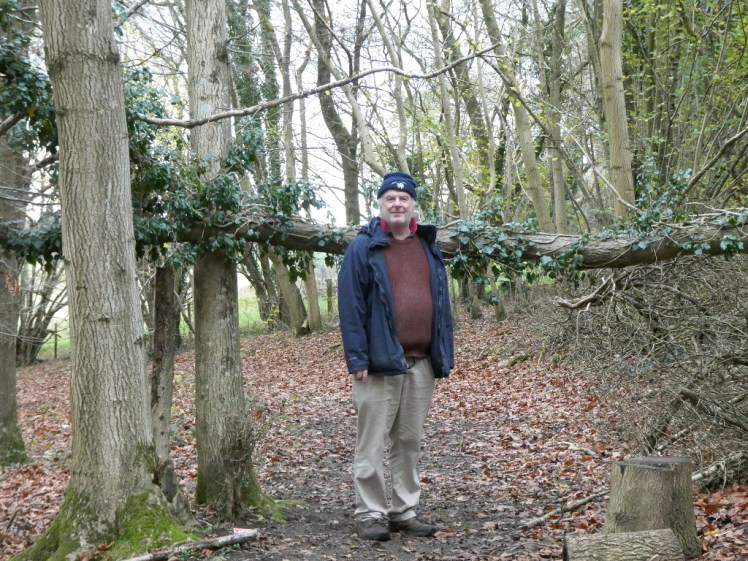
In this second “episode” of A Single Map, I’m taking my dad out for a walk in the woods.
We’ve done a lot of walking this year. Headlands, several hillforts, the local thanks-Dr-Beeching trailway, around town and even a couple of fort-less hills. But woods are new. We didn’t really realise there was much in the way of woods nearby but of course, that’s part of the point of having and exploring a single local map. It turns out there’s a good amount of woodland within 20km of home.
This particular bit of woodland is managed by the Forestry Commission, who helpfully wrote a report on it in 2014 and since that’s about the limit of their engagement with the public, let me give you some of the highlights. This is 90% semi-natural ancient woodland. That means it’s been continuously wooded since at least 1600AD, although “the majority” of the trees are only 50-70 years old, which isn’t even ancient in human years. 1% is plantation on ancient woodland. I thought there was a lot of plantation but actually, we didn’t see much and the map agrees – lots of coppices but little to nothing labelled as plantation. 50% of the woodland is beech and 30% assorted conifers. We didn’t see all that much conifer.
You see, unlike last time, this isn’t open access land so we have to stick to the public footpaths and bridleways. These form four loops, one inside another. We took the second loop and most of the conifers are within the fourth loop.

So, off we went into our majority-beech wood. The path at first was nice wide flat gravel, nice and easy, passing some plantation on the left. Trees just don’t grow in nice neat rows and columns by themselves. At the bottom of this nice neat slope was a big hole and naturally, I investigated. I don’t know much about trees (yet) but I know holes in the ground. We all have our specialisations. The ground here is chalk and this was simply a sinkhole. Chalk is pretty water soluble and the underlying ground had dissolved and everything above it had collapsed. That’s why you don’t find interesting caves in chalk – any baby cave system collapses on itself pretty quickly.
Down this path, there was birch and beech and the first hint of frost – or at least, the first I’d seen. Maybe it’s happening overnight by now but I don’t go out first thing and there’s no sign of it by the time I’m sitting at my desk in front of the window at 9am. By this time of year, I was expecting to be getting tired of my daily walks, that it would be too cold, dark, wet & miserable by November or December. To my surprise, it’s not. Well, it’s dark – I go out after work at 5pm and the world is very much transformed from my 5pm walks in August, but it’s not really cold yet. I generally want a jacket and a hat but I’ve not frozen yet. On my daytime walks, like this one, I generally get too hot quite quickly and have to remove layers, which is the main reason I always take a biggish but empty bag with me.

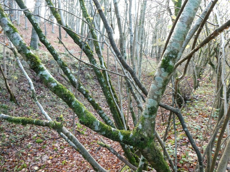
This late in the year is a bad time to try to learn trees. The most distinguishing feature is leaves and of course, a lot of them are pretty bare right now. The beech along the path had hung on to just enough leaves for me to identify it – the leaves are the shape of the Elven brooches Galadriel gives the Fellowship, only don’t look to the movies to see what shape that is because the movie brooches are not beech. I can recognise birch by its bark rather than its leaves – it’s pale, somewhere between cream and the silver-white of Instagrammers’ hair, and it has a kind of horizontal grain appearance. If I didn’t already know silver birch, I’d have learnt it from the amount of it I’ve seen up north. I suppose people picture towering pines when they picture Arctic forests but in my experience, it’s a lot of birch and larch. Larch is a tree I don’t know yet but I’m sure I’ll meet it eventually.
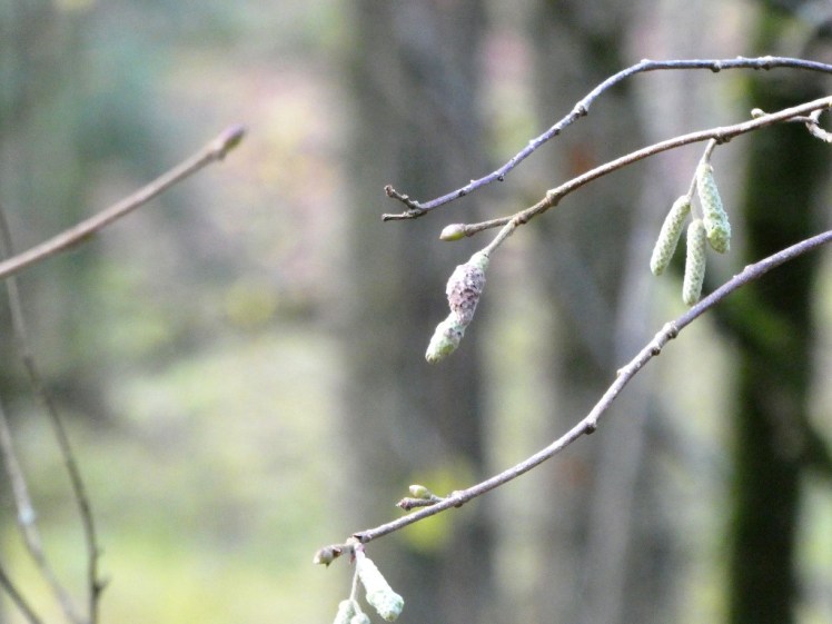
We found a tree I didn’t know. It had tiny catkins, so small you only notice them if someone else points them out, and it had literally three or four leaves. I brought one of them home, pressed it under a few books and it’s now in my nature notebook. It’s fairly round although it has a point of a kind, the edges are jagged and it’s bright green. It also smells incredibly green. I was astonished at how well a single leaf could scent my entire office while it was drying. Between the leaf and the catkins, I tracked it down to hazel. I should know hazel. I was taught to whittle a couple of years ago and we were advised that hazel’s a really good wood for it. How many times have I been out looking for hazel? I notice coppicing but I don’t notice leaves. Hazel lives about 80 years left to its own devices but if it’s coppiced – if it’s cut back to ground level every year so that it grows multiple smaller stems like an upside down umbrella – it can live hundreds of years. That coppiced wood is great for whittling but do not go coppicing trees that don’t belong to you. I pick it up off the ground and frequently find it’s damp and mouldy inside. But anyway, now I have hazel alongside birch, beech and oak in my internal tree-cyclopedia.

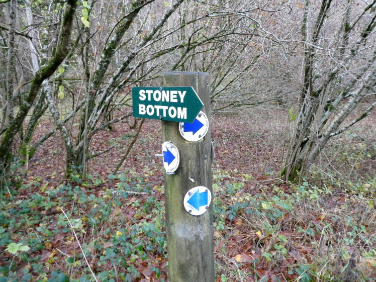
We came to our first junction. Given that I wasn’t even 100% sure which path we’d come down, let alone how far along it, my compass didn’t give us much of a clue which way we were supposed to go. And then down the muddy fork, we spotted blue arrows on a post. That’s largely how the walk went. If there was a junction, the correct way was always the narrower muddier way.
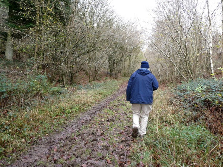
Our second junction took us up a long but fairly gentle hill, this time in mud almost as thick as last time. No more time for looking at the trees; now we needed to watch our feet all the time, which was how we came to discover something else – hoofprints. In the churned mud, it was impossible to figure out whether there were any tracks from any wildlife but there had definitely been horses along here and not too long ago.

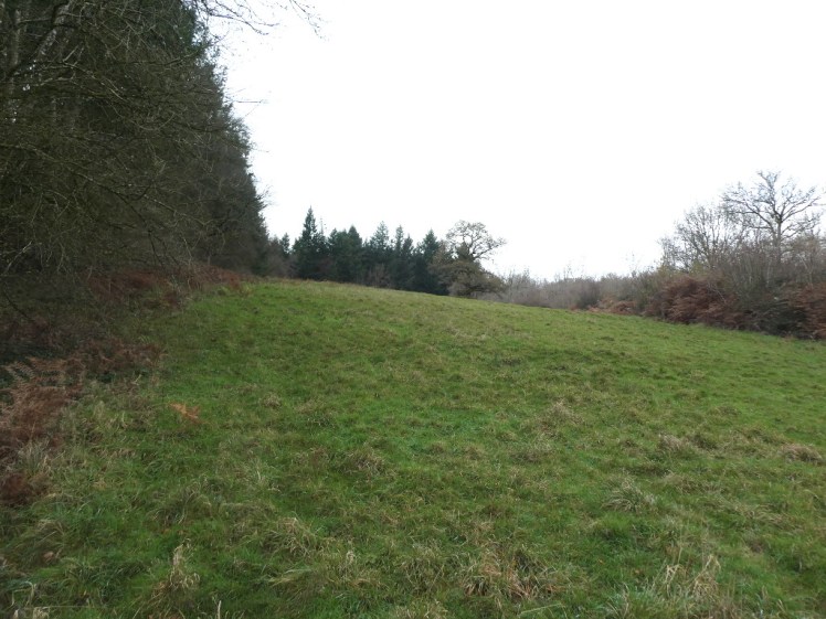
Having the map adds an extra element of fun to a walk these days. Every ten minutes, every time we get to a less muddy patch suitable for pausing in, Dad wants to stop and check and “just see where we are”. That’s harder when you’re still not 100% sure where you actually are. We reached a kind of crossroads, with a path coming up from the left and a “private land – no entry” sign to the right and although I can see from Strava where we stopped and dithered, it’s not obvious at all on the map. But if we were halfway up the main bridleway, as seemed reasonable from the hoofprints, there was something strange coming up – a white empty rectangle in the middle of a large area of green-shaded woodland. Even clearings usually aren’t worth showing up on a map of this scale. What could it be?
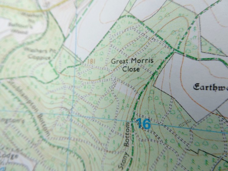
It was very obvious when we reached it. It’s literally just a rectangular bit of ground with no woodland on it, surrounded by woodland, just as the map shows. It’s on a slope and my only guess is that it’s left like that so the landowner has his own private sledging land on those rare occasions when we get enough snow.
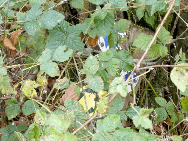
We at last reached the end of the long snaking uphill path at last. Now we should turn left, according to the map – and that white patch had absolutely confirmed where we were – but the path went to the right. That’s where the third loop joins back onto the second. There was a track off to the left and since it’s always the narrow muddy track, we should have realised but we didn’t until we found the blue arrows hiding under brambles at ground level. Almost immediately, it veered off to the right. As per tradition, this path was even narrower and muddier than the narrow muddy one we’d initially taken for the correct one – so much so that it had a second marker twenty yards up and a helpful very round robin twittered along showing us the way, just like a book.

We reached the end of a field presently, where there was a ladder and plastic chair contraption bolted to a tree. I’ve never seen such a thing – it looks like a makeshift lifeguard or tennis umpire’s seat but apparently it’s a hunting seat. Nice. I declined Dad’s suggestion that I climb up and sit in it. That’s something else I took from my caving days, apart from recognition of chalk sinkholes – never put your life in something that someone else has rigged unless you’ve seen them do it and know that it’s safe. Don’t put your weight on random ropes, no matter how handy they are. Rig two ladders next to each other, two ropes on top of each other, if necessary. So no, I wasn’t going up that ladder.

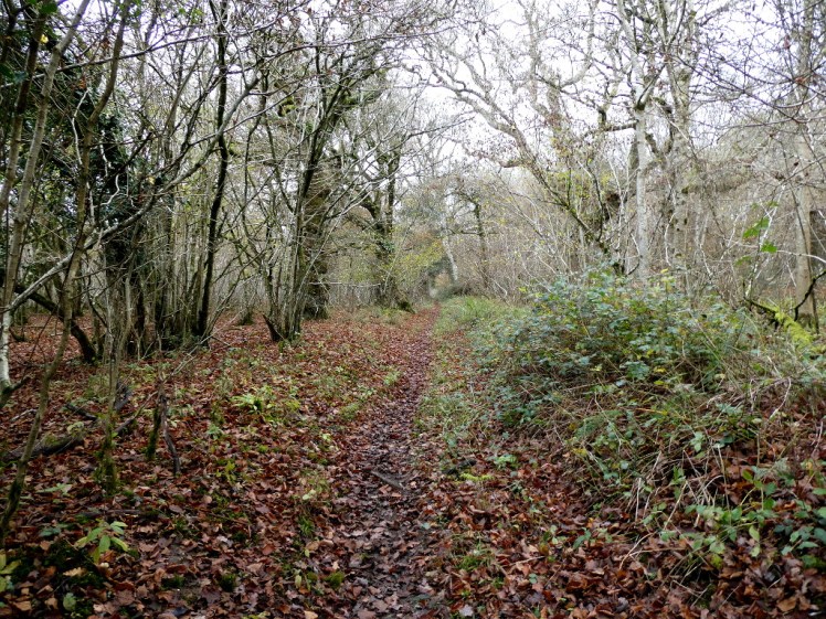
The way back was a bit of a zigzag through the birch wood and from up here, it was all strangely pale. The sky was white, the trees were white and even the lingering leaves seemed to have lost a lot of colour. It wasn’t until we reached the last turn that we seemed to step out of this eerie borderland and back into the real world – a short sharp downhill stretch with lots of orange-brown autumn leaf litter.


I’d thought the second loop was a bit short for an adventure in the woods but it finished up at 6km proving yet again that I’m terrible at estimating walk distances from the map unless I actually make the effort to measure and routecard it. But in fact, we’d had a good walk, I’d learned a new tree and I’d crossed off a whole 1% of my Single Map in a single walk.


One thought on “A Single Map episode 2: a walk in the woods”