I definitely didn’t plan to do three A Single Maps in a row but then again, why not? We’re in lockdown, we can’t go anywhere and it’s a beautiful time to appreciate what’s on your doorstep and get some exercise in the fresh air. Today I’m on the trailway!
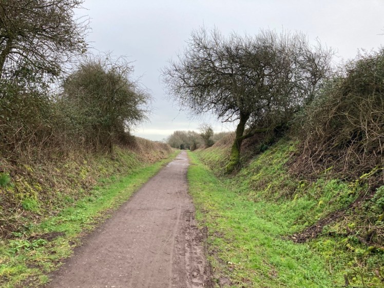
There are plenty of these trailways crossing the country. Dr Beeching closed down a lot of railways in the 60s. Some of them were promptly reopened by volunteers, like the Swanage Railway and the Watercress Line. Others became walking trails or cycle paths. This particular one is the North Dorset Trailway, which is one of the latter; now a walking/running/cycling/horseriding route, stretching around fourteen miles from Spetisbury in the south to Sturminster Newton in the north. Because most of it follows the route of the old Somerset & Dorset Railway (give or take places where it’s had to acquire up and down ramps or bypass unmaintained bridges), it’s pretty flat and while it’s not arrow-straight, it’s reasonably straight most of the way.
It would be nice to have the railways but since they’re gone and won’t be back, it’s good to at least be able to preserve the remains of those old lines and it’s very nice to have this network of recreational trails. I know people who live in the big cities can’t really fathom the lack of public transport in places like North Dorset (“just get off the bus a stop early!” or “you don’t need a car these days, you can get the train or cycle!” don’t work when towns are five or ten miles apart, roads have no pavements or lighting and there are only eight buses a day and no trains at all) but we get it paid back in outdoor opportunities like this. Apart from ordinary walkers like us and cyclists, these trails are really accessible to people with mobility issues, parents with buggies, they’re safer for small kids than paths near roads or parks full of strangers and they’re great for energetic dogs. If you live somewhere more rural, do investigate whether you’ve got an ex-railway trail anywhere nearby.
We set off from Shillingstone, from the car park just to the north of the village. It’s a small car park and there’s only ever one space left when we get there, no matter what time of day. It’s just at the bottom of an old railway bridge, no longer in use. You walk through the bridge and then you can turn right to go to Shillingstone, Stourpaine, Blandford and beyond, or do what we did which was turn left toward Hammoon, Fiddleford and Sturminster Newton, hereafter called just Stur. Several kilometres to the right are marked on my map as a national cycle trail but most of the route to Stur is public bridleway. Some of it is marked as “kindly open to the public by the landowner”, which does make me wonder a little what might become of it if the land changes hands but I’m sure the NDTN folk have things in hand.

So we headed north. At first it’s half road, half track – this is the way up to Bere Marsh Farm and Ham Down Woodland Burial Ground, so there are vehicles occasionally. But it’s still a bridleway, not a road. When we reached the farm, there was a notice up about saving the barn owl barn – they’re after £40,000 to restore their Victorian barn, which has been a home to a pair of breeding barn owls for some years. In fact, they’ve reached £36,572. That’s been enough to rebuild the roof and make the barn watertight, so the owls are safe and happy. They’re still fundraising, so if you want to help contribute towards building a hide for visitors to observe them without disturbing them or buying a camera so everyone can watch the owls from their own home, you can do so here.
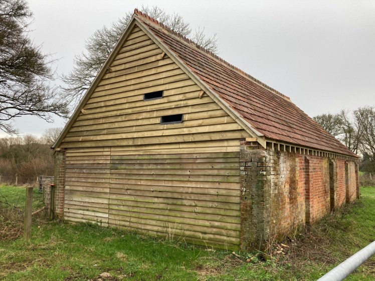
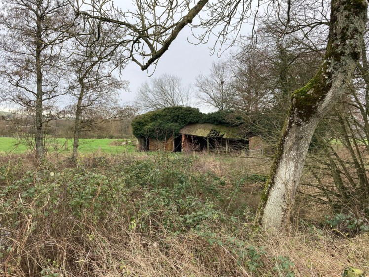
It’s not immediately obvious which the barn is. There’s a wall-less building right beside the trail, and a barn-like thing behind it, opposite the farmhouse. On the other side of the trail and the stream is a ramshackle building that looks like it might once have been a cowshed or a small stable. Further up, there’s a small building with a brand new shiny north end with lead-protected slits. Now I know they’ve rebuilt the roof (and seen the picture on the website), I know this is the building in question but it was something to wonder as we walked up the trail – if you were a barn owl, which of these buildings would you roost in?
A little further up, you see a bridleway going off to the left and leading to a railway bridge. That’s where the original line joined the bridge by the car park and we’ve been walking more or less parallel to the original line for this little bit. Then you reach a car park that only seems to be accessible via the bridleway, you turn left and look down the original line but you’re now back on it. From here, you’re following the railway route all the way to Stur.

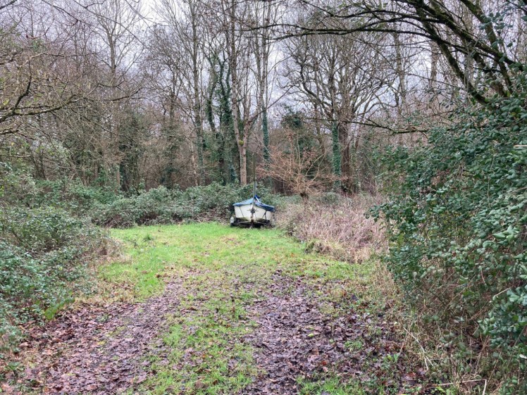
The next bit, up to the Hammoon road, was perhaps the most difficult. It had fluddles – plenty of small floods or largish puddles, the edges were boggy when you got right over to pass other people while keeping as far away as possible, and then a huge puddle that blocked the entire path. You couldn’t even go round it. There was a stream to the left, a weirdly crystal-clear yet very bright blue, copper blue, stream and thick mud anywhere you might be thinking to go round. We picked our way through the shallowest bits, squelched through some of it and made our way to the other side without drowning. Maybe it does get really wet here. I mean, if someone’s keeping a boat right here, which they were. Just off to the left was a dinghy, just lying in the woods. It seems an odd place to store it, difficult to access with a car and trailer and too big for sailing on the river.
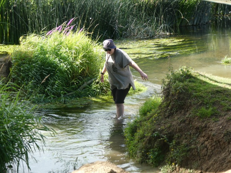
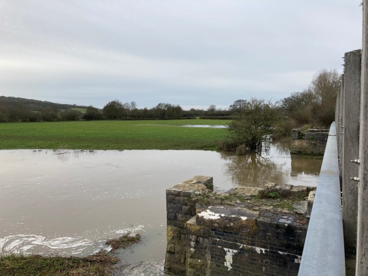
We’d seen the Stour back by the car park but around here it makes a bit loop off to the north. The Stour, by the way, is a popular river name. There’s a Stour in Canterbury, there’s one in Suffolk and another in Warwickshire and another in Worcestershire. But this one, the Dorset one, is the first one listed on Wikipedia which I reckon makes it the original and best. Apparently it comes from the Old English and means the fierce one or something along those lines. It’s not fierce. It widens as it approaches the sea at Christchurch but up here it’s fairly narrow and fairly shallow in places. This is me paddling in it just south of Shillingstone in the summer:
One of the things about these local walks is learning about nature. I’ve read a couple of books and blogs and I’m following a few people in various social media places and I’m going out and looking and listening. Would I have spied a blue tit along the edge of the trailway if we’d done this a month ago? Probably not, even though they’re bright blue. I might have spotted the six or seven robins. I definitely would have seen the pheasant. I’m enjoying seeing my understanding of nature grow literally one walk at a time.
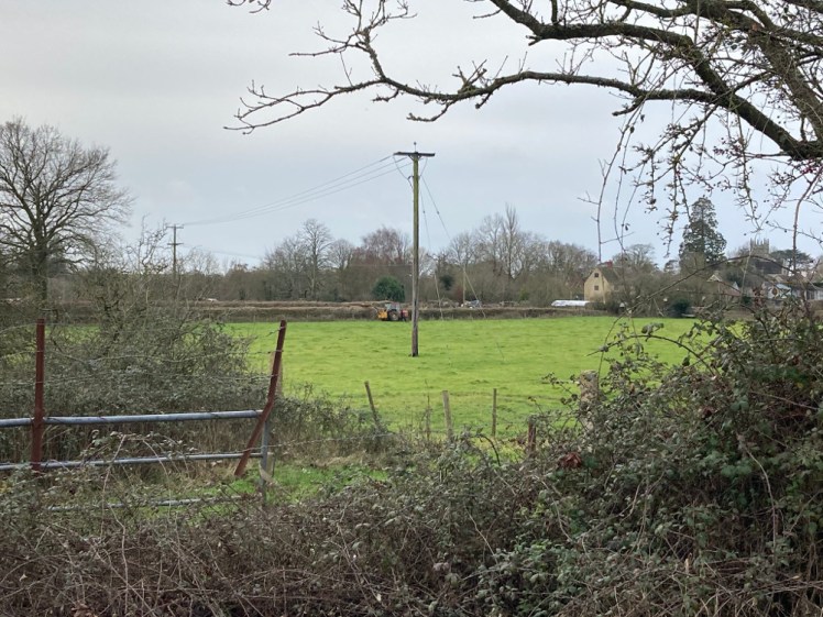
Now there was nothing in particular to look out for other than birds. The bridleway goes off to the north, up to Hammoon village and then comes back down on the other side of the main road (“main”. Small yellow road too small to even be given a number) and the two-hundred metre section from there to the road is technically nothing but surviving earthworks. This is where I saw one of those “landowner permission” signs. On the other side of the road was a game of “where exactly are we?” using the field boundaries. A footpath at the junction of two field boundaries led off to the east end of Fiddleford and a bridleway 300m further on led into the middle of it, although Fiddleford is a sufficiently small place for “the edge” and the “middle” to really not be very different. I’ll have to make a detour into Fiddleford when this is over. Apart from the Inn, which looks like a nice traditional country pub with a traditional menu of sandwiches, jacket potatoes, pub lunches and steaks, nothing pretentious, there’s Fiddleford Manor (or Mill), which is a medieval manor house owned by English Heritage. I like medieval things.

A little further on from those two junctions, we came to a bridge over the Stour, which had turned south and come back down to us. You can still see the posts that held up the original railway bridge. This is a good bridge for walkers and cyclists and horses but you wouldn’t even get a Tube train across here, let alone a chunky steam-drawn train like the ones that were still running when Dr Beeching came along. You get a good view over Fiddleford from here, although it’s hard to see exactly what’s what from this distance.

By now we could almost see Stur. There were cottages on the hill and the trail was starting to get busier, mostly with weekend dog-walkers. Stur’s not a big place but evidently its people enjoy a walk. We were debating where the turning round point might be. Level with the white houses? At the bin? At that wooden thing that might be a bridge? We carried on, past the sewage works, which is always a delightful thing to see on a country walk, past some very enthusiastic dogs who were managing to play-wrestle while also tearing around like crazies, and towards whatever was going on right at the end. We could see yellow road signs, orange plastic fencing, people in high-viz. From that distance it looked like the beginning of a race but we’re in a pandemic, we’re in a lockdown so that couldn’t be the answer.
We were up on an embankment here, the trailway raised a little above the fields below so the old railway could meet the station at the right level. It looks like floodplain – the Stour is very prone to overflowing its banks but the river was a little distance back by now and if it flooded these bits, it would surely flood the houses set just a little back from the trailway. Cockerels in farms on either side of the trail, separated by at least half a mile of field, were trying to out-yell each other, a flock of starlings in the treetops above us tried to drown them out and after nearly five kilometres, we were out of the country and very suddenly in a town, about to walk into a drive-in covid testing centre.
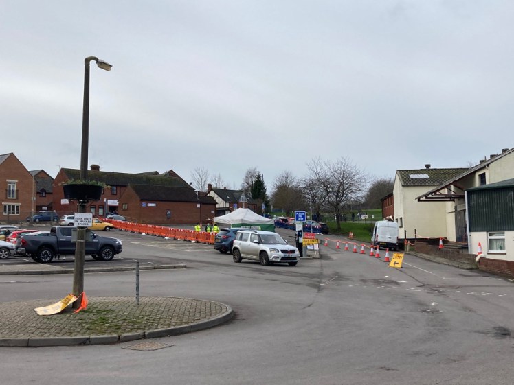
We stopped, sat down on the wall outside the Factory Shop and ate our snacks. Dad observed that he’d suspected this might be where the trailway went as this is where the station used to be and I see from Google Maps that the car park in question is indeed called Station Road Car Park. From Stur, they’re trying to connect the trailway to Stalbridge, which is the next stop on the old railway but it’s an ongoing process. My OS map doesn’t go as far west as Stalbridge but you might be able to follow the Stour Valley Way north of Stur and then take a footpath in the Stalbridge direction if you want to continue. For now though, Stur is the terminus.
Stur, incidentally, takes its name from the Stour. Sturminster Newton is the new town with the big church on the Stour. Further south along the trailway, although not quite joined yet, is Sturminster Marshall so if you’re in the area and casually referring to “Stur” or “Sturminster”, you need to be sure you’re talking about the right one. Further south, where the town actually meets the Stour, there used to be a ford, replaced in the sixteenth century with a stone arched bridge. I don’t know about other parts of the country but a lot of old stone bridges around Dorset have plaques on them threatening transportation to Australia as a punishment for damaging the bridge. We didn’t go down and look at it – it’s not really meant for pedestrians, who are supposed to cross a little to the west by the mill, but mostly we’d already walked 5km and had another 5km back and the bridge isn’t that exciting.
I’d tell you about the walk back but it was pretty much exactly the same in reverse, except that we met a lady called Liz who hasn’t had enough people to chat to since the plague. We sat on a bench and she stopped to chat and then she accompanied us at least half a kilometre to the Hammoon road. Then she turned left and we continued down the trailway.

Over the weekend, I walked nearly 23km and this, at 9.73km, was the longest of the lot and yet the one where I came home the least tired and sweaty. I’d had the sense to not take a coat. I know it’s January but it’s not particularly cold, especially if you’re walking any distance. I have a fairly thick hoodie (with thirteen pockets!) and I admit that at no point did I feel any desire to unzip it and I was wearing a hat but I’m glad I didn’t take a coat. We returned three and a half hours after we set off and I got to colour in another bit of my custom map (I have one copy for using and one copy for marking up).
