The majority of visitors to Iceland stick around the south-west corner of the country. There’s a lot to see but you need a week or two at the very least to cross off a lot of Iceland’s sights and spectacles. This itinerary is for a first-timer who doesn’t want to venture too far from Reykjavik but wants to see the best the country has to offer.
This is a very rough itinerary. It’s not designed to be followed to the very letter. Pick and choose, take two days over things, condense them into less than a day, add in anything that catches your eyes and so on. It’s just meant to give you an idea of some of the most obvious things you can do as a day trip from Reykjavik.
Day One: The Golden Circle
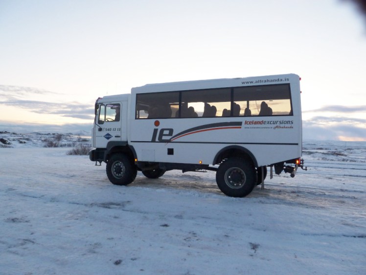
The Golden Circle is a classic for a reason. It’s Iceland in miniature; it’s some of the most interesting landscapes all crammed into one day and you have endless options. I’ve listed just about everywhere you could possibly stop and if you’re determined to visit them all, you could stretch this out into two days. There are plenty of accommodation options, from the shiny hotel at Geysir to farm stays to camping, or you could return to Reykjavik and do two different Golden Circle variants on two separate days. You’re spoiled for choice about how to do it too. You can self-drive – that’s my recommendation for the freedom, or every tour company in Iceland will do a tour. Big ones like Reykjavik Excursions and Grayline will offer different kinds – big coach tours, small private jeep tours, Golden Circle plus glacier or a swim or Northern Lights or all sorts.
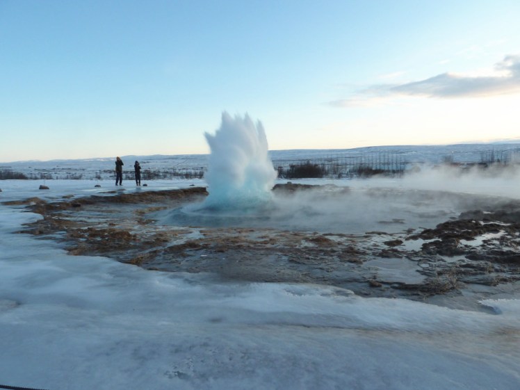
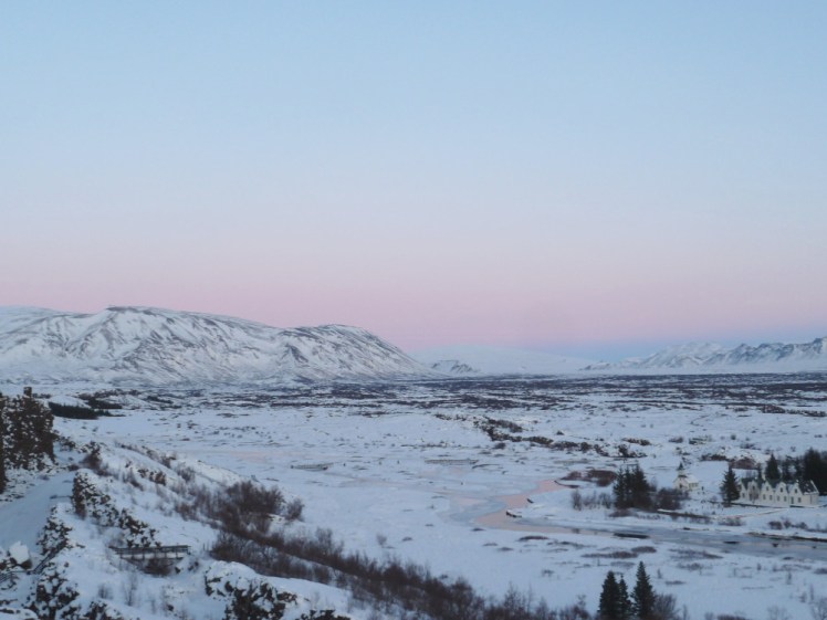
The three big stops that you mustn’t miss are Geysir, Gullfoss and Þingvellir. Geysir is the place with the exploding water, Gullfoss is a big waterfall and Þingvellir is a national park, rift valley and site of Iceland’s first Parliament. Every tour will include those three and if you’re DIY-ing it, you mustn’t miss them.
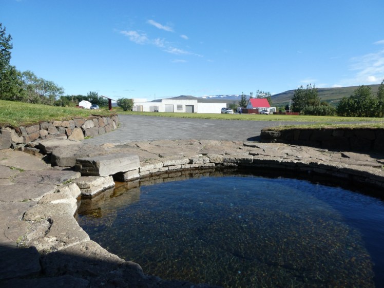
There are plenty of other stops. If you’re after hot water, there’s the luxury spa & lake complex at Laugarvatn Fontana or the more down-to-earth Secret Lagoon. If you’re after food, the two I always recommend are the dairy farm Efstidalur II for burgers and ice cream while staring at the cows that made it, or Friðheimar, a greenhouse restaurant where everything is made with home-grown tomatoes.
For some nature, Kerið is a reddish brown flooded explosion crater – or maybe tiny collapsed caldera – and that’s worth visiting, although it has a small controversial entry fee. Faxafoss is a waterfall remarkable for the series of small cascades up the side – it’s a ladder to help salmon swim upriver! And then, for some culture, there’s religious and educational centre Skalholt, which is also where Iceland’s last Catholic bishop was assassinated.
Day Two: Reykjanes
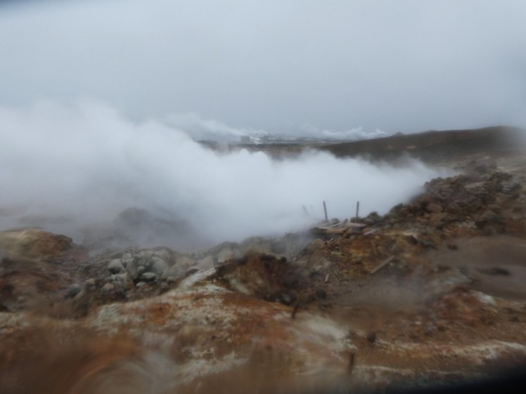
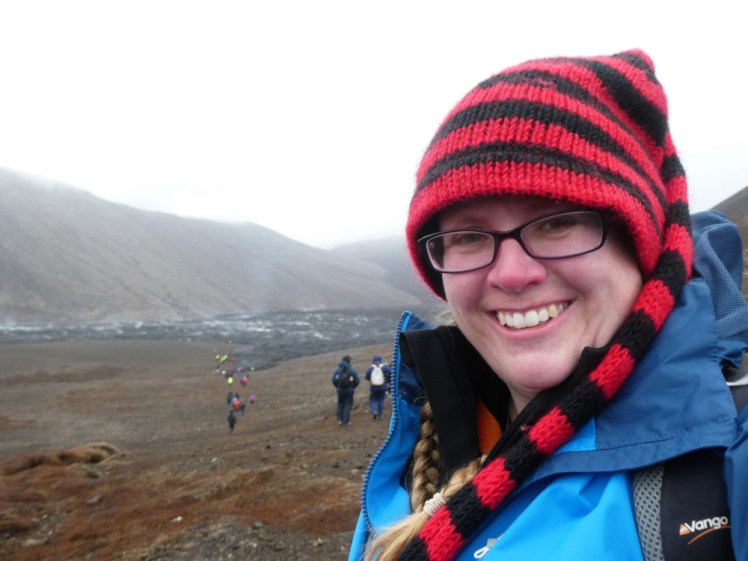
Tourists tend to rush straight past Reykjanes in their hurry to get from the airport to the capital but it’s worth taking a day to explore the peninsula. It’s got two notable geothermal fields – Krysuvik, where the ground is scorched in white and orange and there are grey-blue boiling mud puddles, and Gunnuhver, which is a massive steam vent which has eaten the previous boardwalk. You can drive the coastline and stop when you stop something of interest but Brimketill is fun – it’s an eroded bit of cliff and in bad weather, the waves fly up through a bowl-shaped hole and splatter everywhere. Then there’s the Bridge Between the Continents. Don’t believe that this is literally a bridge spanning two tectonic plates – it’s metaphorical, but it’s true that the North American and Eurasian plates meet in Iceland and the line between them runs from Reykjanes up to the north-east. You won’t actually know where and when you’ve crossed but it’s fun to stand under the bridge and imagine it’s real.
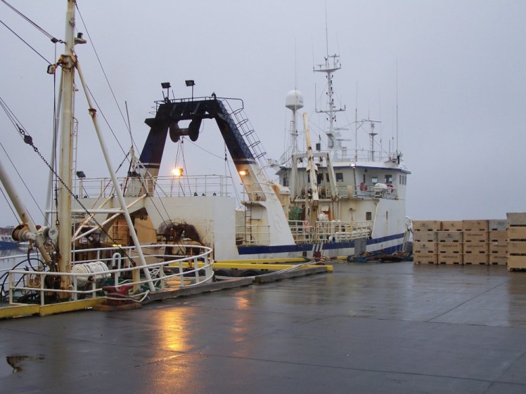
There are endless fishing villages along the coast, if you’re interested in the fishing industry or in small local cafes serving freshly-caught fish dishes. Grindavik is the biggest settlement around here, so make a stop there.
Obviously, there’s the volcanoes. The 2021 eruption is easiest to get at – park at P2 and the lower end of the lava field is just over the ridge a five minute walk away. Or park at the main car park on the bend as you come up from Grindavik and then follow the marked path either for half an hour or so up to the viewpoint or further along until you see the craters or you can keep going until you get to Meradalir, 7km away. Be prepared for a long hike over the mountains, where the weather can be bad and where it’s likely to be windy. Also bear in mind that at time of writing, all these volcanoes are still and silent.
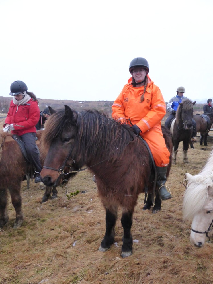
On the north coast, you can do Inside the Volcano – you’ll need to book that one and go with a tour. Or you can go to Ishestar and ride a horse out onto the lava. They do pick-up from your accommodation in Reykjavik or you can book independently and go along in your own car.
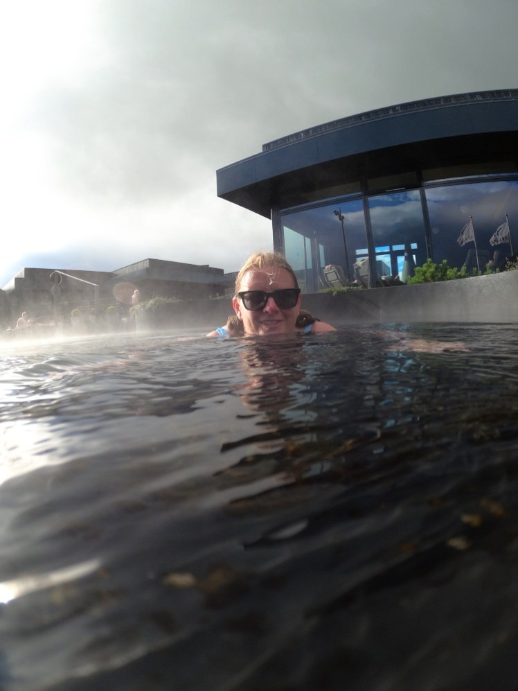
And finally, how can I recommend Reykjanes without finishing up at the Blue Lagoon? You’ll need to book in advance – it’s popular and it no longer does walk-up tickets. Oh, it’s touristy, but it’s worth it, especially after a long cold day on Reykjanes. Don’t know why it is, but it’s always rained miserably when I’ve been out and about.
Day Three: the South Coast
You can keep going along the south coast until it becomes the Eastfjords but for today, we’re going to stop at Vik. It’s a long day – the round trip is 240 miles and there are plenty of places to stop, so allow for leaving early and getting back late.
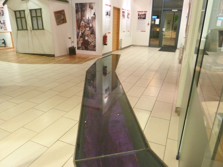
Drive an hour or so east from Reykjavik and you’ll reach the Greenhouse Village, Hveragerði. Make a stop at the shopping centre. When they built it in 2008, there was a lot of tectonic activity. In fact, it disrupted building and destroyed the foundations. Now, if you go in the main door and walk around towards the supermarket, you’ll find a glass trail in the floor which looks down into a crack in the Earth, created by the earthquakes. That’s a real crack in the real foundations. The twinkling red and yellow LEDs down there are not real lava! There’s an earthquake simulator, if you’re interested in knowing what it feels like, but it’s never, ever been working when I’ve been there.
There’s nothing to detain you in Selfoss but Hella and Hvolsvöllur are both good places to stop, get fuel, get a hot dog etc and at Hvolsvöllur, there’s the LAVA Centre. Now, disclaimer, I’ve not been there and I know nothing about it but it’s a volcano exhibition and I’ll stop there next time I’m driving the south coast.
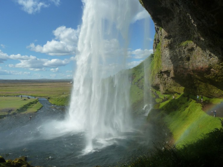
A little further on, you get to the first obvious highlight of the south coast, Seljalandsfoss. This is the waterfall you can walk behind. It’s carved out a kind of cave in the rock. A word of warning: it’s slippery and wet. You’ll need waterproofs and you should bear in mind that your expensive camera may not enjoy the spray. Other than that, definitely do it!
Further down is the Eyjafjallajökull viewpoint and info point. Last time I was here, there was an entire exhibition but that’s long gone. I have no idea what the info point consists of but it doesn’t hurt to pause and find out.
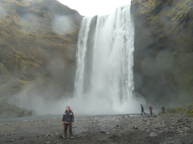
Next is Skogafoss, which is big square waterfall of surprising power, with a box of treasure hidden underneath. Climb up the stairs to see the waterfall from above, while you’re here – and also go to Skogar Museum. It’s really a museum of rural life and it has some turf houses. It’s not the most exciting thing you’ll do all day but it’s worth getting a taste of what it’s actually like to live in Iceland, rather than just be a tourist here.
The next stop is the plane wreck and again, I haven’t done this. It doesn’t appeal. You park next to the Ring Road and then walk a couple of kilometres across black sand to the wreckage of a plane that crashed here in 1973. People like how it looks in photos, I gather.
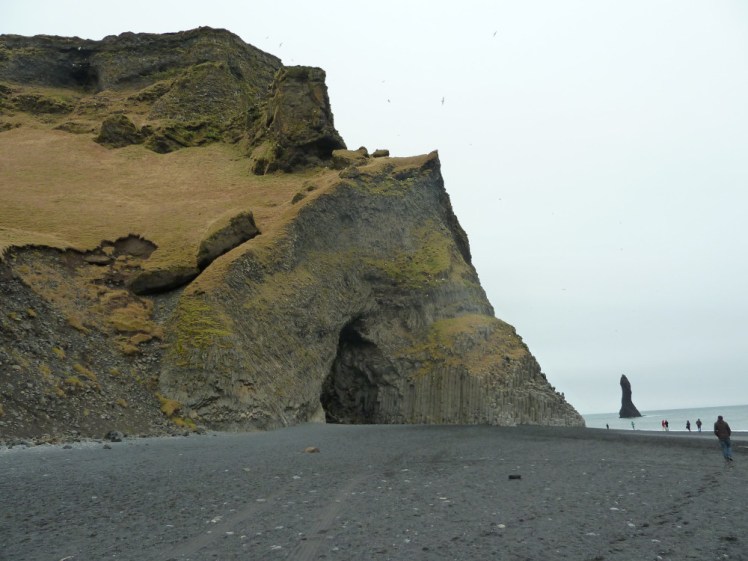
Then we get to the black sand beach. You can park at Dyrholaey, where there’s a big hole in the cliff and that’s interesting in itself but I like the views east towards Reynisfjara. Or you can continue and park at Reynisfjara. The cliffs are spectacular, with a cathedral-like wall of basalt columns and there’s a cave with a columnar basalt ceiling but this is also the place where the waves will try to grab your feet and haul you out to sea and kill you. Stay well back from the water! No paddling! No swimming! Don’t even get your toes wet!
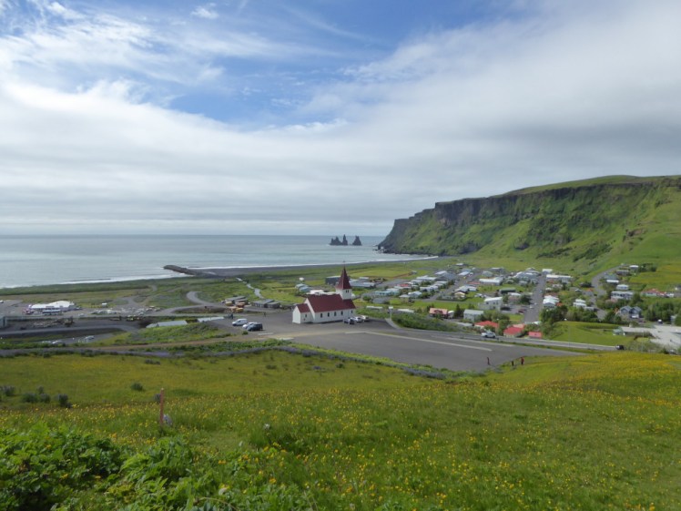
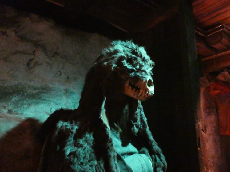
Head north back to the Ring Road and round to Vik – it’s only a couple of kilometres if only you could follow the beach round the rocky headland but you can’t. Vik is where we end our journey. It’s traditional to get a hot dog in the roadhouse, go in the Icewear wool outlet for your souvenirs and I highly recommend walking across the dunes to a bit of black beach you’ll have more or less to yourself. Going up to the church gives you good views over the town and the coast and I also have my eye on the Lava Show – every hour, they shovel some actual lava into the room. So if you want to know what it feels like to be up close and personal with molten rock, without having to hike right up to a live eruption, this is the place to go. It’s absolutely on my to-do list!
Day four: the west
For a slightly quieter day out, head for the west. You can go via the Hvalfjörður tunnel, which cuts driving time and distance considerably or you can drive all around the fjord, where the roads will be quiet and the views picturesque. To be honest, I do tend to take the fjord rather than the tunnel.
Your first stop should be the Settlement Centre at Borgarnes. Take the audioguide and spend half an hour each in the two exhibits. The first is the Settlement Exhibit, the story of the early Icelanders and that’s interesting. But the Egil’s Saga one is the jewel and if you only have time for one, make it this one. It brings the saga to horrifying, creepy life via carvings and pictures and lights and all sorts. I love it.
Next, a pitstop at Borg a Myrum. This is where Egil lived and where the action in the first part of the saga takes place. Today there’s a couple of country houses and a church but if you peek around the side of the church, you’ll see the “borg” of the name – a great big bit of rock. Borg means rock. So the farm was named after the rock and then Borgarnes – the headland of Borg – was named after the farm.
Head east, inland. The next stop should be at Reykholt, at the cultural and religious centre that was once the home of Snorri Sturluson. Snorri was the author of Egil’s Saga (affiliate link to bookshop.org) and a descendant of Egil, and he also spent some time living at Borg. He was the Lawspeaker and finally he fell out with the Norwegian king and got himself assassinated. His pool, Snorralaug, is the most popular sight here.
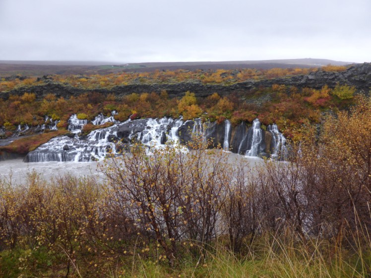
If you want to keep going, there are two interesting waterfalls. Hraunfossar oozes out from the lava along a couple of hundred metres of the riverbank and Barnafossar, so-named because of the legend of the children drowned there, is a rushing cataract where the river is funnelled through a narrow twisting bit of shallow canyon. If you want to go even further, there’s the village of Husafell. This is where you start your tours out to the glacier. It has a golf course and it also has an interesting pool complex that I’ll try out one day.
On your way back, take in the Icelandic Goat Farm. These are the original goats, brought over by the Vikings in the Settlement days. You’ll hear all about the horses, and how the bloodline is pure and how no new animals can come over but the same goes for the goats, in a quieter way. Some of these goats were in Game of Thrones, although I was told that back in 2014 and I make no promises about the lifespan of goats.
And last, before you head back to Reykjavik, stop at Deildartunguhver, Europe’s biggest hot spring. I mean, stop for its own right, it’s quite interesting – it steams spectacularly – but you know by now I’m always going to recommend some hot water and this particular spring powers Krauma, a series of black hot pots of various sizes and temperatures overlooking their own source. I wouldn’t make a special journey for it – it’s quite expensive for what it is – but it’s worth stopping while you’re passing, for the novelty of really seeing the connection between the Earth and the baths.
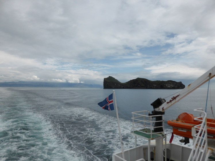
Day five: Heimaey
And for a bonus day, why not head to Heimaey, largest of the Westman Islands, named after the Scottish and Irish slaves – the men from the west – who rebelled against their master by murdering him right back in the first few weeks of the Settlement?
There are three ways to get across. You can fly direct from Reykjavik (that’s the Domestic airport in the city centre, not Keflavik) to the tiny airfield in the middle of the island. You can drive to Landeyjahöfn, which is about an hour and a half from Reykjavik (turn right instead of left at Seljalandsfoss) and take the 35-minute electric ferry over, or you can take the ferry from Þorlákshöfn on the southern Reykjanes coast. That takes two or three hours and the ferry only operates from there in bad weather or winter. Honestly, if the only ferry is running from Þorlákshöfn, I wouldn’t bother going.
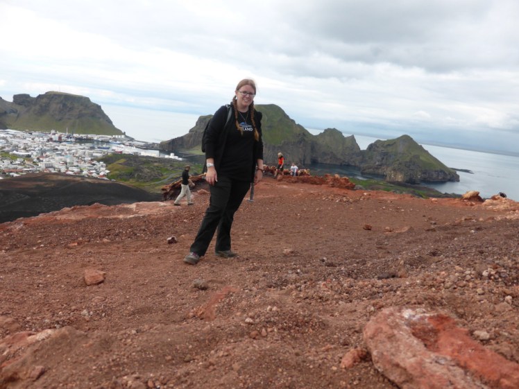
Once there, I’d personally head straight for Eldfell, the “new” volcano that formed in an eruption in 1973. If you’re on foot, follow the road up – I tried to get there via the lava field and got horribly lost. It’s a relatively easy hike to the summit, although the path is a bit gravelly and thus a bit slippery. You get views across the lava, down to town and across to the harbour and if you literally scratch at the surface, you’ll find it’s hot even an inch down. If you have space in your bag for some marshmallows and skewers, you can probably find somewhere to toast them, fifty years on from the eruption.
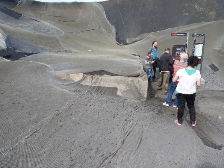
Back in town, there are a few places worth visiting. There’s Eldheimar, now a museum, formerly an open-air dig and before that, people’s homes. This is where they’ve dug a couple of houses out of the lava that buried them in 1973. Everything was left as it was – well, no one had time for much packing when a volcano started up in their garden at 1am. When this was still in its dig stage, it was called Pompeii of the North; the name seems to have been abandoned. Fortunately, volcanoes that destroy homes and lives are rare in Iceland. I don’t think any that have happened since have caused much physical damage. The 2021 eruption threatened a road for a while and the 2014-15 sent gases drifting over some of the north-west on days when the wind was going the right way but because most of Iceland is so sparsely populated and because volcanoes and hostile environments often go hand-in-hand, it’s rare for people to live as close to a volcano as Heimaey – and to be fair to Heimaey, until it started erupting, there was no volcano there!
Down at the harbour is the Beluga Whale Sanctuary. A pair of them were brought over from China in 2019 in a 30-hour operation involving a special whale plane and individual lorries. They initially moved into the pool on the harbour front so they could get used to their new home and the new care team and are currently living in the care pools. They were due to move to the intermediate habitat in the bay this month but an accident with one of the specialist boats has delayed that until next spring. When they’ve got used to living in the bay, they’ll move again to their forever home in a more open bit of the bay but that’s not going to be until the summer of 2023 at the earliest and probably not then. However, by next summer they should at least be out in the bay, learning how to whale properly. You can learn about the whales at the Sanctuary, which also operates as a puffin hospital. Heimaey has a lot of puffins and there are places around the southern “tail” of the island where you can just sit on the cliff and watch them. Those that get into difficulties, or the pufflings who get confused by the lights of the town, get rescued, rehabilitated and released via the Sealife Centre.
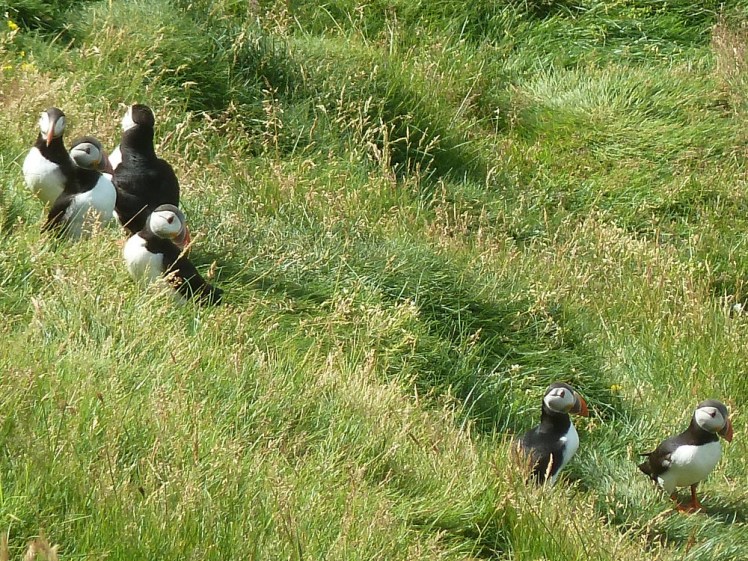
If you want to see the island and the puffins a bit closer, you can take a boat tour of the island. I’ve done a small tour boat but there are also RIB tours, if you’d like something a bit more high-octane and there are probably more sedate trips too. You can find and book those from the various companies clustered around the harbour and I think that’s definitely a must-do if you’re interested in really seeing how the volcano shaped the island and a cliff shaped like an elephant. I also did a coach tour of the island – I have no idea if that’s readily available as I did it as part of a day tour from Reykjavik – which is another option for visiting Heimaey.
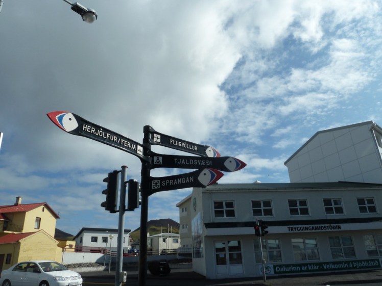
And finally, don’t miss the quirky touches: signposts with puffins for arrows and fish-shaped zebra crossings.
And that’s it for my itinerary around the south-west! I hope it’s helpful in getting to see some of Iceland without venturing too far from Reykjavik and that you’ve discovered some things you might not have done otherwise.
