Back in 2014, I finally did something I’d been wanting to do for a while. Given the lack of English-language information, putting it all together and figuring out how to do it was a bit tricky and so let me save you all that. This is how to climb Esja.
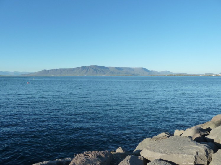
Esja is Reykjavik’s mountain. If you stand on the seafront and look across the bay, that big chunk of mountain over there, that’s Esja. It’s not technically a mountain and I suppose it’s not technically a volcano. This is a volcano range. If it’s not extinct – and it’s probably best to assume nothing is extinct in Iceland – it’s certainly been quiet for a very long time, probably two to three million years. In the same way that views of Poole Harbour and Brownsea Island quadruple house prices in my native Dorset, views of Esja push up house prices in Reykjavik and no wonder.
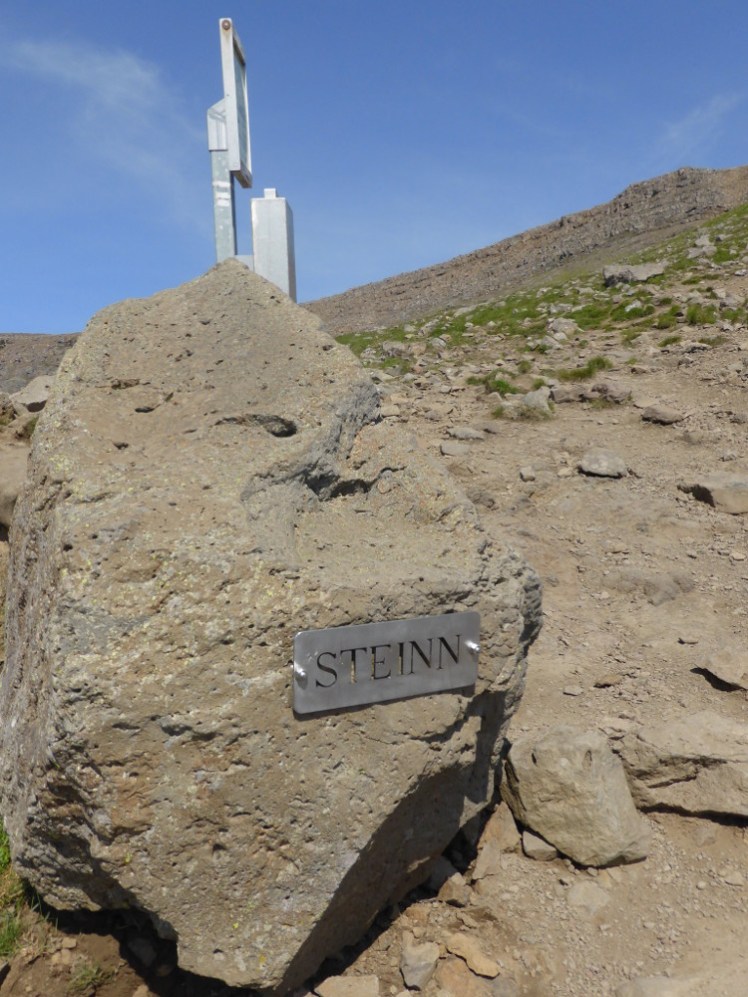
Climbing the volcano is a popular pastime in Reykjavik and entire families, from small children to elderly grandparents, will make their way up on sunny bank holidays. It’s eminently climbable, at least up to the viewpoint marked by a boulder called Steinn. I’m not going to talk about going any higher because the path gets more difficult and more technical. I’ve not been beyond Steinn, I’m not going to go beyond Steinn and I’m certainly not qualified to advise about what’s going on above Steinn.
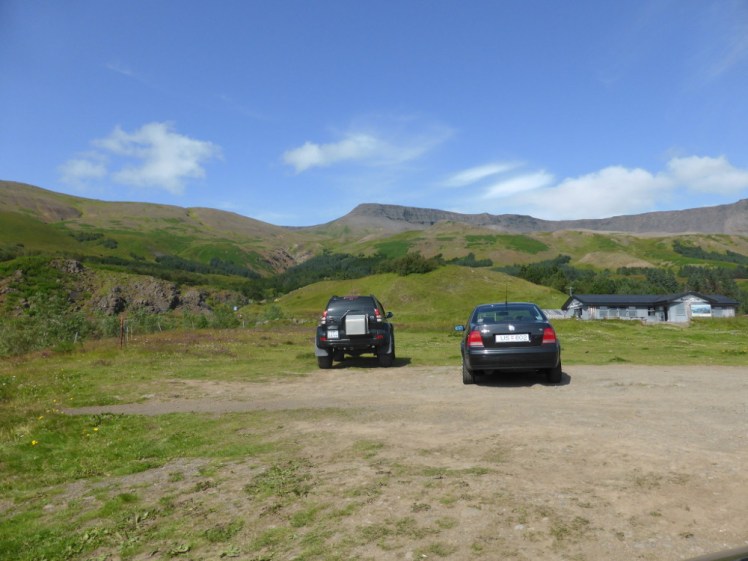
You drive out north of Rekjavik, around the end of the bay and you’ll come to a car park on a hill. If you don’t have your own transport, you can take bus 57 in the direction of Akranes, Borgarnes and Akureyri from Mjódd, Reykjavik’s main bus terminal. The bad news is that Mjódd is a bit of a pain to get to from downtown Reykjavik; this all worked much better when Hlemmur was a bus terminal. Bus 3 from downtown Reykjavik is probably your best bet for getting to Mjódd. You’ll know when to hop off the bus – the mountain will be looming in front of you, the information board will say Esjurætur or Esjumelar or Esjuskáli and you’ll see a car park full of cars, which will stand out somewhat on this bit of fairly rural road. It takes about half an hour from Mjódd.
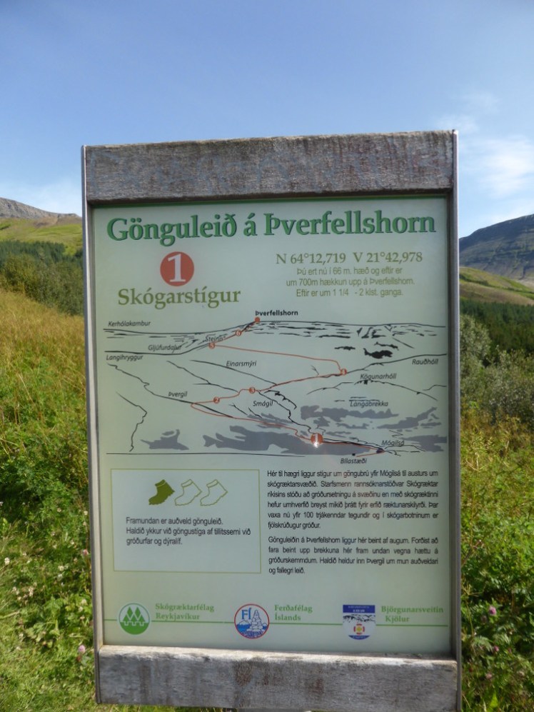
Below is a map of the route up to Steinn. Please don’t use this for navigation. You’ll find information boards and the paths are well-trodden and as long as the weather is ok, you should have no problem. Unless you’re an experienced mountain climber, don’t try this in bad weather and certainly not in snow. Of course, if you’re an experienced mountain climber, you’re probably not reading this.
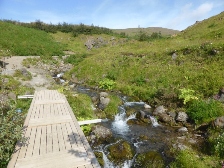
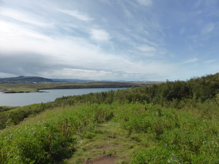
You’ll find the bottom of the path in the car park, along with various facilities. Everyone follows the same path for the first 1.4km or so, a fairly gentle path across meadow and the occasional stream. It’s all quite pleasant, all very green and lush and the view across to Reykjavik appears surprisingly quickly. There’s a well-trodden path so as long as visibility is ok, you don’t need any navigation skills whatsoever.
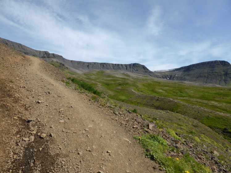
Then the path splits and you have a choice. The route to the left is a little shorter but it’s a lot sharper and features a lot of very slippery gravel. Only pick this way if you’re very sure-footed. I went this way by accident because I was a fool and I regretted it, especially on the way down when I couldn’t move without the certain knowledge that any shifting of my gravity would send me falling straight down the mountain. How steep? This picture is aligned to the horizon and therefore this is genuinely how steep it is:
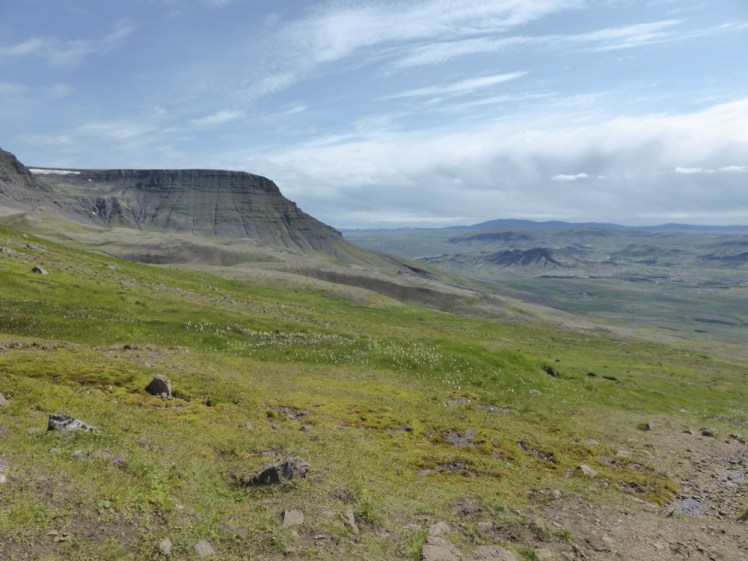
The route to the right is longer but it’s a lot gentler. If you’re reading this, the path to the right is probably the best one for you to follow. It takes the less steep way around what amounts to a cliff on the other path and you’ll end up meeting together at Steinn.
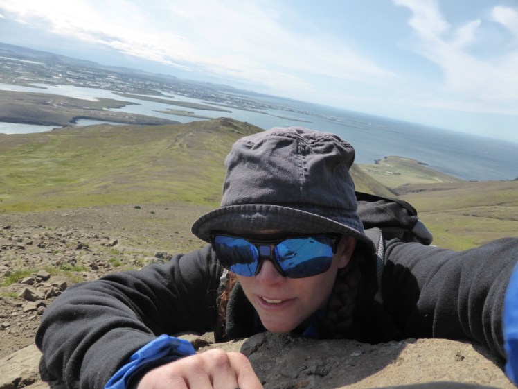
This is the summit for ordinary unequipped people. From Steinn, Reykjavik and the bay are laid out beautifully in front of you. Take your time here, you’ve earnt it. Sit down on the grass, enjoy the view, take a selfie at the summit and be proud of climbing a mountain.
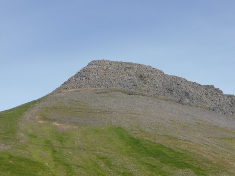
Then look upwards. I’m not entirely sure where Esja’s actual 914m summit is, because it’s not here above you. It’s somewhere in the middle of the range. But this is Þverfellshorn, a summit. You can see from here how steep it gets near the top and you may be able to see how loose the rock gets. I believe you need to actually climb a few times to the very top and that probably means specialist equipment, which is why we’re stopping here.
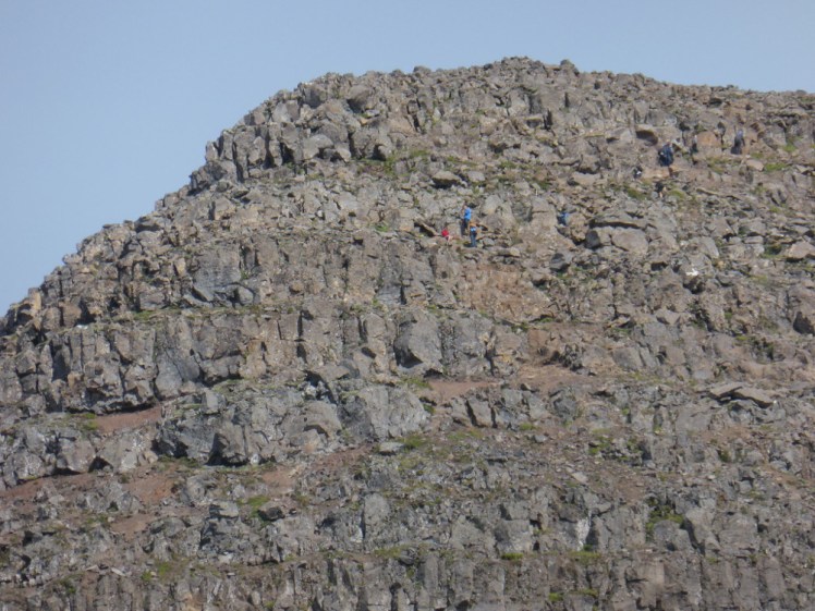
For scale, this is a close-up of that steep rocky bit right at the top with climbers visible. That’s a huge chunk of rock, it’s steep and it’s very loose. Stop at Steinn, the top is for professionals.
And now, after you’ve taken your selfie and had your picnic and appreciated the view, it’s time to go back down. If you came up the steep path, please please take the longer gentler path back down. It’s one thing battling loose slippery gravel on your way up but when you’re trying to go down, you’re going along with gravity and you absolutely do not want to go too far along with gravel and end up falling down the mountain. Going up was hard work but going down was when I stopped, unable to move and just yelled furious terrified obscenities at the mountain. You need really good shoes to take on a path like this downwards.
When you get back down to sea level, I highly recommend going off to one of Iceland’s geothermal outdoor swimming pools – it’s a really good antidote to sore feet and tired legs, it’s far better than just having a hot shower. And once you’ve done that, you can put your pictures on social media to tell everyone you’ve just climbed a mountain.
