When I was planning, or half-planning, my two-week adventure around Iceland’s Ring Road, I wanted to schedule in time to cover the north. I meant to do it last time but ended up accidentally driving the entire Ring Road instead of doing the north west to east then turning round and going back again, so I tried to deliberately plan for a few days there this time to find out where its best-kept secrets were. I’ve read a lot of blogs and watched a lot of videos and people almost invariably skip over the north, either because they’ve run out of time after stopping at every waterfall along the south coast or because they get all their travel advice from Instagram and TikTok and social media isn’t great on showing off the north of Iceland. So it was down to me.
I succeeded in spending five days in the north of Iceland! Two were in the Myvatn region, which I’ve talked about a lot before, and very specifically, on my very last post from four days ago. So this one is going to focus on the North West, the bit between about Borgarnes and Akureyri. I actually joined the Ring Road about 20km north of Borgarnes after spending the night at Kleppjárnsreykir, at a campsite on a tomato farm opposite Krauma and about halfway up the road that connects Borgarnes to Husafell, so that’s really where this starts.
Grábrók

Ten minutes from that junction, about half an hour north of Borgarnes, is the first attraction in my North Iceland adventure. I’ve written an entire blog post about Grábrók before but it’s getting a summary here. It’s a collection of craters at the side of the road, about 6000 years old, reddish-brown and covered with yellow-green moss. The “main” crater in the group has a set of wooden steps leading up it and after venturing right into the heart of the crater, you can continue up to walk around the rim, taking in views across the landscape, the other craters in the group, the tiny university town of Bifröst next door (yes, as in the Rainbow Bridge from Thor, only it’s pronounced more like “beev-rerst” than “bi-frost” in Icelandic). Strictly speaking, Grábrók is part of the West of Iceland but you’re probably only going to come this far up if you’re heading north or on your way back from the north so it’s getting counted as part of the north.
Kattarhryggur
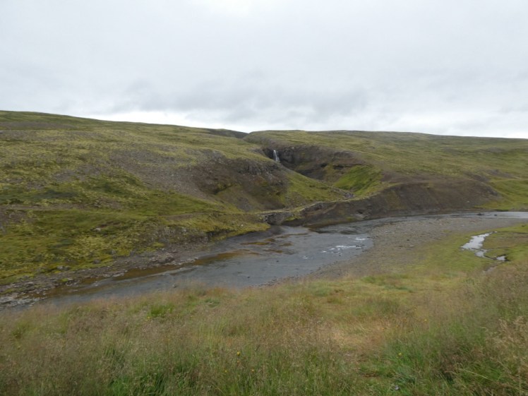
“Cat’s Arch” is actually an utterly unremarkable concrete bridge carrying a narrow road, once the main road to Akureyri, originally built for horses and carts and improved to take motor traffic since 1930. Now, it would probably be a contender for World’s Most Dangerous Roads and you can feel smug and modern as you look at it from the tarmac Ring Road. But it’s not the bridge that catches most people’s eyes. There are people who are crazy about obsolete infrastructure but most people will spy the waterfall. In a country with as many waterfalls as Iceland, this one isn’t even worthy of a name but it’s worth pausing on the side of the road for a couple of minutes to see the semi-vertical canyon it’s carved out of the side of the hill, flowing under Kattarhryggur to weave its way down to join the Hvitá just outside Borgarnes.
Þingeyraklausturskirkja
After Kattarhryggur, there’s quite the expanse of pleasant rolling green hills and mountains with nothing particular to stop for. However, when you reach the end of Húnafjörður and start seeing signs to Blönduós, there’s a little picnic place off to the left of the road and a gravel road that runs for some 6km up to a church.
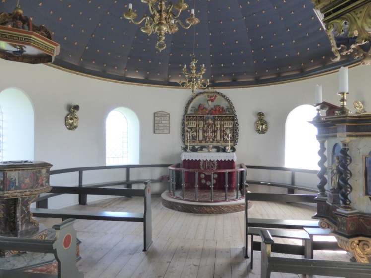
The church was only built in 1877, the stone brought across the nearby lake by sledge during the winter. It’s a nice enough church, if you’re lucky enough to be there when it’s open, with 1000 gold stars painted onto the blue ceiling and 100 small panes in each of the 10 windows to represent the year Christianity was officially adopted in Iceland, 1000AD, around July. But the relatively modern church is only what’s visible today. Þingeyrar is significant because of what used to be here: a 12th century monastery, a religious and cultural centre of the time. Some of the original saga manuscripts were probably written here and it was home to a bishop, Jón Helgi Ödmundsson, 1st Bishop of Hólar (Iceland Archbishop of York) who performed miracles like… ahem, getting God to clear the ice from the fjord. In May. I hate to argue with the good bishop but I feel like that was already about to happen. Anyway, in return for getting rid of the ice, Jón had a farm and church built here.
Blönduós
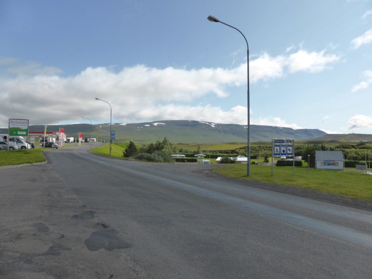
If my drive up from the west had taken four more hours, I’d have stopped for the night at Blönduós. It looks like a nice little town as you sail through it, green with a well-behaved river flowing through it, a pool complex with colourful slides visible from the road, set on the edge of the fjord and whatever the western as I drive through, my mental image is always of sunshine over it. More practically, it’s got a decent supermarket just a couple of streets away from the Ring Road and a roadhouse on the Ring Road. There are plenty of opportunities for fuel and snacks along this stretch (I’d be stopping no later than the first opportunity after my fuel gauge showed a quarter tank, though) but it’s the only thing even approaching the name of a “town” between Borgarnes and Akureyri so it’s a good place to stock up.
Glaumbær
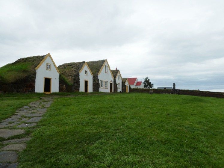
If you turn left at Varmahlið, the next roadhouse after Blönduós, and follow the road north for about ten minutes instead of continuing east on the Ring Road to Akureyri, you’ll find a turf farm and open air museum without nearly enough parking for the volume of visitors. I’d driven all this way half-wondering where all the tourists are and assuming they’re on the South Coast. No, they’re here, on a coach.
Glaumbær looks ancient, a row of turf houses with grass roofs and wooden facades. The first few are separate buildings inside – blacksmiths and stables and storage and workshops etc. The last one is actually the entrance to a warren – starting with well-lit guest rooms that look like they belong to a wooden cabin, it then goes into a dark corridor from which dark room,s go off to each side – kitchen, pantry, more stables and so on. At the far end, the light returns and there’s a long bedroom complex and a room currently used as a museum in the more traditional sense, artefacts in cabinets. It’s incredibly hard to get pictures because you’re never alone in any of these rooms for the 2.5 seconds it takes to snap a photo, which I found very frustrating. The rooms are too small and dark to really see them when there’s a tour group standing in there making gormless faces. The Polish group were particularly gormless bit the Italian group were the one who picked up and fondled every item despite the tour guide and the multilingual signs telling you not to touch the ancient and fragile artefacts.
Ancient? The interior feels like something from the Dark or Middle Ages but in fact, Glaumbær was inhabited until 1947. There has been a farm, probably with a turf house on it pretty much since the Settlement back in the 9th century but this one actually only dates back to about the middle of the 19th century.
Grettislaug

Grettislaug has had its own post so I’ll just say that if you keep driving north from Glaumbær, following the edge of the fjord, eventually you’ll find yourself on a gravel road and at the end of it is a campsite and pair of natural hot pools which made an appearance in the 13th century Saga of Grettir the Strong. They’re good pools, worth the detour, especially if it’s late enough in the day to decide to camp there.
Roadside canyon without a name

Somewhere between Varmahlið and Akureyri, the Ring Road runs alongside a fairly steep-sided canyon and shortly after that, there’s a picnic place with a narrow path that takes you to a look out where a second canyon runs into the first. Perhaps it’s not quite as pretty as Fjaðrárgljúfur, “the Justin Bieber canyon”, but it’s pretty eno8gh to stop at and you won’t find it overrun with tourists and would-be social media influencers. This is the very definition of a hidden gem, a beautiful thing no one knows about and no one goes to visit and you found it because it was pretty and you were driving past it.
Hauganes hot tubs

This is probably going to come under a theoretical “what was the best pool I visited?” post so I’ll keep it short too. Hauganes is a small settlement half an hour north of Akureryi, where they’ve set up three hot tubs and a boat-shaped pool of Schrodinger’s Temperature (it’s hot but it’s also cold and you won’t know until you step into it) on the beach, with great fjord and mountain views. Best of all, because it’s so small, you’re never going to run into a tour group there!
Akureyri

Iceland’s second city, barely any bigger than my own obscure small town that has a fame radius of about twenty miles. It’s a good place to stock up and a good base for exploring the north but it’s a functional town, not a tourist one. Once you’ve seen the cathedral and done a whale watching trip (if you’re not doing it/haven’t done it at Husavik), you’re likely to find you’re running a bit short on things to see and do.
Forest Lagoon
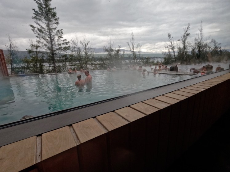
The Forest Lagoon had its own post two years ago. It’s another of these tourist-oriented geothermal experiences and one Iceland’s second city desperately needed. It’s just on the other side of the fjord, giving you glimpses of Akureryi through the trees. However, it’s a bit on the small side and while it doesn’t get the hordes the Blue Lagoon does, in the evening it’s like being in a crowded bar, only it’s a bar filled waist-deep with hot green water and a third of the drinks are radioactive blue. Perhaps earlier in the day it’s genuinely quieter and more relaxed and feels like more of a hidden gem up in the less-visited north or maybe I’ve just always happened to have been there at the same time as a tour group from a cruise ship – that’s where most of the big tourist groups in the north have come from.
So that’s my summary of the north-west. If you take your time, leave the Ring Road and meander up the jagged coastline, I’m sure you’d find enough quiet, interesting, beautiful things to keep you busy for weeks, and feeling smug that you’re the only person who’s discovered them while everyone else is on the circuit of the same sights. This is just what I found on my way to Akureyri and it’s still more than most people seem to see.
I’m taking a break from the Iceland content for the next week and you’re going to hear all about this year’s Rebel Summer Camp and then I’ve got another adventure coming up this very weekend but it’s not the end of Iceland by any means, there’s still plenty to say about my two weeks in a campervan this summer, so look out for that in October.
