Grábrók is one of my favourite attractions in a country full of incredible things to see and do, and I can’t quite believe I’ve never written about it before.
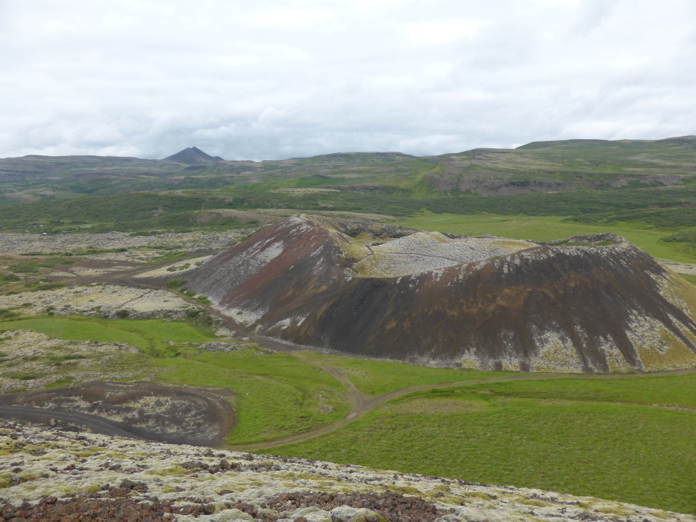
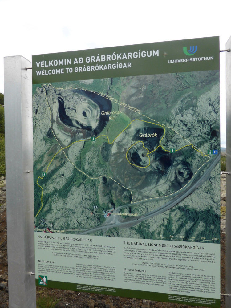
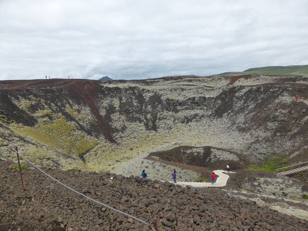
Technically Grábrók is “they”, not “it”. “It” is a little cluster of moss-streaked red craters beside the Ring Road: Stóra Grábrók (Big Grábrók), Litla Grábrók (Little Grábrók) and Grábrókarfell (Grábrók Mountain). Little Grábrók doesn’t really exist anymore, having been mined down to nothing for road-buikding gravel and rock. Grábrók Mountain is a fine thing to look at and there’s a boardwalk running up the side, around the top of and then into the crater of Big Grábrók.
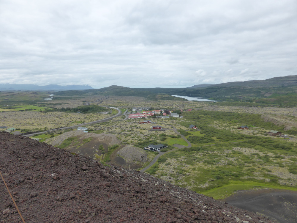
This all happens a little way north of Borgarnes, on the Ring Road heading for Akureyri. About half an hour in, you’ll come to a tiny settlement called Bifröst – yes, the same as the Rainbow Bridge you’re familiar with from the Thor movies. Icelanders don’t pronounce it “bi-frost” like we do in English. I believe it’s more like “bee-vruhst“. I have no idea why this tiny place has such a significant name from Norse myth. It might be nice to believe this is where the Norsemen of the 6th-10th centuries believed was directly linked to Ásgarðr, or Asgard, the realm of the gods, but the fact is that the first settlers didn’t come to Iceland until 874, well after the tales of the gods had been established so it feels unlikely this was believed to be an important place. Second, this “town in the lava” is home to little more than a university and the few facilities needed to keep it running. I’ve heard no tales that this had any pre-Christian religious significance. Of course, perhaps there’s extensive archaeological evidence buried or destroyed by the aforementioned lava.
Which brings us to Grábrók. I daresay these three craters poured their share of lava onto the region but the worst of the lava flow actually comes from fissures further up the valley to the north-east. The Grábrók craters are part of the Ljoufjoll system which extends from the eastern end of Snæfellsnes at the Beserkerhraun south of Stykkishólmur all the way onto the “mainland” at Grábrók. The Grábrók craters were first formed over 3,000 years ago and their last eruption was about 1,000 years ago. You’d think that makes them long-extinct but remember, until 2021, Reykjanes had been silent for more than 800 years and now we’ve had, I think, seven eruptions – maybe make that eight if the next one started between me writing it two and a half weeks ago and it publishing today. Grábrók is probably finished but in Iceland you just never know.
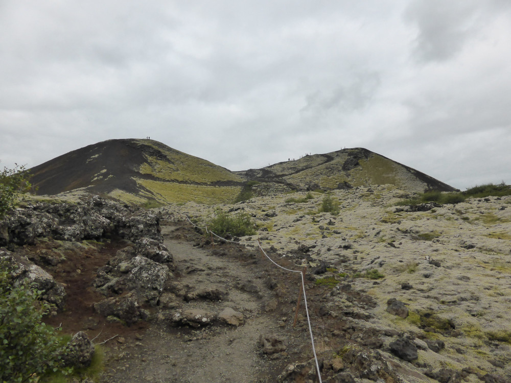
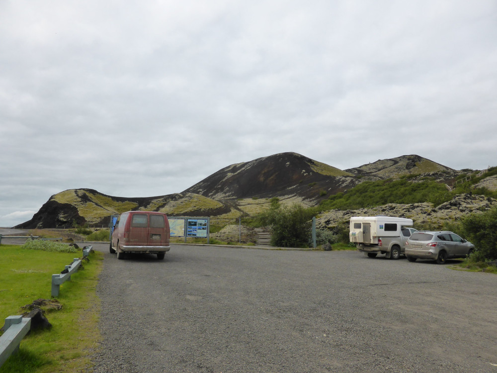
There’s a small car park off the Ring Road, an information board and then a path to walk up Big Grábrók. It’s about 170m high but the climb is nowhere near as onerous as that sounds. It’s got steps and it winds around the side of the crater rather than marches straight upwards. From the top, you can see right across the expanse of lava, down onto the remains of Little Grábrók and over to Grábrók Mountain. It’s a good and unusual viewpoint for relatively little effort, although it was damp and cloudy both times I’ve been up. Pick a clear day for best results.
Once you’re on the summit, you can follow the path around the crater rim for those 360⁰ views – and you can walk down into the bottom of the crater. These days there’s nothing in – it’s just a hollow in a hill – but imagine a millennium ago, when molten lava fountained and splashed here, building itself a wall with the lava cooling and setting and building up more layers of splash. Look past the reddish-brown rock and the grey-green lichen and moss. Picture this crater fresh and black, with that lava in deepest neon orange and yellow so bright it’s nearly white. Hear the rumbling grating sloshing of rock so hot it’s melted, spraying tens or even hundreds of feet in the air and crashing back down. Hear the bubbles. Smell the sulphur, imagine the heat you can feel 100m away, the rivers of lava pouring out from any weakness in the newborn cone. Add a shrieking pterodactyl for effect (Iceland didn’t actually have dinosaurs; its first corners didn’t pop out of the ocean until 50 million years after they all went extinct).
That’s the fun of volcanoes. Climbing them is good but what makes them better than ordinary mountains is imagining the drama that came with their birth. That’s why I have an entire category dedicated to exploring volcanoes. And this one is very easily explored. You really don’t need to take more than half an hour out of your journey along the Ring Road to tick “climb a volcano” off your bucket list.

One thought on “Roadside Volcanoes: Grábrók”