Girlguiding SWE and LaSER always have a Dartmoor training and leisure walking weekend the weekend of the 20-somethingth of September. I usually go. I did my training in 2014 and I use the leisure weekend to build up my logbook. You used to email them and request a place and now there’s an event site and you book it online like you’d book anything else. Except when I went to book it, it had vanished. Either I’d missed the deadline or it had sold out. Sold out, most likely. It’s a bunkhouse, there are only so many spaces.
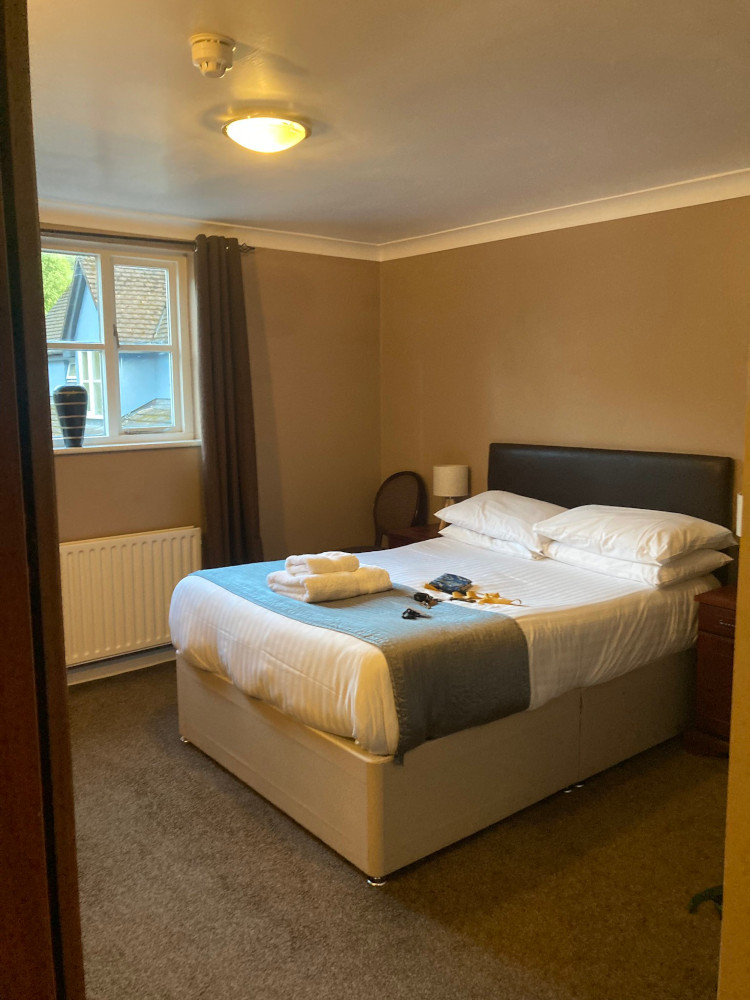
But I’d planned my September around this trip. I’d declined at least two other events that weekend so I had to go. I was also depending on it for another logbook walk. Ok, I’d just go by myself. I found indoor accommodation – I tend to camp when I go to Dartmoor on my own and then I have a habit of getting up in the morning and finding excuses to not hike 10km across the moor. I stayed at the Dartmoor Lodge Hotel, a few miles from Haytor, the usual training area, where I could sleep in my own room with a bath instead of sharing a bunkroom with twenty other people who snore, switch the light on every ten minutes to go to the toilet and complain about how they can’t possibly get into a top bunk.
On the other hand, while the training group trains into the evening – theory on Friday night, night nav up the side of Haytor in the dark on Saturday night – the leisure group spreads maps across the tables and plans their hikes together. “Leisure” usually means you’re here for a logbook walk so it has to meet the requirements, the minimum of which is that it’s 10km long. Anything obvious has already been done. We want easy parking, we often want to cross off a tor or two, we want to avoid marshes and mires and we occasionally have to take into account whether we want to be blown by strong winds in the morning or in the afternoon. On my own in a pub, I simply couldn’t be bothered to plan a route. I decided to drive up to the Haytor area, find a car park and pretty much walk for just over five kilometres before turning back.

I parked at Cold East Cross, which is a little way south of Rippon Tor, one I avoided for years. From the Haytor side, it’s a proper mountain of a tor, although it’s actually only 16m higher than Haytor. It’s not so bad from the south side. We did Rippon Tor twice last year, which is why I’m less scared of it than I was. I followed the wall up the south-west side of the tor. I think I’m bad at hills but actually, if I’d done a route card for that climb, I’d have beaten my expected time by quite a bit. It’s about 1.5km from car park to summit. We use “group” speed of 3km/h, so that’s 30 minutes by itself. Then we add either 30 seconds or 1 minute per 10m of ascent, depending on whether it’s steep or not. I use 1m because the spreadsheet that does my sums for me doesn’t allow for “Yeah, I think this counts as steep”. The car park is at 360m and the summit is at 473m, so that’s 113m of ascent which is a little over eleven minutes of extra time. Call it 41 minutes from car park to cairn. I did that in just under 30 minutes, sweating, swearing and thinking I was struggling.
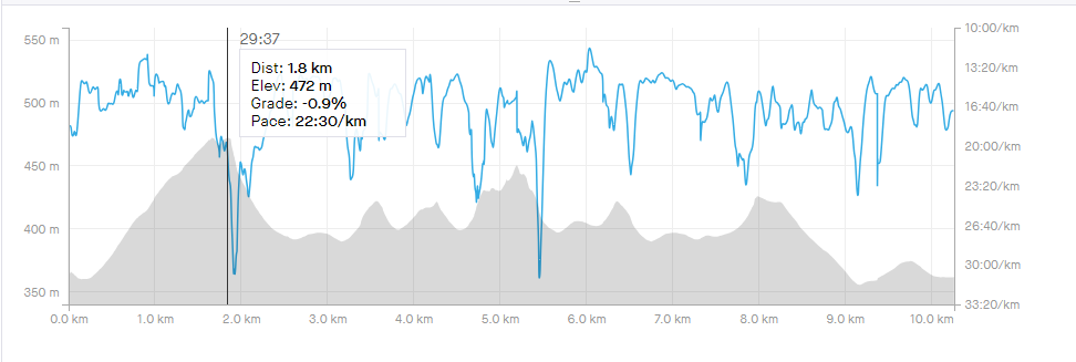
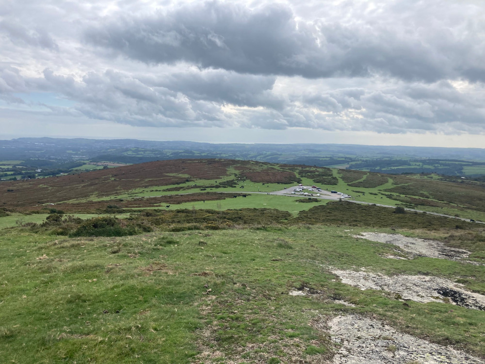
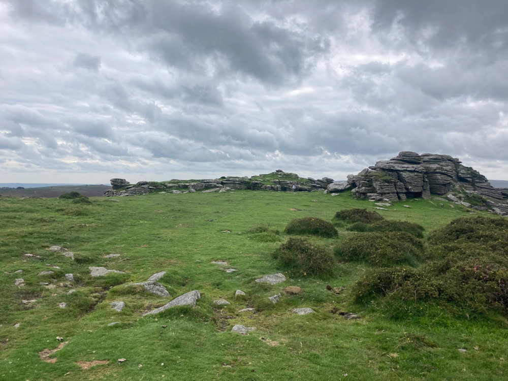
From there, I followed the track north-west to the car park at Hemsworthy Gate. You can also go down in a more northerly direction but it’s more awkward. From there, I walked along the road and climbed Saddle Tor – that’s the peak you can see at about 3.5km in the graph above. That should be a lot easier. Judging from my graph, it’s a little steeper than Rippon Tor but it’s a lot shorter and you’re starting a lot higher, so the elevation gain is under a quarter of Rippon’s elevation gain. From there, I looked across at Haytor, which is never quite where I think it’s going to be. Saddle Tor doesn’t point quite where I expect it to and I find myself looking due north and surprised every time that Haytor isn’t there.
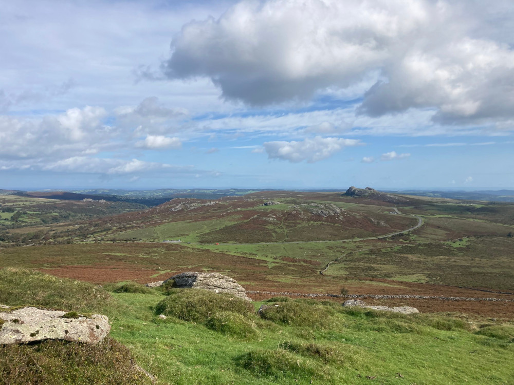
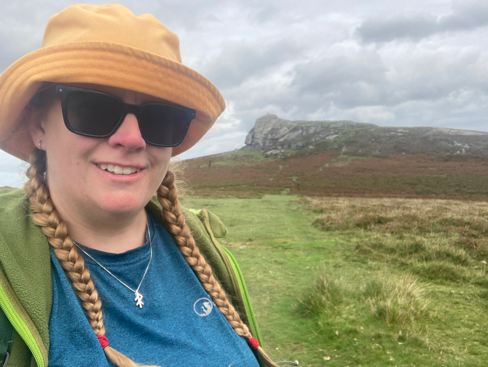
It’s a pretty easy walk across to Haytor but I decided to extend it slightly by detouring left to the quarries, which just look like an unnamed tor before detouring back to the right and scrambling up the natural “steps” on the west side of Haytor. It astonishes me how far it is to the visitor centre from here; there are wide “roads” up the side of the tor from that car park but standing on the top, it looks miles away. You wouldn’t think of just running up and down if you were beamed onto the top like you do if you park at the bottom.
I met the region group on Haytor. I spotted a group of ladies, dressed seriously, gathered around a map and in the middle I spied one I recognised, so I sidled over. Yes, I looked very suspiciously lingering a few feet away while they examined the map. Anyway, it transpires the bunkhouse wasn’t full and if I’d just phoned, they’d have happily booked me on.
It’s good for me to go out on my own, I think. I know from past experience that I can keep up with the navigation. We stop regularly for someone to ask “Where are we?”. That’s not a genuine question from someone who think they might be lost. That’s an instruction from someone who wants to test our navigation skills. The answer does not include the words “I think”, “are we” or any question marks. All the same, it’s easy to be lazy with the navigation, to read the map in the same way I read a Chalet School book over a meal, to tag along on the group. Not that this walk was requiring any navigation, since I know this area pretty well and was making it up as I went along, but it’s good for me to plan and walk my own walk. The big thing that group is good for is making sure I don’t have the opportunity to think “I’m too tired/it’s too hot/cold/wet, I can’t be bothered”. I’d have my 20 logbook walks by now if that wasn’t my usual habit when I’m on Dartmoor on my own.
I was going to have lunch on Haytor but it was breezy and I was looking at the sky a little nervously. It had been bright blue and sunny when I left and I decided not to bother carrying my waterproofs. Needless to say, by the time I’d crossed Rippon Tor, the sky was doing a Dartmoor and looking quite threatening. 8.5km before the rain started. Better get a move on. For what it’s worth, it didn’t rain until the next day but I got a nice reminder why we don’t ever leave our waterproofs behind when we go out for a day on the moors.
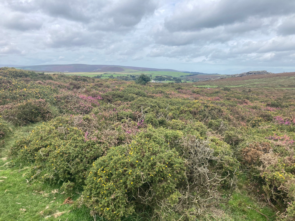
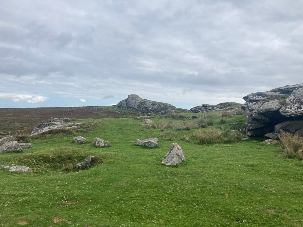
I took the straight route back to Saddle Tor. In theory, I’d have my full 10km if I just retraced my steps but I suspected that I’d pushed it over the 5km by ambling around Haytor, which I wouldn’t be replicating. To make sure I reached my goal, I’d have to detour back to the car a bit. So I walked back to Saddle Tor, along the road to the car park at Hemsworthy Gate and then instead of climbing Rippon Tor to the south-east, I turned 180 degrees and headed for Top Tor to the north-west. It’s a pretty easy scramble up and then a straight walk to Pil Tor a couple of hundred metres away. Then I’d cross Blackslade Down and cross to the car park on the other side of the road.
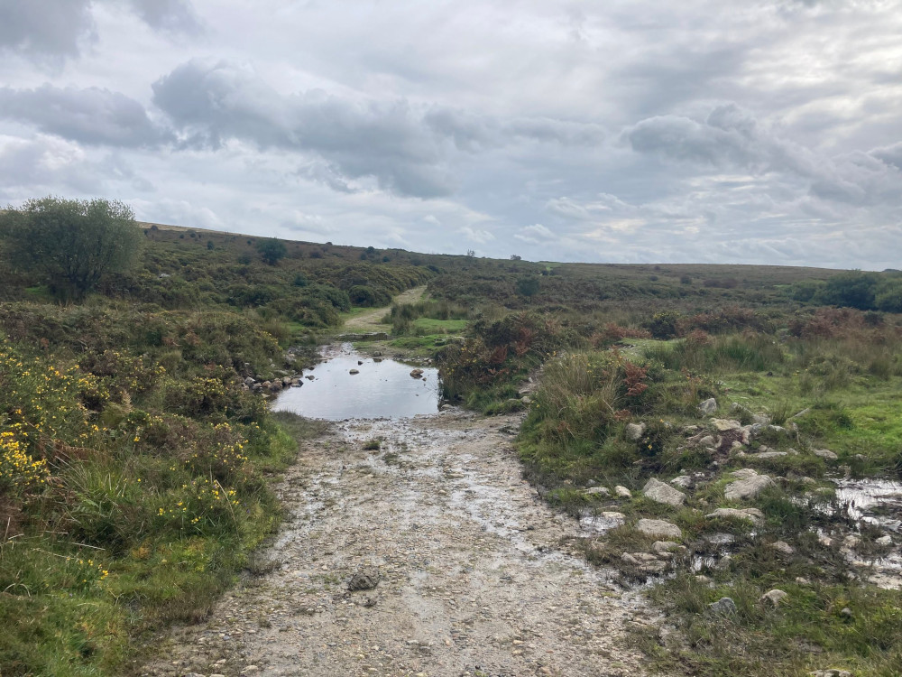
This is where I did have to use the map a bit. We did this walk in reverse last year, discovering that there’s a reason a section between Pudsham Down and Pil Tor isn’t marked as Open access land. It’s because it’s private land surrounded by fences and walls. I wanted to join the bridleway that runs south to the road just above the car park and to get to it, I had to walk down from Pil Tor towards the corner of that square wall. Somehow I failed that and crashed into the bridleway halfway across the wall instead. But I was where I wanted to be, on the nice obvious path. Then I had a steep descent without ending up in Blackslade Mire, down to Blackslade Ford. That took me by surprise, a fast-flowing stream across the path that I hadn’t expected. “That wasn’t on my map,” said I, unfolding the map. Oh. Not only is it marked on the map, it’s named on the map. I picked my way across some stepping stones and began the walk up to the road. From Pil Tor, that had looked like a long and steep pull that made me wonder if I wouldn’t have been better off just climbing Rippon Tor again but it was fine. The road was the worst bit – it’s really only a single-track road and it isn’t necessarily easy for a walker to get out of the way of oncoming traffic in several stretches of it.
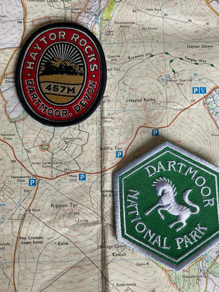
I measured the walk on both my Strava app and using my GPS. I try not to use Strava for longer walks because I don’t trust my phone’s battery. On the other hand, I really don’t know much about how my GPS works. They measure differently, that I discovered. Strava said I’d done 10.26km. The GPS said I hadn’t quite reached 10 when I got back to the car, so that’s at least 300m difference. I suppose that’s not really a lot over 10km but it’s the difference between something counting as a logbook walk and something not counting as a logbook walk. I detoured across to the Haytor Visitor Centre on the way home because I wanted to see what there was in the way of badges. And there were badges! They had the Adventure Patches Dartmoor badges so I got myself a Haytor! There were also two or three other tors I’ve done but I’d rather get them when I do/redo them rather than backdate.
Of course, I still hadn’t eaten but that was ok. I was staying in a pub! I went home, changed into clothes that were a bit less sweaty and went down to the bar for some garlic bread and a pint of orange juice and lemonade.
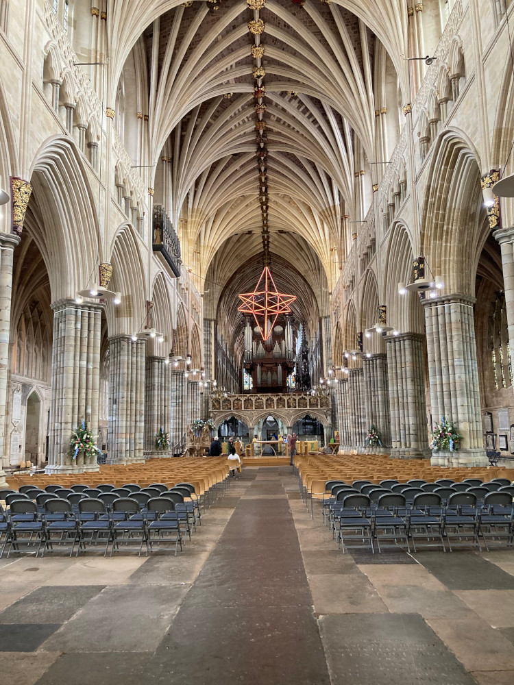
I didn’t bother with a second walk on Sunday. I rarely achieve a 10km logbook walk on Sunday even on a region weekend. Either we cut it short to get home before midnight or my feet hurt too much. Anyway, I wanted to see Exeter Cathedral. I drive past it on the way to Dartmoor and I never have time to stop. So I made a point of stopping on Sunday. It’s worth doing – it’s a particular kind of soaring Gothic with a really long medieval vaulted ceiling (longest in the world, I think) and enough pillars that the video describing it as looking like a forest was actually correct. I also did a little shopping – some books that will appear in later Travel Libraries and maybe a bag of bath bombs from Lush. A wonderful melty cheese panini and mini chocolate fudge brownie at Honiton and I got home nice and early on Sunday for once.

My new county walking advisor was on that weekend
LikeLike