Not all of it! I didn’t walk the entire length of the South Downs Way. I didn’t even walk the entire length of what I had planned. But I managed 28km of it, which is 17.5% and that’s not bad.
My plan was days one and two as given by both the South Downs Way website and the Cicerone guidebook (that’s an affilicate link to bookshop.org). 20km from Winchester to Exton and then 20km Exton to Buriton. That is, by “Exton” I mean the pub in the village over the road, Meonstoke, and by “Buriton”, I mean Halls Hill car park at the top of Queen Elizabeth Country Park, which is where the guidebook marker shows that stage finishing.
I can walk 10km in a day pretty comfortably. The most I’ve ever really done in a day is 14km so I was a bit nervous about taking that up to 20. Surely I can do that. It’s just a matter of taking it slowly, taking breaks and taking sandals to change into when my feet get hot and sore. I had an escape plan for day two in case 20km two days in a row was too much and… ok, I was nervous. I’m not a long-distance hiker.
I set off from the bus stops by the King Alfred statue in Winchester at 5.48am. Yep. I didn’t arrive by bus – my dad had a bus day (long story; he loves vintage buses) and offered to drop me off on his way to Weybridge. My first plan had been for my mum to drop me off closer to 9am or even a little later but an early start made sense. I’d written a route card and it would take me about nine hours in all – that includes the distance, the extra time for height climbed, scheduled breaks and lunch, at a speed of 3kph. That’s what we use for Dartmoor weekends. Most of us walk faster but it allows for time to check the map and look at the view and look at moss and whatnot and when I’ve walked alone, I’ve found it’s pretty accurate. That would get me to the pub at Meonstoke about 6pm. If I was slower than expected because 20km was too much for me, I’d be stressing about arriving before it either got dark or they locked the doors on me. Departing at 6am gave me time to pretty much be as slow as I liked.
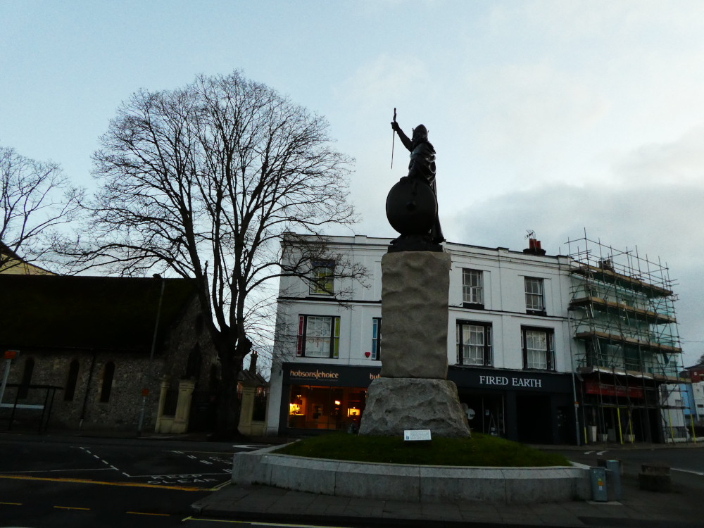
So there I was in deserted Winchester before 6am on a Saturday. It’s a couple of minutes up to the City Mill which is the official start point – the actual sign is locked behind a gate at this hour, which I already knew – and off I went. I followed the signs down by the river and then instead of turning left and crossing the river, I carried on until I was behind the cathedral and on the other side of the gardens – all of 200m from where I started.
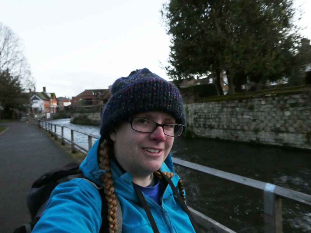
The first major obstacle was finding the footbridge over the M3. It’s hidden down the back of a bit of a maze of residential streets, with no signs just where you need them most. I had an OS map – that is, I had the Cicerone map book which reproduces the exact sections you need – but those are useless in cities. I had to resort to my phone. I had second breakfast on the other side. I’d had first breakfast at 4.15 and now the dawn effect had worn off and I’d walked a kilometre or two, I needed food.

This was where it felt like the trail should start, now I was in open countryside. Not terribly inspiring countryside, admittedly. This is probably a lovely field of wheat or barley in the summer but today it was close-packed rows of green shoots half an inch tall. The South Downs Way ran along the top of the field and it was muddy. Not muddy mud but wet chalk mud – simultaneously treacherously slippery and also so sticky it tries to tear your boots off. I hate mud. It takes an unreasonable amount of effort to walk on and I’m always conscious I’m about to crash to the ground. I was very glad to reach the tarmac of tint picturesque village Chilcomb – looking at my GPS track later, my dad was amazed to find I’d walked through here because that’s where one of the groups keeps their buses! Anyway, I employed my mini tripod and a signpost to take timer selfies and a video of me walking towards the camera for a “mini documentary” I plan to make about my walk – at time of writing, I got home 6 hours ago so I haven’t even unpacked my camera yet and I know how I drag my feet over editing.
Then out of Chilcomb and back into… well, a steep climb up a tarmac lane, skirting the edge of a military shooting zone then back into open countryside, passing Winchester Science Centre (I’d been through a whole village quite a way back; how was I still in Winchester?) and finishing the third leg on my route card by crossing the A272 at Cheesefoot Head. The natural amphitheatre below, now home to Boomtown Festival, was where President Eisenhower addressed the Allied Troops before D Day. There were two hikers ahead of me who’d mentioned this and I caught just enough to wonder what Eisenhower had to do with Hampshire. Reach Cheesefoot Head, see the info board, mystery explained.

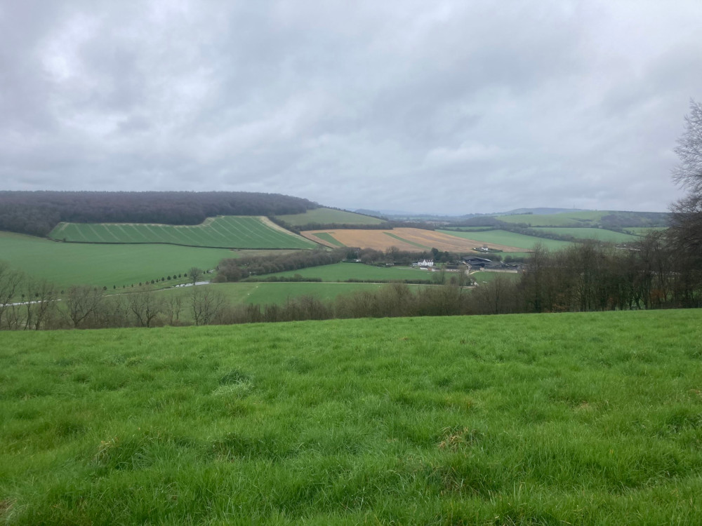
Now I had six or eight kilometres of countryside before I reached my lunch stop. I estimated I’d be there by about 10.30 or 11 – early for lunch but fairly late for someone who’d done nearly five hours of walking. I had elevenses at ten to nine – early in clock time but late for three hours in. I didn’t find the countryside very inspiring. People talk about the magnificent beauty of the rolling chalk hills – well, maybe the problem was that it was still wearing more of its winter browns than summer greens. Maybe it was that it was the sort of overcast day that keeps threatening to rain, although it never actually does. Maybe it’s that I live among rolling chalk hills. Hills, farmland, rounded valleys and little tracks through deciduous woodland is right on my doorstep. Farmland isn’t pretty at this time of year and there were no cows.

My aim was the Milburys, a country pub in the middle of nowhere. I had no real idea if it was even open. It had a succession of appalling reviews between about 2011 and 2015 and a handful of better ones starting around 2021. I couldn’t find any opening times and I wasn’t entirely sure whether it still existed. If it did, and if it was open, I’d probably get a drink there. Maybe food. If it didn’t, I could probably still sit outside in its car park and eat my own food. It’s the only potential food- and toilet-stop on all of day one.

It wasn’t open when I got there at about quarter to eleven but it didn’t look entirely derelict either. The car park looked reasonably well-maintained, there were two cars parked there, there were picnic benches outside and there was a small window open next to the door. Well, I had that third option. I plonked myself down on a bench, took off my boots and sat down for lunch. Second lunch. I’d had my first lunch in a field some three kilometres back. It showered a bit while I sat there. It had showered a couple of times – the sort of minor shower where a softshell jacket is plenty to protect you. But this shower got heavier. I pulled out my waterproof jacket and packed away my camera and concluded that maybe I’d get walking again instead of sitting still getting cold in the rain. At that point, the pub door opened.
The kitchen didn’t open until 12 but I could sit down in a proper old-fashioned dark pub with a real fire and a ton of horse brasses, dry off, put my feet up and drink a glass of orange juice and lemonade. At 12, I ordered some cheesy garlic bread and what with one thing and another, I didn’t leave until about quarter to one. I had a 35 minute break scheduled here and I’d stayed two hours. That was fine, that was precisely why I’d opted for the really early start. I’d still be at the overnight pub before they locked the doors.
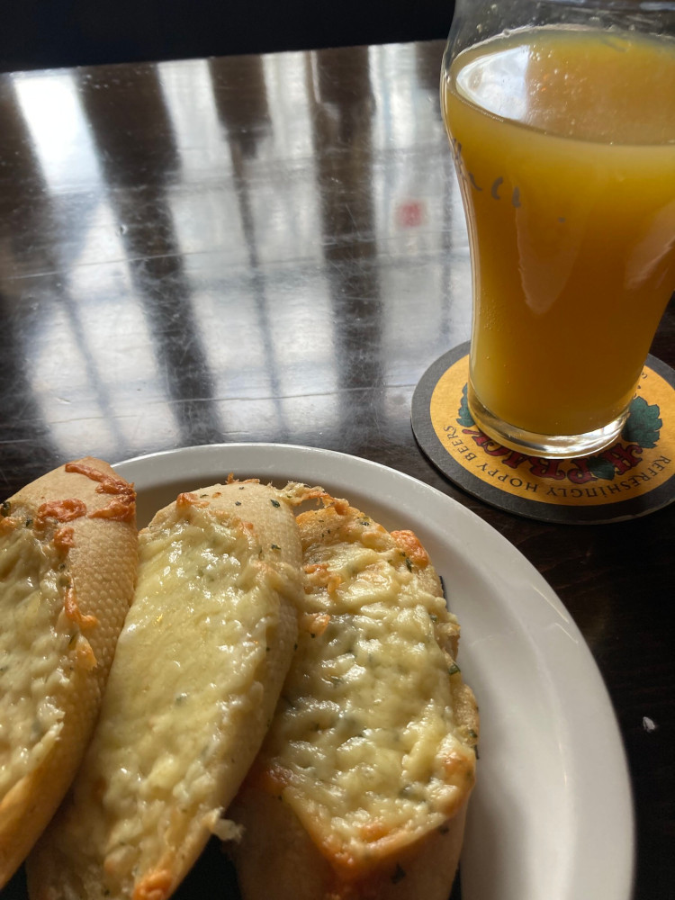
A quick review of the Milburys: it’s a proper old-fashioned country pub with a slightly grumpy landlord in pin-checked suit trousers who gives you a look if you order a Florida Orange – it turns out that’s just orange juice & lemonade with a dash of lime. I don’t think you’d get cocktails here. Honestly, I was amazed when someone asked what wines they had that the landlord didn’t just say “White or red”. It definitely exists, it serves food strictly between 12 and 2 and it has “the best fire in Hampshire”, possibly it’s not open on Mondays, and I’d definitely consider it for your lunch stop.
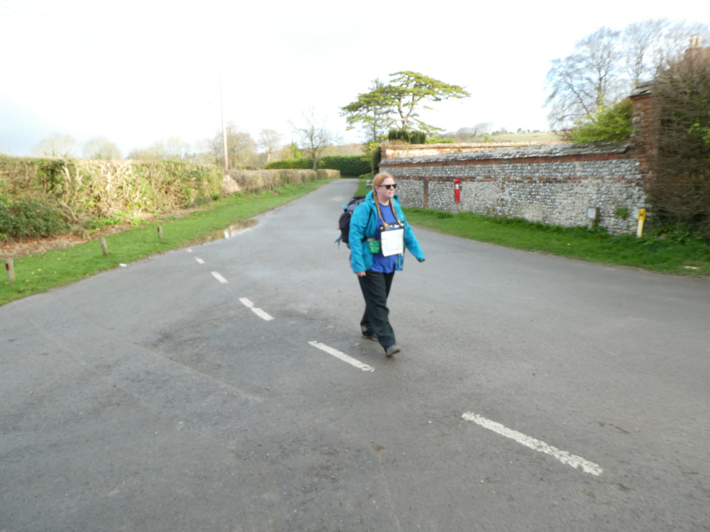
I was now about two-thirds of the way through Saturday. The next bit was another section of countryside up to the top of Beacon Hill where the path had a bit of a wobble before it led steeply downhill. I changed into my sandals here – my feet couldn’t have done much more in boots. Because I was headed for Meonstoke rather than Exton, I opted for the bride route rather than the walker’s route, which meant carrying on down the road instead of turning left into the fields. It’s a tarmac road but I only saw one car on it the entire nearly-hour I was hobbling down it, and that was when I reached the bottom and was sitting on the soft grass outside the first house.
![]()
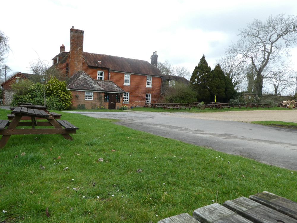
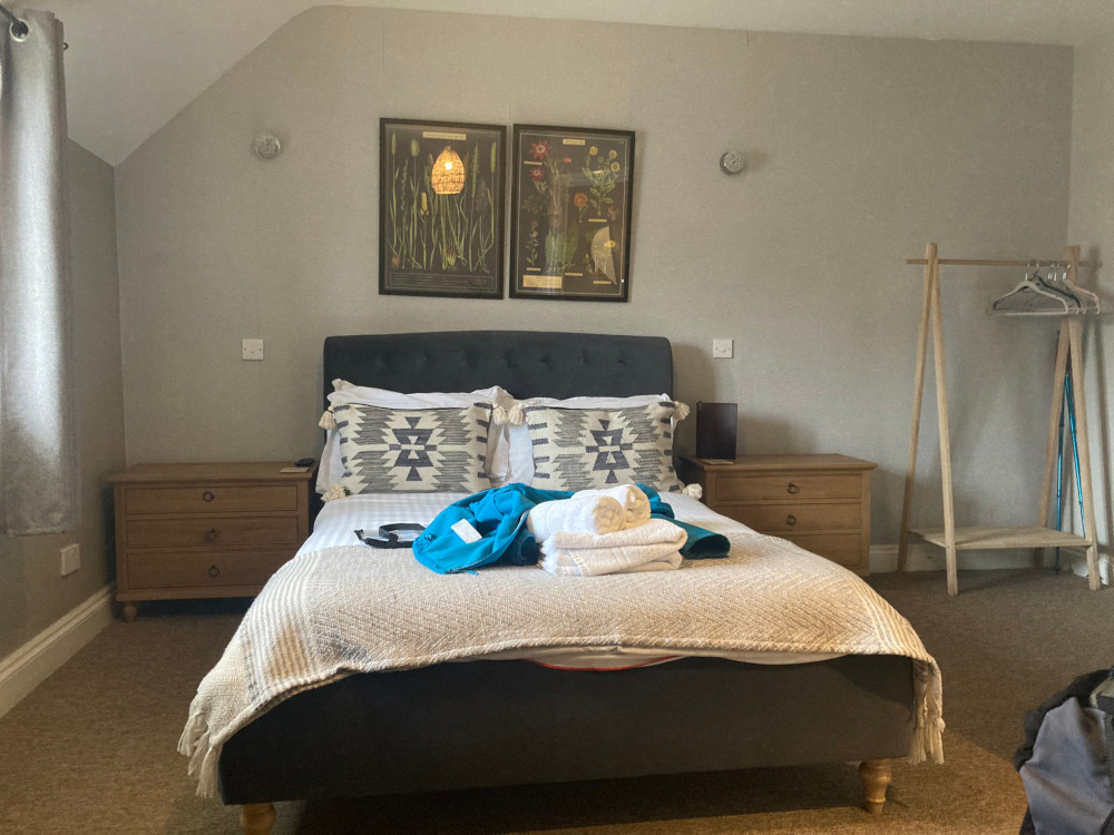
I arrived at my overnight stop, the Bucks Head in Meonstoke, by about 3.30 in the afternoon. I went up to the room and luxuriated in a long bath until dinner started at 6. Then I requested some drinks and a cheesy garlic bread pizza-thing which was delivered to my room, I watched two episodes of Diagnosis Murder and the last hour of Legally Blonde, dragged myself out of a warm comfortable bed to stretch and bend and loosen muscles and joints that were trying to tighten up and went to bed pretty early.
It rained on Sunday. 20km today wasn’t an option. I cut my walk down to 6.5km and even that seemed optimistic when I was looking at the map on Saturday night. Feeling a little better over breakfast on Sunday, I was quite excited. 6.5km seemed a lot but when I looked at the map, it didn’t look nearly that far. I was going to keep walking! I could be at the end of my short walk in just an hour or two, surely! Yeah, I can do this!

I put on my waterproofs, glad it was a bit cold because otherwise I’d have boiled in the bag. I followed a dismantled railway line back to the South Downs Way which immediately started up two hills. The second was Old Winchester Hill, a hillfort dating back to the Bronze Age. Despite the drizzle and the climb, I felt good when I got to the top. I could see Beacon Hill opposite and I could see all the way down to what I thought was Portsmouth – and looking at the map in my other screen, I was right! – and there were sheep and barrows and I felt triumphant. Three kilometres to go and it’s all downhill from here!

Those were possibly the worst three kilometres of the entire weekend! Within a few hundred metres of the outer ring of the hillfort, I was in mud – not wet clay this time, but brown thick mud. 1.5km to the next major junction should have taken 31 minutes, according to the route card. According to me and my experience, I walk 2.3km in 28 minutes pretty much every day. At that speed, I could have done it in 18 minutes. It took an hour! Ok, I sat on a bench for a couple of minutes, I paused to unwrap a Babybel but mostly I just slipped and slid in the mud and yelled at it out loud and cursed that the car park wasn’t marked on the map, making me think I was a lot further on than I would.
The very last leg was even worse. Mud plus slippery clay plus a very steep hill! Plus being able to see the end. My feet and brain are always more tired right at the end and it’s deeply frustrating to spend forty minutes looking at the end but not actually being there. Please let this be what I think it is. Please let this be the end. Why is the car park so far from the centre of the farm? Please let my feet carry me another couple of hundred metres.
(This was the point when I gave up on photos, although one day I’ll edit the video together and there’s a little video of the end.)
I’d requested that my parents pick me up from here at 1pm, which would give me time to get there and if the clubhouse was open, maybe give me time to get a drink. I arrived just in time to sit on a bench, turn off my GPS and then look up at the sound of an approaching engine. I was in the right place, they were in the right place and it was done.
How did I ever imagine I could have another 20km in me? Even another 15? I didn’t really even have that 6.5km left in me. I’m not a long-distance hiker. I’m not even a consecutive-days hiker. I need a better bag if I’m ever going to try anything like that again and I need to be more realistic about daily distances – although in my defence, short of illegally wild-camping, Exton/Meonstoke is about the only place I could stop. There’s allegedly accommodation at the Milburys but you have to contact them directly to ask and I’m a millennial. Please let me book online without speaking to a human being at any point, especially if that human being is only going to answer the phone for two hours during the day.
Will I do more? Maybe. If I can figure out the logistics. I have 13km left that I should have done – that’ll make a day in itself. The remaining seven days will need to become at least ten days, probably more. But really, if I’m going to put miles under my feet, I’m going to do either Dartmoor or the South West Coast Path and preferably put some more level 2 walks in my logbook. For all this was the hardest walking weekend of my life so far, it’s only a level 1 walk. I earned the pin badge, that’s for sure.

2 thoughts on “I walked the South Downs Way!”