There’s nowhere better to holiday in winter than Iceland. Northern Lights, snowsports, Yule Lads, warming up in geothermal pools… I wish I wasn’t on my way to Germany right now! But what to do as a winter in Iceland itinerary? I considered it and then I realised. What you’ll see in magazines is bargain trips to Iceland from your favourite regional airport to spend a few days in the north. The north!
Day one
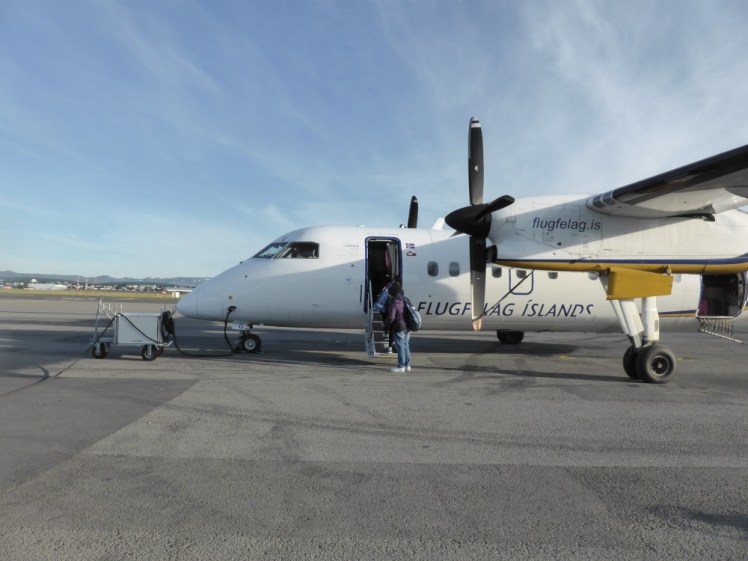
You’ll arrive, as usual, at Keflavik in the south-west corner of Iceland. Get yourself to Reykjavik Domestic Airport – you can do this by taxi but the cheapest and easiest way is to take the airport bus, which is just as happy to drop at another airport as it is at hotels – and take a 45 minute flight up to Akureyri, the capital of the north.
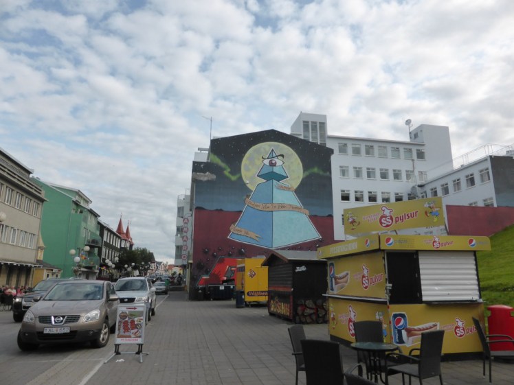
You’re going to stay in Akureyri tonight. It’s the biggest city in the area, yet little bigger than your average market town in the UK, so you get the best of the Christmas shopping and the food but without feeling like you’re on a city break. I won’t tell you where to stay. Please yourself on whatever budget you have. You can go for the expensive luxury hotels or you can have a bunk in a hostel. Spend your day exploring Akureyri and then this evening, go hunting for the Northern Lights. I can’t emphasise enough that you should do this as early as possible in your trip. The Northern Lights are so temperamental, so elusive – if they don’t come out tonight, you’ve got more opportunities.
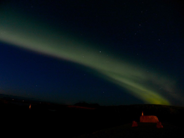
Of course, the easiest way of chasing the Northern Lights is to hire a car and that’ll make your trip so much easier. But bear in mind that this is a winter itinerary, so you should feel comfortable driving on snow and in the dark. I personally would do a winter trip with tour companies. The advantages are that someone else does the scary driving, someone who knows where they’re going and what the best things are to see and you can relax and enjoy Iceland from a comfortable seat. Plus many tour companies have an offer that if you don’t see the Northern Lights, you can come back for free another night and try again – which is another reason to do it as early as possible.
These are some good options in the North:
Geotravel
Saga Travel
IceAk
Star Travel
The Traveling Viking
Arctic Fox Travel
Day two
Today we’re heading for the Diamond Circle. Iceland likes to arrange its tourist sights in circles. This one encompasses Husavik, Ásbyrgi and Dettifoss. I’m keeping Myvatn for tomorrow, so you might like to move to the Myvatn region, possibly to Reykjahlíð, for a couple of nights. On the other hand, this is really rural and accommodation is less easy to find than in the big city so it’s up to you whether you’d prefer to stay in Akureyri and have an hour/hour and a half to drive between Myvatn and Akureyri.
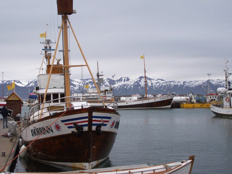
Anyway. First stop, Husavik. This is the whale-watching capital of Iceland. Take ten minutes to appreciate the harbour and then get on your boat of choice. Do you want a high-octane RIB adventure or a sedate tour boat or even a tall ship with sails? Most companies should supply you with warm suits to wear on board but if you haven’t booked online in advance and checked that’s definitely available, then take warm stuff with you. Iceland is cold in summer; on the water in winter it’s going to be freezing. Take gloves and a hat. Also, be prepared to not see many whales. You have the best chance in Husavik and the whales are active in winter but they’re wild animals and there’s no guarantee where they’re going to be hanging out or that they’re going to feel like leaping out of the water. It’s all entirely on chance.
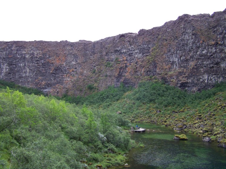
Back on dry land, get yourself warmed up with a hot drink on the harbourside and then head along the coast to Ásbyrgi. It’s a huge horseshoe-shaped cliff, 8km wide at its widest and at least 15km long. They’re really good sharp cliffs, cut so incredibly neatly. You can see why one of the legends associated with it is that it’s a hoofprint from Odin’s giant eight-legged steed. The more prosaic reality is that it was probably caused by a massive glacial outburst from Vatnajökull, which is the source of the river that dominates this corner of Iceland.
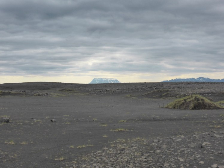
And that’s your next stop: Dettifoss. Five or ten minutes further up the road is the first of two roads that go directly south. Both finish up on the Ring Road east of Myvatn and both stop at Dettifoss, a huge waterfall in the middle of the huge and ferocious Jökulsá á Fjöllum river. There’s no crossing. If you want to see both sides, you have to either drive all the way back to the north and back down the other road or all the way down south and back up the other road. Once you pick one, you’re stuck with it.
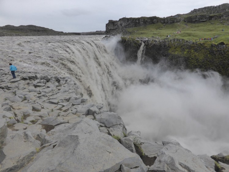
The east bank, the one accessed by the 864 road, is the one were you get the best close-up view of the huge waterfall. It’s all very grey and very white and very post-apocalyptic and I think this is my favourite side.
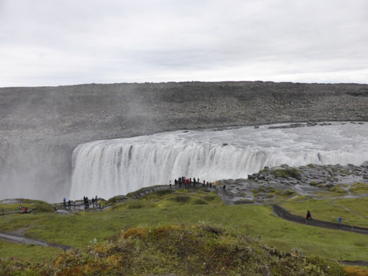
The west bank, the one accessed by the 862 road, is the nice green accessible one, with soft grass and marked footpaths. This is the one tour buses are most likely to take you to.
It’s entirely up to you which one you like the look of the most and if you’ve got two or three hours, there’s no reason why you can’t do both sides. It’s just going to take time. I’m out of date about which bits of those two roads are tarmacked and which are rutted gravel. I believe – but I’m not certain – that the west road, the 862, is at least tarmack from the Ring Road up to Dettifoss. In 2016, which is the last time I drove it for myself, the east road, the 864, was 100% gravel. It’s perfectly drivable, even in a small car. Also, bear in mind that this is a remote part of Iceland and I don’t know whether these roads are even accessible in winter without a 4×4. Check on safetravel.is to see what conditions are like on the day and pay attention. ICE-SAR will be seriously annoyed if you drive on a road marked Impassable.
You’ve had a long day. There’s so much to see and do around Myvatn and you’re going to do that tomorrow. If you get home early enough, you can have another go at the Northern Lights.
Day three
Myvatn day! There’s so much to see and do in the Myvatn region and it’s almost all volcano-related so it’s probably going to be warmer than you think!
I think we’ll start by driving east out of Reykjahlíð and going up to the Krafla area. This is on the side of an active volcano – that doesn’t mean it’s currently erupting or likely to start any time soon but the ground under your feet is hot.
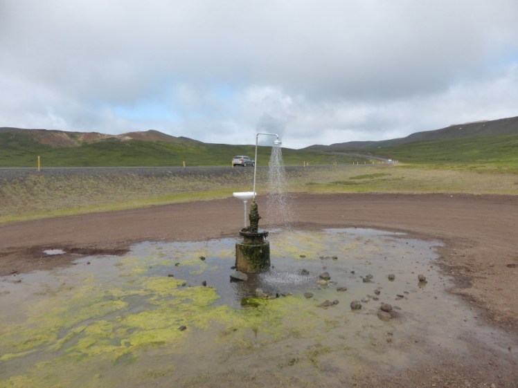
Stop at the perpetual shower. I don’t know why it’s here – possibly simply to show off how hot water literally springs out of the ground here. There was an algae-ridden puddle under it when I was there but I haven’t seen anyone else reporting that. What I have seen is many people sticking their head under it for photos.
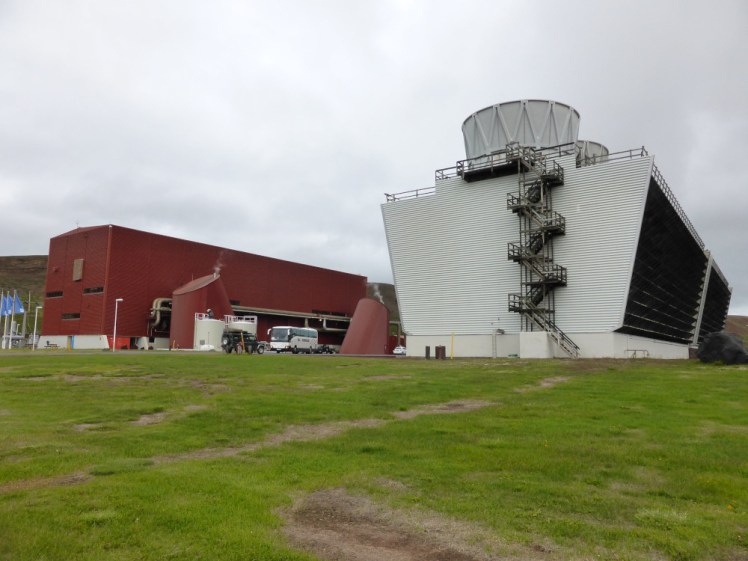
Then up towards the power station. I recommend stopping here and going into the exhibit to find out how it all works. You don’t have to stay long and you don’t have to become an expert in geothermal electricity generation but you’re in an unusual place and it might be nice to have an idea what’s going on.
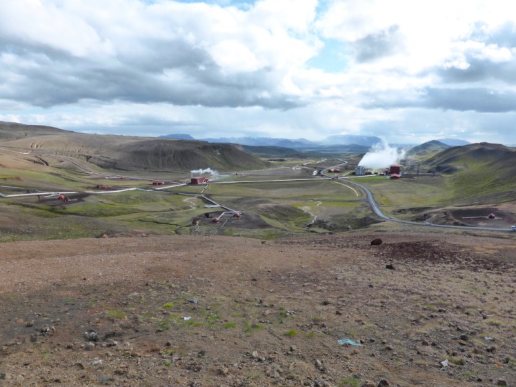
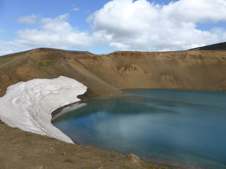
Carry on up, pausing for photos at the viewpoint. Then up again to Víti. This is the less famous of the two Víti craters in North Iceland. The other one is on top of the volcano Askja which is pretty much totally inaccessible this time of year. This one is a deep steep-sided flooded crater. You can’t go down to it, it’s roped off and in icy or snowy conditions I almost guarantee you’d end up falling in that water, which is dangerously cold. Look, don’t touch.
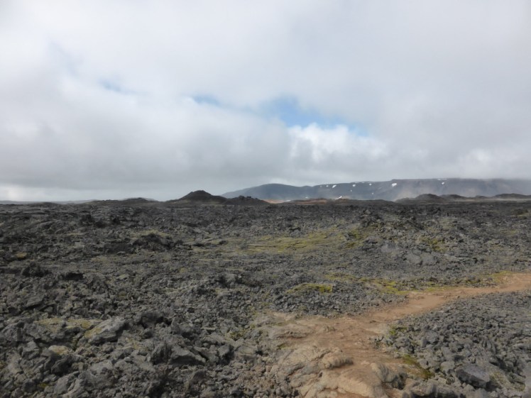
Then across to Leirhnjukur which is a fairly young lava field accessible via a short hike. This volcano finished its last eruption in the first half of the 1980s but in wet weather, it still steams because lava holds an incredible amount of heat.
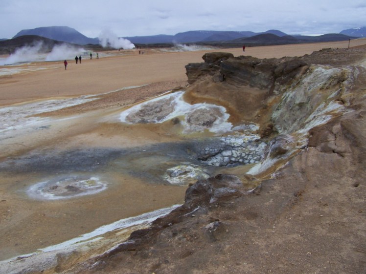
Back down to the lakeside and we’re going to start at Hverir which is what Icelanders call a “low temperature area”. Those of us who don’t live on top of active volcanoes might disagree with that title. This is where volcanic heat beneath the ground literally boils the Earth. Everything here is scorched, streaked white and orange with sulphur, pools of grey mud bubble and a pile of rocks screams like a boiling kettle. Oh, and if you step off the guided track, you risk getting your leg trapped in 100+⁰(C) mud so don’t do that. Iceland has quite a few places like this. They stink, they’re perpetually warm and they’re so alien!
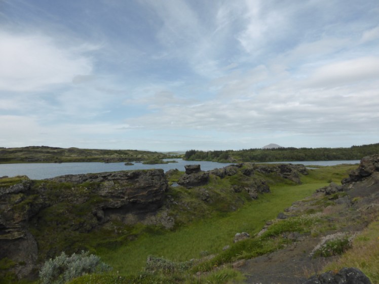
Next, to Skutastaðir where you’ll find lots of small rounded hillocks clustered by the lake. They’re pseudocraters and they’re where lava flowed over marsh. The marsh immediately boiled, the steam was trapped and so it blew the lava up into bubbles. As everything cooled, lots of the tops collapsed like a soufflé taken out of the oven too soon, leaving miniature craters.
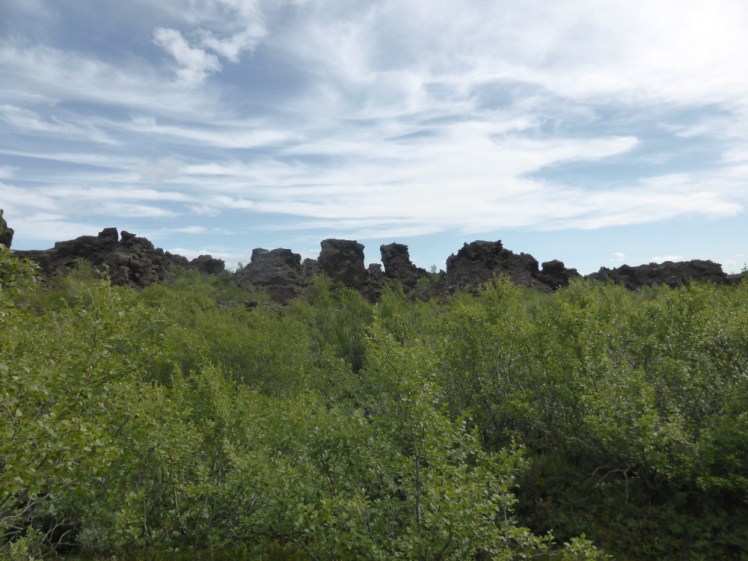
On the road on the way back up to Reykjahlíð, stop at Dimmuborgir. This is a very weird place – it’s a lava field but it’s the remains of lava pillars and bubbles rather than an endless spread of lava like pouring a bowl of rocky road mix into a baking tray. Iceland has twelve “Santas” – actually, it has twelve trolls which come down to town from the mountains on the twelve nights leading up to Christmas. They’re called the Jule Lads and in some tales, this is where they live. Take some time to wander the birch-lined lava paths and maybe you’ll meet them.
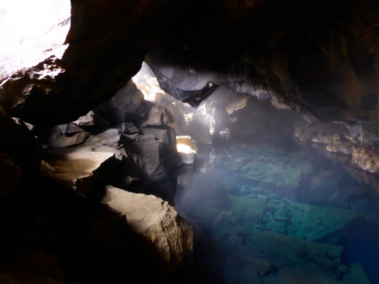
Your penultimate stop is at Grjótagjá which is a flooded cave which you may or may not recognise from a scene between Jon Snow and his lady friend in Game of Thrones. I personally don’t but I still appreciate this cave because it’s very beautiful. Don’t bathe in it – the ceiling is unstable so it’s not particularly safe to even stick your head in but that gorgeous blue water is also too hot to dunk yourself in.

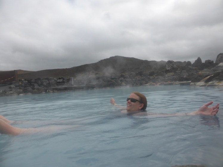
The time for bathing comes next – five minutes up the road to Myvatn Nature Baths, which I regard as the Blue Lagoon’s smaller wilder cousin. It’s another lagoon full of milky blue waste water from a power station but the views are better and it’s not nearly as busy. If you’re really lucky, you might get to see the Northern Lights over Myvatn from its hot water.
Day four
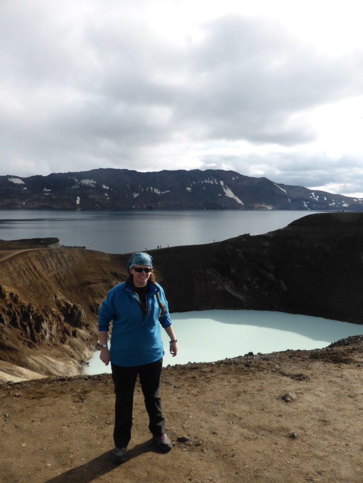
Most North Iceland itineraries would have sent you south again by now. I’m going to be a bit vague about this day because it’s very much up to your tastes – find yourself an adventurous activity! If you’re using this itinerary in summer, I highly recommend going out to Askja, Viti and maybe Holuhraun but if you’re doing a winter itinerary, that’ll be inaccessible by anything except helicopter and I’m not aware of any helicopter trips and of course that’s an option (although an expensive summer-only one)!
How about one of these?
- Lofthellir Ice Cave tour with Arctic Adventures
- Snowmobile tour with Geotravel
- Guided snowshoe walk with Geotravel
- Aldeyjarfoss Superjeep tour with Geotravel
- Horseriding with Langhus Farm
- Ice Fishing with the Traveling Viking
- Handcrafts and Micro Brewery tour with the Traveling Viking
(Geotravel are pretty good for North Iceland adventures – I went to Holuhraun and Askja with them in 2016)
Day five
Time to head back to Reykjavik for your flight home. This is your holiday so if you want to spend more time in the south-west, I’ve got an itinerary for that! But the plan in this itinerary is to fly back to Reykjavik, maybe grab some lunch and then drive out to Keflavik for your afternoon/evening flight.
