Now that I’ve been to an actual live eruption, I realised it was time I did an Iceland Itinerary for Volcano Fans. Why haven’t I done this before? It’s not like there aren’t enough volcanic delights to get a book out of (and I know; I’ve been trying to write it for five years).
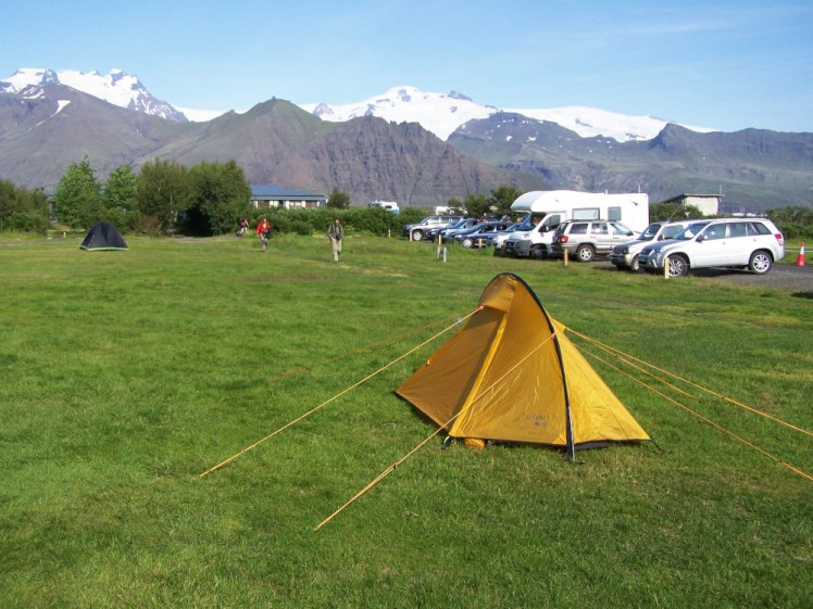
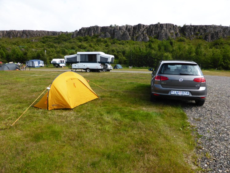
This itinerary lasts around a week, depending on how quickly you get round bits of the Ring Road and whether you want to add in other visits – as usual, this is a guide rather than strict instructions. Obviously, I’m never going to know if you’ve used this so I certainly don’t care if you’ve adapted it. My idea is that you’re going to camp because a couple of these places are a bit short on hotels and guesthouses, especially if you’re being a bit spontaneous, so I’ve suggested campsites for each leg.
And once again, this is an itinerary for people who have a car – there’s virtually no public transport outside Reykjavik so you’d need to find tour companies to take you around if you don’t have a car. You can fly on a small plane from Reykjavik Domestic to Heimaey, Egilsstaðir, Akureyri and Höfn and there are plenty of tours around the Myvatn region, if you can get there from Akureyri. But honestly, your choice is car vs tour bus.
Day One
I don’t know when your flight arrives but we’ll take Day One as your first full-ish day and we’re going to enjoy the geothermal delights of the Reykjanes peninsula and finish up with the new volcano. Unfortunately (especially for this post!) it only lasted eighteen days and has been judged by experts as having finished but it’s still interesting to see.
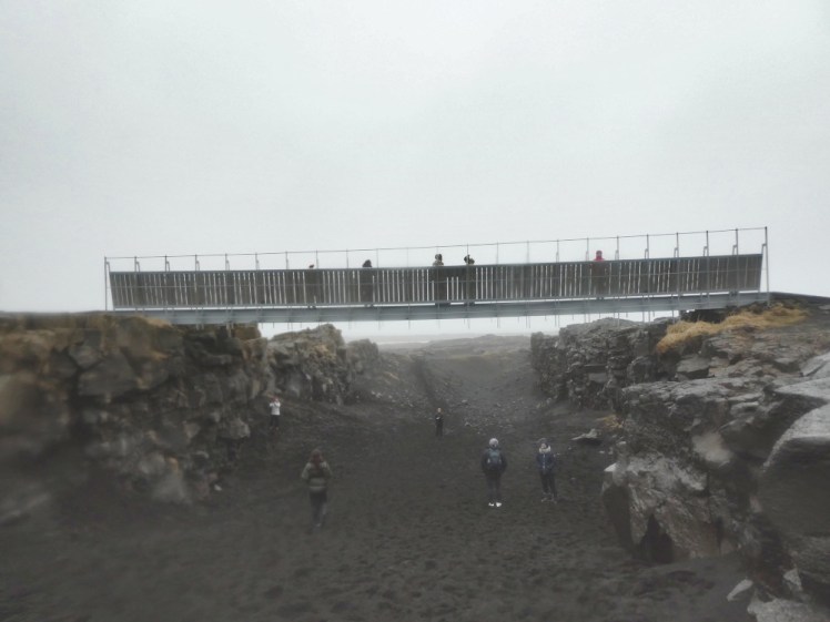
First, head along the coast to the Bridge Between the Continents. This is fake symbolic but it might give you an idea of how volcanoes actually happen in Iceland – in short, half of Iceland is on the North American tectonic plate and the other half is on the Eurasian plate. Those two are pulling apart and the Earth can’t have a vacuum so it throws up lava in the middle to fill the gaps. Unfortunately, this runs from the south-west to the north-east which means the two most active areas are at opposite ends of the country, which means you get to drive the entire Ring Road in this week with some quite volcano-free days. Anyway, the Bridge represents the gap between the two continental plates.
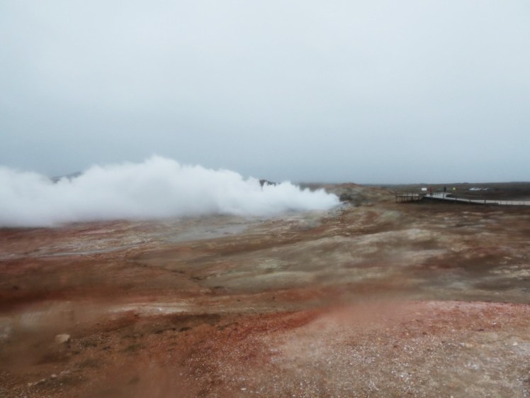
Further down the road is Gunnuhver, a hot springs area where you’ll get to see fire and brimstone and steam and smell Iceland’s famous sulphurous smell (I know that probably should be with an -f rather than a -ph but I take after my industrial chemist father: sulphur, not sulfur, around here). Gunna is an enraged ghost who starved herself to death in revenge for her landlord taking her cooking post, her only possession, in lieu of rent. The ghost killed the landlord and his wife and haunted the peninsula until a priest tricked the ghost into falling into the hot spring. All that steam, bubbling and chaos is Gunna being furious but trapped.
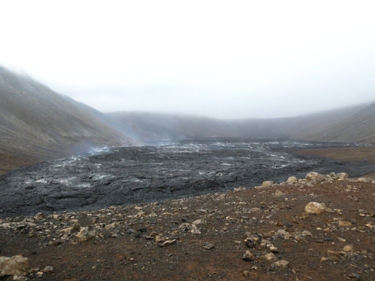
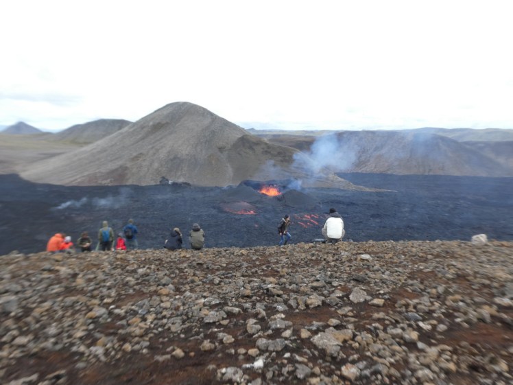
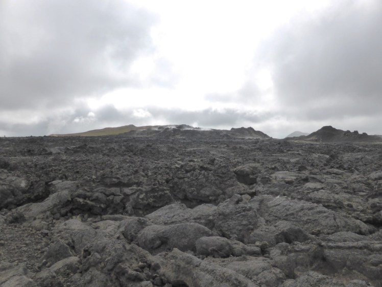
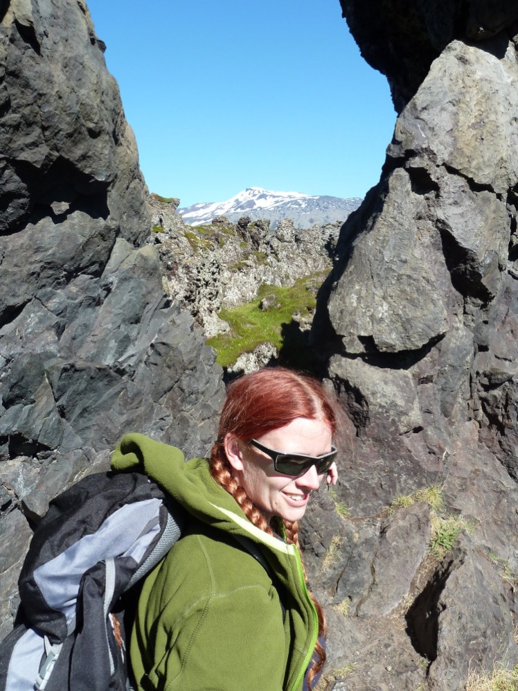
Then we’re going to the new volcano! Actually, I’m going to leave it to you to decide whether you want to visit the 2021 craters or the 2022 one. The easiest access is at P2 parking. Park, pay online and then follow the path. It’ll take you up the ridge and on the other side is a valley full of lava. At the moment it’s still fresh enough that it’s still steaming in lots of places. This walk will take ten or twenty minutes. If you really want to, you can turn right at the top of the ridge and climb up the mountainside which apparently will give you views over a lot more of the lava higher up and possibly even the craters. Follow the signposts.
If you want to see the 2021 eruption from higher up, or visit the 2022 eruption, park at P1. There are two entrances and they’re both signposted “volcano parking” at the moment. Park in the field, pay online and then walk up to the road and cross to the start of the trail.
For the 2021 eruption, you’ll be looking down on the valley behind P2 within about two pretty flat kilometres. You can then climb up the sharp zigzags and up the hill for better views over the lava field and eventually, the two new craters the eruption formed. Walk as far along here as you fancy.
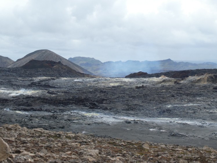
If you want to see the 2022 eruption, keep going along the path past the 2021 eruption. Most of it is marked but there’s a section that hadn’t been made into a path when I was there. It lasts about 1.5km but you’ll see marker lights/tripods/things to keep you roughly on track and then the path returns and will take you all the way to the eruption site. It’s 6/7km each way, it’s a small crater and it’s no longer shooting out fire.
Read my April blog post about the 2021 volcano as seen from P1
Read my August blog post about the 2022 eruption hike while it was still active
If you have time, and if you’ve booked it in advance, I’m never not going to recommend the Blue Lagoon. But it does need to be booked in advance and it fills up quite quickly, especially in summer.
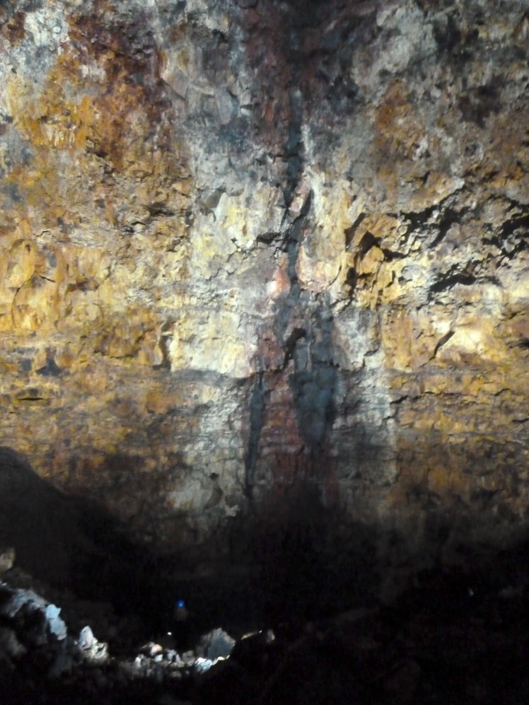
If you want to hang around for an extra day, you can go Inside the Volcano – the only place on Earth where the magma chamber is known to be empty and accessible. It’s about a half-day tour from Reykjavik, although you can meet at the car park. It’s then a walk of around half an hour across the lava field and you get lowered inside the volcano, which has the glorious name of Þríhnúkagígur and you can find out what a volcano looks like on the inside.
You’re going to finish the day by driving an hour or so east along the south coast of the peninsula to the campsite at Hveragerði. That’s because it’ll save you an hour’s drive in the morning.
Day two
Today we’re heading east and out to sea to visit Heimaey. It’s about an hour’s drive to Landeyjahöfn where you’ll catch the ferry – head out along the Ring Road until you come to Seljalandsfoss, turn right and drive right to the end. This is a car ferry but if it’s sold out of car tickets, you can leave it here and just go over as a foot passenger. It just means you’ll have to walk through town.
Eldfell erupted in 1973, in the middle of a dark and stormy night, forcing the residents to evacuate by boat. The eruption swallowed part of the town, enlarged the island by 20% and was fought by the residents, who won. It’s a relatively easy hike up to its summit where you can sit and watch how the lava trickled down towards the town, look straight down into the crater and even cook toast over vents that are still hot nearly 50 years later.
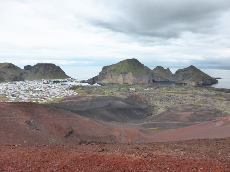
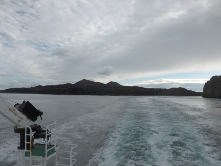
Back down in town, there are museums dedicated to the eruption and the subsequent dig to uncover what they could. When I was there, admittedly ten years ago now, there was a film about the eruption playing on repeat in a cafe by the harbour and that’s really interesting. If you’ve got the time, you can do a boat tour around the island where you can see its spectacular cliffs, including the famous Elephant Cliff and get a glimpse of Surtsey – Iceland’s newest island, which erupted out of the sea in a huge submarine explosion in the late 60s. You can’t land there unless you’re a registered scientist and even then you have to be careful but it’s interesting to see in the distance.
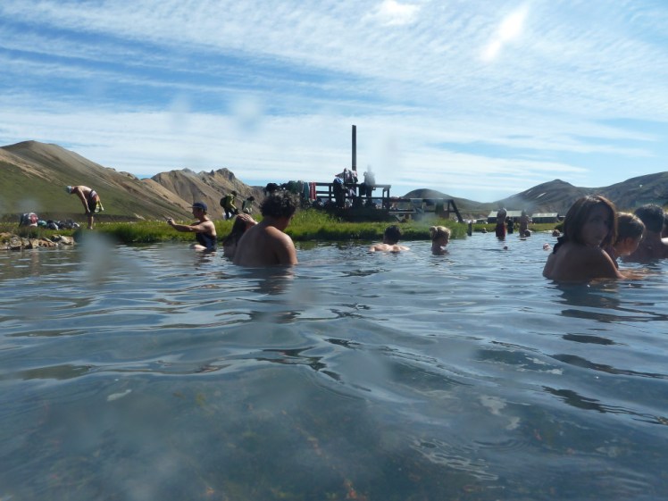
Return to dry land. I’ve suggested camping at Hvolsvollur, which is a good place to get picked up for a Landmannalaugar tour tomorrow, if you fancy that. It’s a campsite at the foot of a lava field, which is still so hot 500 years on that it boils a spring underneath it. That mixes with a cold river that happens to flow past and the result is the most amazing natural bathing pool. It’s also an oasis in the middle of some gorgeous colourful rhyolite mountains and I absolutely recommend going there. Best done with a tour company though. The road is very rough and as it’s only a gravel track through a gravel landscape, it’s very easy to get lost, to say nothing on the river you have to ford right at the end. You could also head east and camp at Skógar. If you do, take some time to stop and enjoy Seljalandsfoss before you go and obviously take time to enjoy Skógafoss.
Day Three
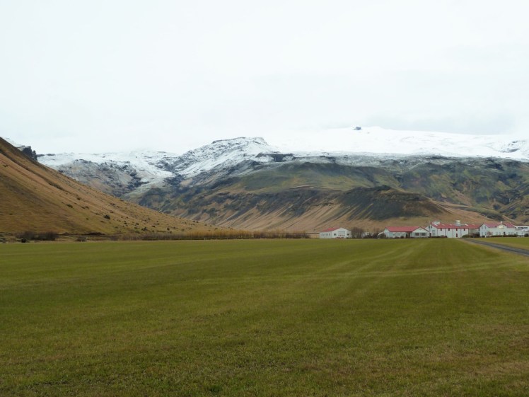
Day three is one of those long driving days. Actually, from here it’s not so long. You’re going to camp at Skaftafell National Park today, so you’re going to pass Eyjafjallajökull. The best place to stop to appreciate it is at the info point opposite Þorvaldseyri, which is the farm at the foot of the volcano. You’ll have seen it buried under ash in many photos, if you were keeping an eye on Eyjafjallajökull at the time.
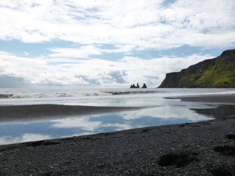
While you’re driving the south coast, do stop at the Black Sand Beach (Reynisfjara) but keep well away from the water – those sneaker waves can creep up on you, grab you and pull you out to sea. It’s an incredibly dangerous beach but if you keep well up on the beach and well away from the water, it’s a beautiful, if overly popular, place to stop. Stop in Vik as well, have a hot dog at the roadhouse and go in the wool outlet for a nice warm Icelandic souvenir.
Then you’ve got a trek across two sandurs, which is where volcanic floods come rushing down in the event of an eruption under the ice on either of the glaciers. Don’t hang around here. It’ll probably be fine but bear in mind a volcanic flood can punch a hole in a mountain and you’re unlikely to get any warning of one happening. It’s quite the landscape, though – mile after mile after mile of wet grey gravel. I know, it doesn’t sound attractive but it’s undeniably interesting.
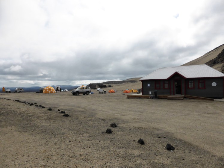
Eventually you’ll get to Skaftafell where they have lovely soft grass and one of the biggest campsites in Iceland. Depending on what time you get here, you might want to stroll down to one of the three glacier tongues that more or less meet here or you might want to hike up to Svartifoss.
Day four
This is another driving day. Half of it will be along the south side of the vast Vatnajokull and the other half will be winding your way around the Eastfjords to Egilsstaðir, the capital of the east. Google Maps says you could press on and reach Mývatn tonight and that’s entirely up to you. If you don’t fancy some seven or eight hours of driving, break the journey at Egilsstaðir. There’s enough in the area to keep you occupied for a day or two if you want to make sure you explore Iceland’s every corner rather than stick to the volcano itinerary.
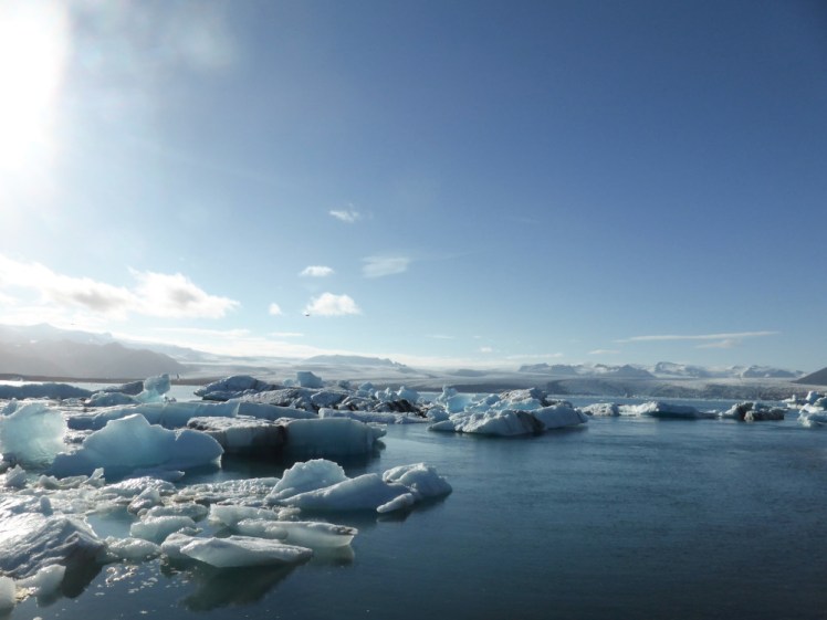
One thing I do highly recommend is that you stop at Jökulsárlón, the glacial lagoon, in the morning, It’s about 45 minutes on from Skaftafell and the reason I recommend it today rather than yesterday is just to give you something to do today that’s not driving. You can just admire the lagoon from the shore or you can take a boat ride, either in the big clunky amphibious boats or a Zodiac, which are the smaller faster RIBs. Cross the road and see the Diamond Beach as well – this is where the icebergs on the glacial lagoon have broken up and are still sitting on the black sand, waiting to be washed out to sea or melted.
If you’re going to stop and make this two days, then I’d recommend camping at Egilsstaðir, especially if you’re going to stick around the Eastfjords for an extra day.
Day Five
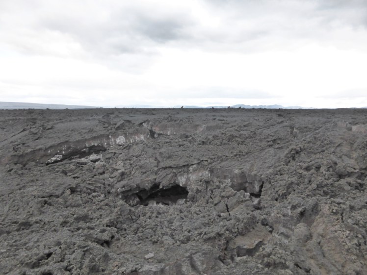
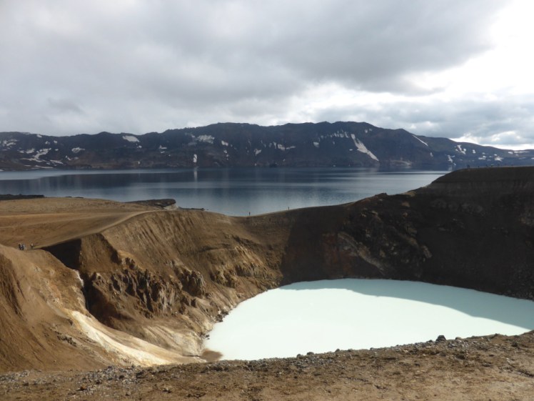
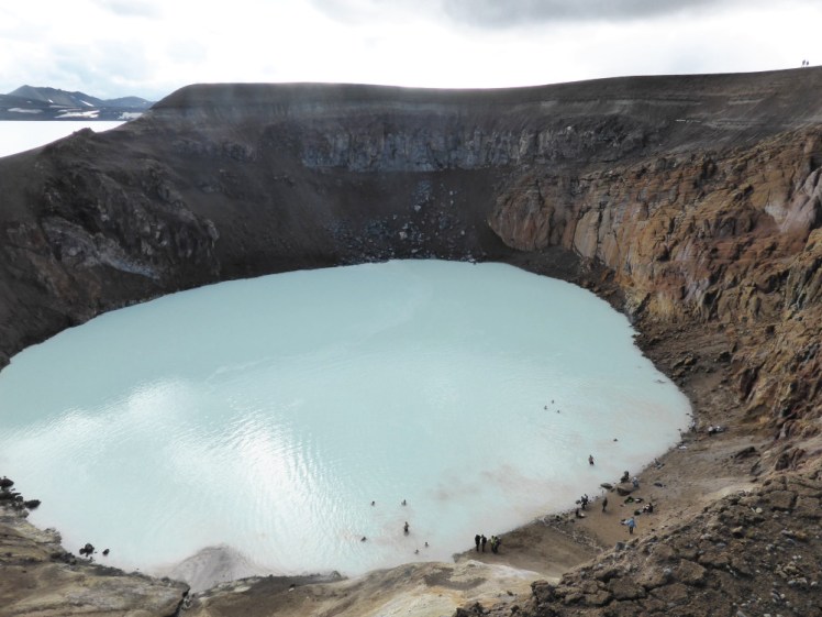
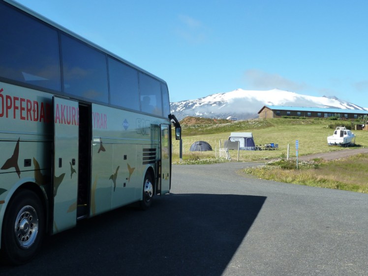
Remember what I said about all the volcanic stuff being at opposite ends of the country? Well, today we’re going to Mývatn. It’s only a couple of hours from Egilsstaðir. First you’re going to cross the Desert of Misdeeds, a huge, ugly and inhospitable lava field. Then you’re going to arrive at Mývatn, set up camp and spend the rest of the day enjoying the volcanic delights of the area. You’ve crossed the Krafla area to get here – Krafla last erupted in the early 80s and is still hot enough to power a geothermal power station.
- You could go up there and visit Leirhnjúkur, a still-steaming lava field laid down back then, or to Víti, a large deep crater filled with blue water.
- Back down in the valley, on the other side of the road, is the Hverir hot springs area, which features a lot more white-stained orange sulphurous landscape dappled with grey bubbling mud pools, and a lot less violent steam eruptions than at Gunnuhver.
- Down the road, you could climb up Hverfjall, which is a glorious perfect huge black crater. Go to Dimmuborgir, which is a lava field full of weird and wonderful twisted shapes which has earned it to the name The Dark Cities.
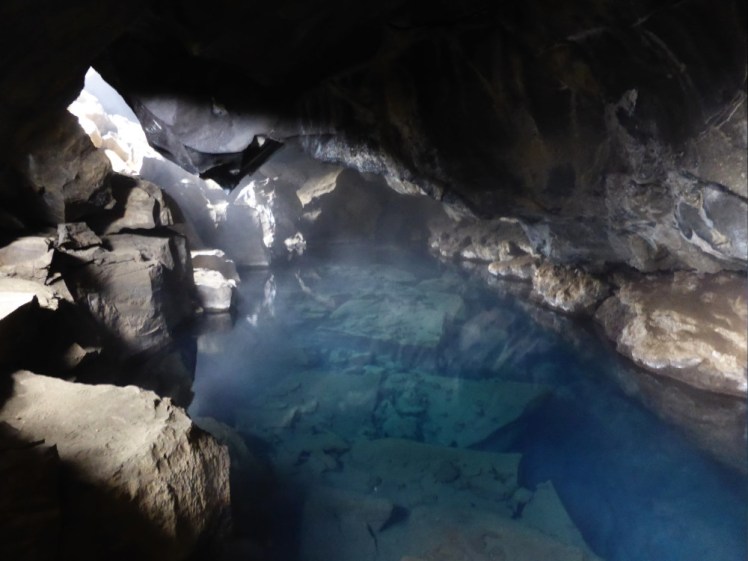
- Stick your nose into Grjótagjá, a cave-like thing formed by the lifting of the ground, a bit like an old-fashioned tent, and flooded with hot water. This is the one that I believe is now too hot to bathe in and the ceiling is too unstable but it’s very pretty to look at and – it hurts to say so – you might recognise it from a scene between Jon Snow and his ladyfriend in an early episode of Game of Thrones.
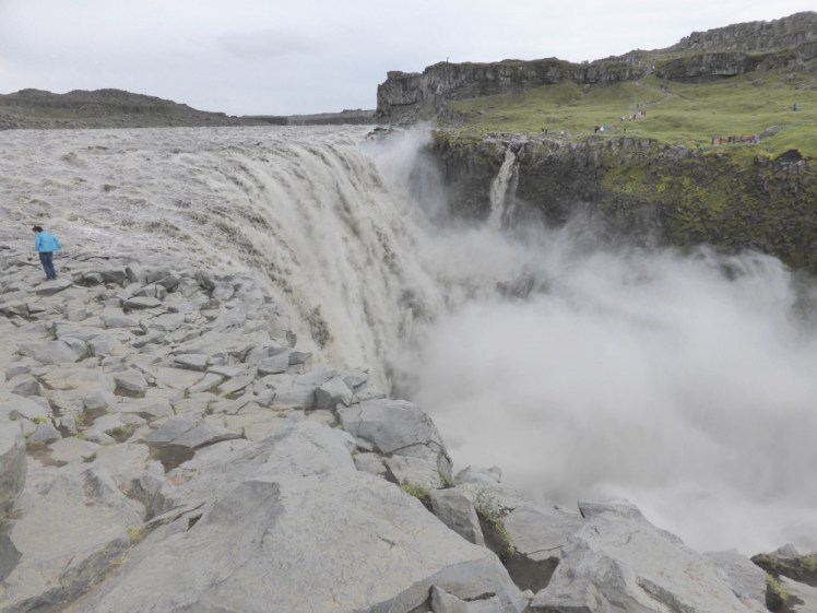
You could spend another couple of days up here doing the Diamond Circle, which is the tourism name for the Dettifoss-Ásbyrgi-Húsavík tour. Dettifoss has two banks, with no easy way to get between the two so pick which one you want before you leave. I understand the roads are mostly paved now but when I was last there, they were mostly rough gravel. The west side is green and lush but the waterfall isn’t so easy to see because of the shape of the hill. The east side is grey and littered with boulders and honestly looks like a scene from a post-apocalypse film but you do get a really good view of the waterfall.
Ásbyrgi is a huge horseshoe-shaped canyon probably formed by a volcanic flash flood but possibly from the hoofprint of Odin’s eight-legged steed. Húsavík is a lovely fishing village and also the whale-watching capital of Iceland, so feel free to take the time to go out on the sea.
Day Six
This is my favourite day! Take a tour, preferably with either Saga Travel or Geo Travel, out to Askja and Holuhraun! No, you can’t drive this one yourself, I’m afraid. It’s a long day driving into the Desert of Misdeeds but highlights include visiting the lava field from Iceland’s 2014 eruption, hiking across Askja and swimming in hell – aka Víti, which is Icelandic for hell and is a warm explosion crater right on the edge of the scariest lake in Iceland. It’s an amazing day. Take two meals, waterproofs, an extra jumper and your swimming stuff. This day is awesome.
Day Seven
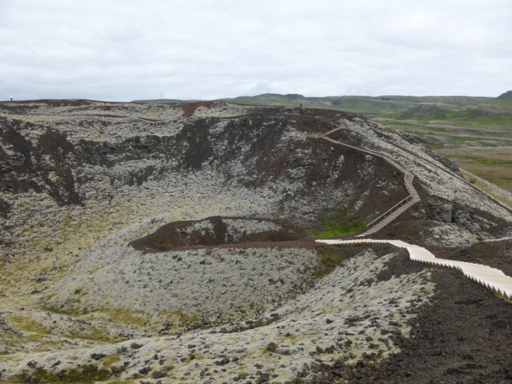
Another long driving day. We’re heading for Borgarnes tonight. Stop off at Goðafoss, where Iceland sealed the deal to give up Óðinn and Þórr and take to Jesus instead. Stop off at Akureyri, Iceland’s northern capital and second city. A lot of the landscape around this section of the Ring Road is calm and green, rolling hills, small idyllic villages and nothing in particular to see. Stop an hour or so out of Borgarnes to climb the Grábrók craters at Bifröst. Bifröst has three USPs: it’s named after the Rainbow Bridge of Norse mythology; it’s a Town in the Lava and it has these craters with paths on them, which you can just climb. They’re not big or difficult. They won’t take long but they’re definitely worth stopping for.
I’ve put down to camp at Borgarnes but in truth, I’ve never actually found the campsite open. That is, it’s open but none of the facilities are, so if you don’t have a toilet in the campervan, you’re a bit scuppered. I personally would drive down to the end of the peninsula and find somewhere with a solid roof around Borgarbyggð. If you’re in time, the Settlement Centre is worth a visit, especially the Egil’s Saga exhibition, and I’d definitely spend my evening in the pool. It’s just a local pool but you can see Snæfellsjökull across the bay through the chainlink fence and that’s a pool with a view.
Day Eight
We’re off to Snæfellsnes today. That’s the peninsula that sticks out to the north of Borgarnes and it all centres around the big volcano at the end. Snæfellsjökull looks exactly how a mountain should look – it’s cone-shaped and it has a perfect coating of snow on top.
You’re spoiled for choice here. This is wild open Iceland – there are no specific tourist must-see sights so you can do your own thing. You can make your way around the peninsula stopping at all the little villages and caves and canyons like I do. Or you can find a tour company to take you up onto the volcano itself. Either way, you’re going to get up close and personal with the lava fields that make up a huge chunk of the peninsula and you’re going to feel the presence of the big volcano – until recently, the only volcano in Iceland that wasn’t being actively monitored. No, it’s not doing anything but it’s gone from aviation code grey (no one’s looking) to green (it’s not doing anything).
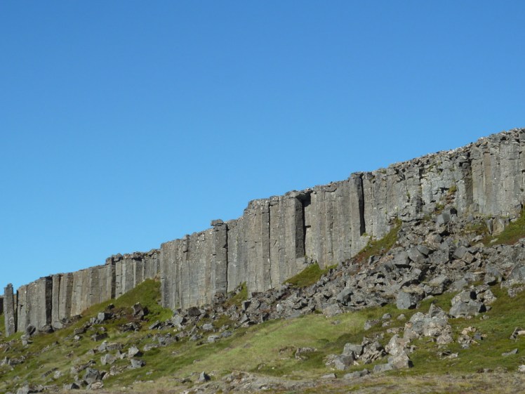
Places worth stopping: Gerðuberg, an inland cliff of basalt columns, created when lava cooled very quickly. I still don’t understand at all how these columns form but it’s all to do with lava and cooling. Saxhóll is a small crater east of Snæfellsjökull which you can climb. Return to Borgarnes via route 55 across the landward end of the peninsula, which crosses the Berserkjahraun, a pretty spectacular lava field named after the Beserkers, the frenzied violent Vikings.
Day Nine
And home. It’s about an hour and a half from Borgarnes to Reykjavik, so stop off in the capital if you fancy. But I’m going to take you back out along the Reykjanes peninsula for one last look at the new eruption and maybe a trip to the Blue Lagoon on the way to the airport and then we’re off. Bye! Hope you’ve enjoyed all the lava!
