Consider this post the launch of my new Iceland Hub!
People know me for Iceland, both on social media and in real life and although there’s so much Iceland content here, I don’t really make it as prominent as I could, so now there’s a whole pretty page dedicated to gathering it all up together in one place that’s right there in the menu and I’ll point it out every time I do Iceland content from now on.
This is a new category of content, the first of a series of Useful Iceland Maps. Maybe they’re not as obvious as the Iceland Itineraries or as pretty as the maps I do every time Iceland appears on TV or the tourist maps but these are practical and non-aesthetic and no one else is doing maps like this.
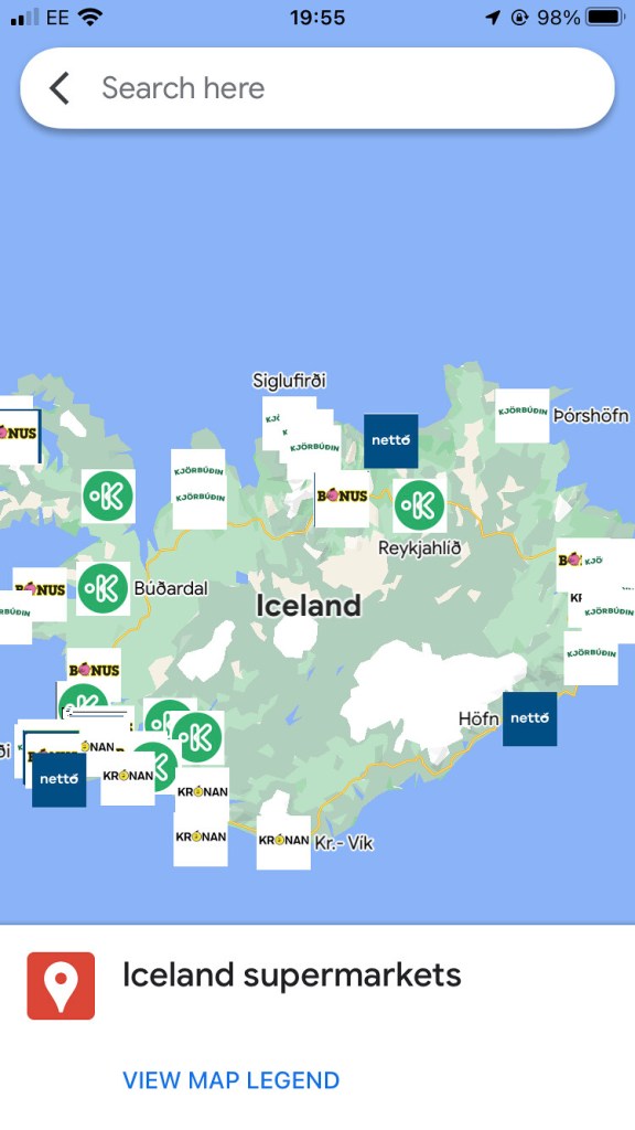
This one shows where every supermarket in Iceland is. Let me repeat that: every supermarket in Iceland. Well, you can’t eat out for every meal (can you? Not once you leave Reykjavik, surely?) so you need to know where you can get food, whether it’s snacks or meals.
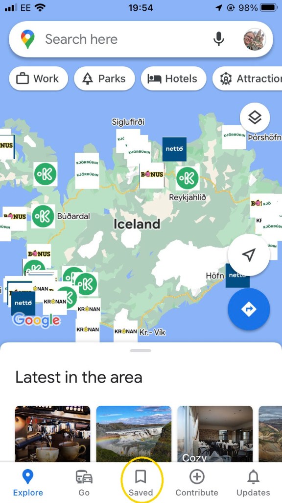
You can open this map on your phone. I’m not entirely sure how. Obviously I can open it because I made it and it’s sitting there in my saved stuff automatically. If you open this blog on your phone, there must be a way to get it to open in the Google Maps app and once it’s there, there must be a way to save it but I can’t figure it out. Never felt more like my own grandmother as when I can’t figure out how to save a custom map.
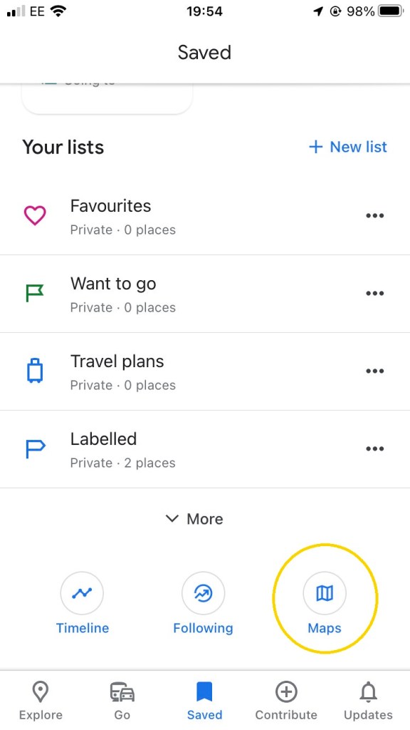
If you can get it saved, you’ll find it hiding under the Saved Icon and then under Maps, as circled in the screenshots below.
So why did I do this?
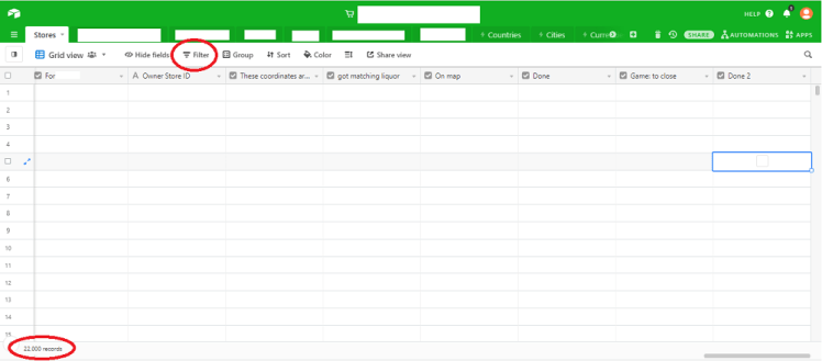
This is basically my job. I spend my days searching for supermarkets to go on our super-fancy maps. My work doesn’t deal with Iceland so I’m not actually stealing my work from work, but this is what I do in 51 other countries, on a continent with some of the lowest levels of internet access in the world. No, I’m not in the habit of openly naming anything that might make my blog pop into my boss’s Google Alerts but if you follow me on Twitter, you can probably figure it out pretty quickly. We’re the world leaders in this sort of information, for the simple reason that it’s incredibly niche and it didn’t occur to anyone else to make a job out of finding all the information on 22,000 supermarkets. Yes, 22,000 precisely. Thank you, database, for that incredibly round number!
Anyway, at some point in 2021, it dawned on me to apply this specialist skillset and specialist interest to my own specialist country and the Iceland supermarket map project was born. It started in Airtable, which is where we keep our data at work but when I started to put the map together, I came across some problems.
We employ what my boss calls A Wizard. He has created a proprietary mapping tool for us which is fed by Airtable. I don’t have the script for it, wouldn’t know how to create it, attach it to my blog, update it or do anything with it. And the chances are it’s incredibly expensive. Worth it for work but absolutely not worth it for my little blog. So I went back to Google Maps and after a little more playing, I realised I had no idea how to connect Google Maps to Airtable, so it had to move into Google Sheets. That’s fine for Iceland but it got overwhelmed by our continent-wide collection more than three years ago when the collection was a lot smaller, which is why we moved to Airtable in the first place. I did have a go with Google Data Studio but there’s a reason why people use Google My Maps to create custom things rather than GDS.
Long story short, I now have a map – with logos! – of every supermarket in Iceland, which I think is up to date as of November 2021. There are a couple of other supermarket maps out there, which is why I’ve put this off for a while. The Reddit Supermap is interesting but extremely short on groceries. The Reddit Map of All Icelandic Gas Stations and Supermarkets is extremely out of date and the guy who made his own update of the Reddit Iceland Map is even worse. Plus, mine has more information – opening hours, phone numbers, price range and so on. And logos. Let’s not forget my blessed logos.
I had an idea of putting all the fuel stops on there as well, the N1s, the Orcans, the Olises and especially the ones that have a convenience store, kiosk or roadhouse attached. But that would make the map unwieldy and so the Useful Iceland Maps idea was born. It’ll go on a map in its own right but it’ll be a really big job because there are far more fuel stops than supermarkets. That’s why there are huge gaps in the supermarket map: those places are served more by the roadhouses. Well, it’s not worth running and stocking an entire supermarket when it’s only going to serve thirty-odd people along a fifty mile stretch of road – the entire south coast between Vik and Hofn, most of the north and parts of the north-west between Blonduos and Borgarnes. And of course, the Interior. No one lives in the Interior and if you’re venturing in, you take enough food with you to last your visit.
In case you’re looking forward to them, I won’t be doing hotel or restaurant maps – as you all know from guidebooks, those things go out of date really quickly and it’s not worth mapping. But fuel stops, campsites, pools, I’ll be doing maps for them.

One thought on “I found every supermarket in Iceland”