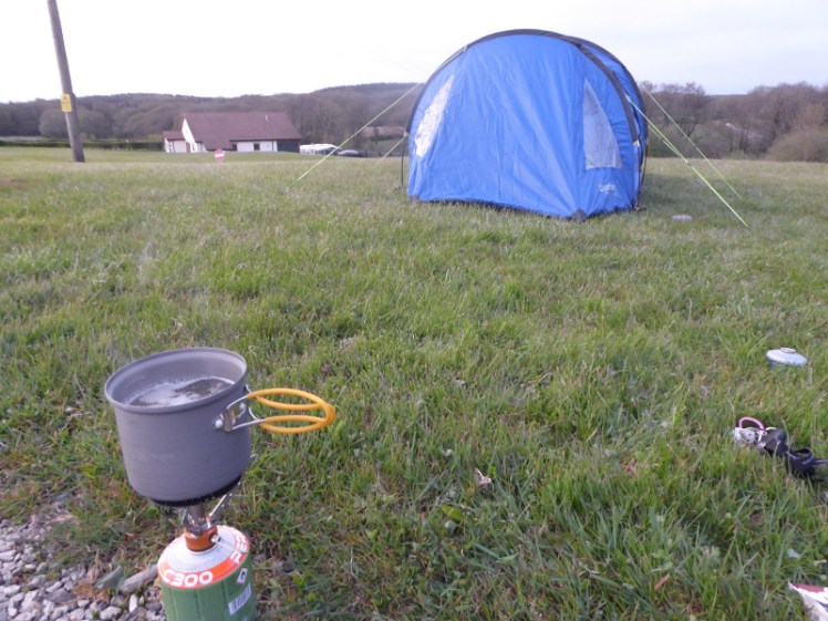
With my six day trek across the Icelandic Highlands now just next month, I had to do some real walking. I packed my tent and headed off to Dartmoor for the weekend – well, for Friday and Saturday anyway, since I needed to be home on Sunday to go to a local music festival.
I’d picked Okehampton as my base, mostly for its proximity (ha!) to the north Devon coast. The Okehampton part of Dartmoor is inside a huge firing range, which has made me instinctively shy away from it before and it’s also borderline what GG would probably call Level 3 territory. I haven’t done the Level 3 training.
Level 3 is remote, relatively high, with fewer navigational features – and most importantly, major consequences if you get lost. You can walk for a very long way south before hitting a road or a phone box or even a line of pylons. That’s the big difference from Level 2, emergency escape from the landscape.
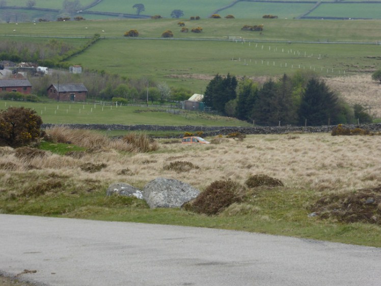
But when I arrived on the track outside Okehampton Camp, with my guidebook in one hand and my OS map in the other, I realised it wasn’t going to be that hard. I was going to walk up a hill and cut across to Yes Tor, the nearly-highest point on Dartmoor. Aka that huge hill right there. I was then going to walk down it in the direction of my car, which is orange and reasonably easy to spot on a greenish moor.
Had the weather been bad, I’d probably have backed away from L3 territory pretty quickly but it was ideal walking weather. Warm enough to not need a coat, a bit cloudy and not hot enough to get sunstroke.
I didn’t park exactly where the book told me too – “anywhere you like along the camp’s wall”. There was a wall but it was a lowish drystone one, a farmer’s wall, not a military encampment’s wall. A local dog walker recommended a parking place half a mile up the hill and that did very nicely, although it left me utterly confused about precisely where the walk was supposed to begin. My micronavigation skills are not quite as good as I’d like them to be.
Fortunately it didn’t matter. I knew where I was going even if I wasn’t sure which sheep-path I was supposed to be on. I reached the top of Black Down and eventually chose the most obvious path towards Yes Tor.
As I reached the bottom of the valley I became aware that there was a man walking down the same track. Gaining on me. I have never felt scared out on my own before but suddenly I realised there was a stranger following me and I’m alone on the moor. I have nothing I can even improvise as a weapon. I can’t outrun him. So I stopped to take pictures of wherever was going on up West Mill Tor to let him overtake. I didn’t consider the possibility of him stopping to chat.
Neither did I consider that this man might be a pleasant local walking enthusiast in his late seventies and much to my mother’s horror, I joined him to climb Yes Tor.
We chatted. He’s a retired agricultural chemist who’s spent his life working with pesticides and local farmers all over the world and has retired back to the town he was born in. He’s walked every hill on the entire horizon and can identify and tell a story about all of them.
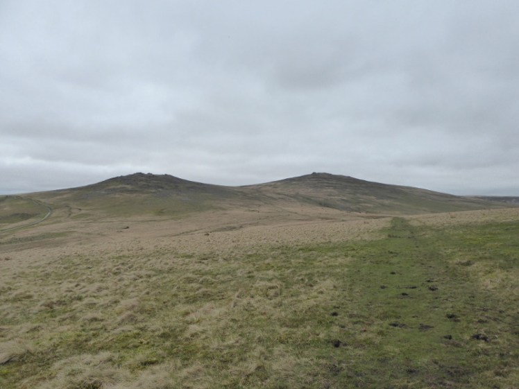
Bill – how could his name be anything but Bill? – is of the opinion that although Yes Tor isn’t as high as its neighbour, High Willhays, it’s a better tor. It looks higher, it looks more interesting and it has a better view – exactly the same opinion as my guidebook and actually, entirely correct. High Willhays is two metres higher but it’s not as prominent. It’s just a small summit on a ridge leading away from Yes Tor. There’s no angle from which it looks like a mountain in its own right, which Yes Tor does.
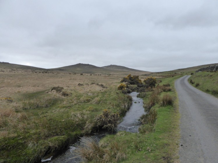
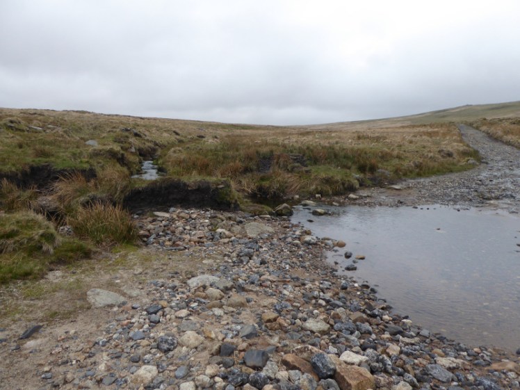
We followed the path halfway up and then ploughed our way up the side, hopping over Red-a-ven Brook, the water course with the highest source on Dartmoor and allegedly higher than many in the Pennines. The ground above the brook was squidgy and boggy in places but nowhere deeper than the top of the foot, mercifully. Last time I was out walking seriously, in South Wales last November, almost every step was in ankle-deep bog.
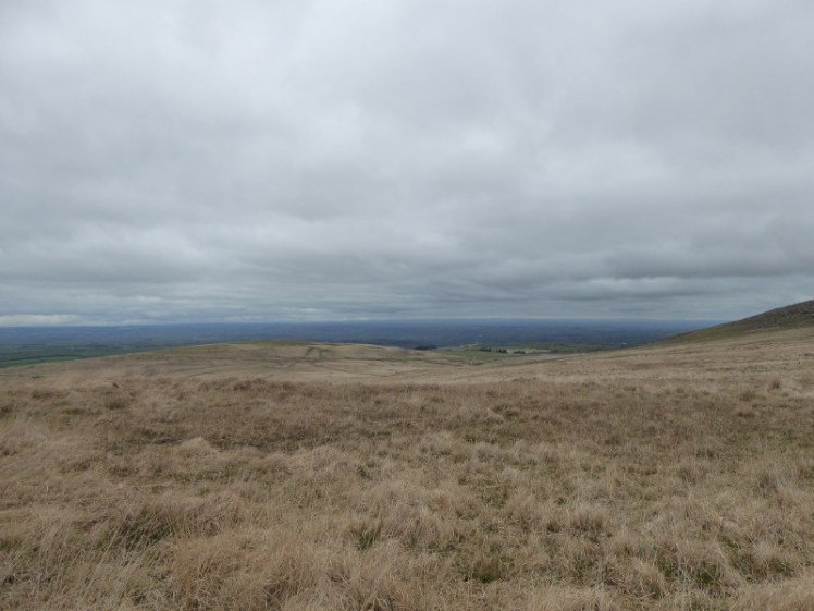
Because I’m unfit and Bill’s old, we stopped on a nice flat rock two-thirds of the way up to rest and admire the view. From here I could see exactly which track I should have taken across Black Down.
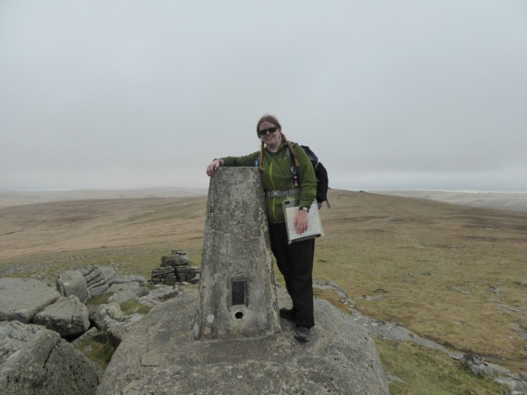
We ploughed on. The ground became drier and rockier and at last we were on top. The rocky outcrop isn’t quite as impressive as Haytor but it’s not bad and the view is better. We climbed up it and Bill insisted on taking my photo at the trig point, which is nice because a selfie just isn’t the same.
It was snack time. Bill drank tea and had a pork pie and I drank squash and ate a cereal bar while we compared language prowess. I have a degree in French and Spanish but he has a Spanish wife and a fluency in colloquial farmer’s Spanish from working in Honduras.
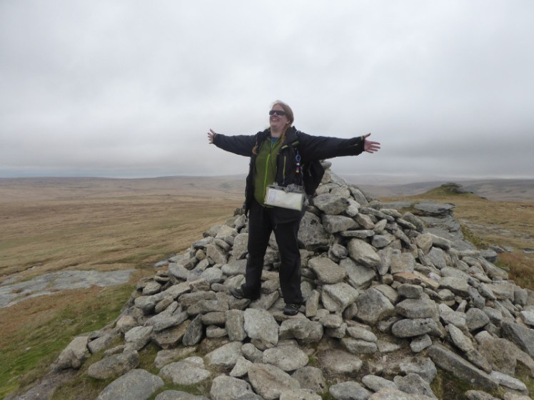
I planned to continue back to West Mill Tor and aim for my little orange car but we were a pretty flat fifteen minute walk from High Willhays, the actual highest point on Dartmoor – and indeed anywhere in England south of Ingleborough. I had another photo here, and a chance to look back at Yes Tor, definitely more deserving of the title of Highest Tor, if not for those six feet.
We walked back towards Yes Tor. Along the saddle, I’d be turning right to the track that leads past West Mill Tor and eventually returns to my car. Bill was turning left to continue his walk for another hour down to the dam. We parted ways and I spent the rest of the uneventful walk down the track considering Bill’s life story and the fact that I’d been scared of him at first.
The track was boring. It’s a gravel path that goes down the south-east side of Yes Tor and then gently meanders back to the road. No Level 3 micronavigation required here. The only thing of interest was that the Red-a-ven Brook crossed the path twice, both times as relatively fast and wide streams and I had to stop to consider whether there was any point where I could hop across or whether I was just going to have to bite the bullet and wade.
My boots started to hurt on the last mile or so. The inside of the left one tends to slip back and the front edge rubs my toes. I knew I should have stopped, taken the boot off and rearranged it but it’s hard to be bothered when you can nearly see the car. Should have done – I was majorly hobbling by the time I got there and trying to compensate did bad things to my knees, which took it in turns to lock up as I tried to investigate the huge lump of flint on the seafront at Ilfracombe that evening.
Saturday dawned hot. Hot enough to feel uncomfortable sitting outside my tent eating breakfast. I knew I’d collapse from heat exhaustion if I tried hiking in that. So I spent the morning lounging in the sun, reading, eating chocolate spread straight from the jar and waiting for every drop of dew and condensation to burn off my tent before I rolled it up more beautifully than any tent has ever been rolled up and headed home.
