Since I’m walking the Laugavegur trail in July, it’s time to talk about the time I sampled it.
In the summer of 2012 I did a day trip to Landmannalaugar. Just long enough to visit the hot spring and then run across the floodplain to see what else this little oasis had to offer. I saw a beautiful green canyon but I didn’t have time to explore it. But I mentally filed it away for future exploration.
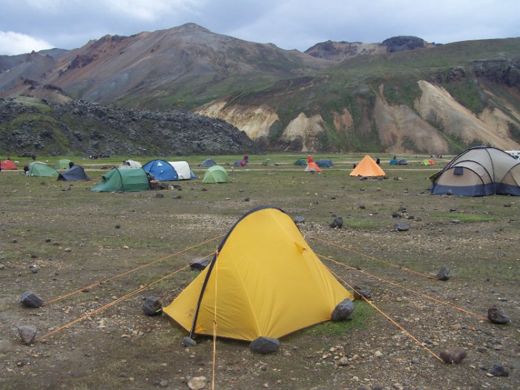
In the summer of 2013, I had a bus passport for the Highland highlights, which I used to cross the Sprengisandur from Skaftafell to Goðafoss, changing buses at Landmannalaugar. The nature of these two journeys being that they take the best part of a day each, I stayed overnight at Landmannalaugar. And then I discovered that the second bus only runs alternate days and had no choice but to stay a second night.
I used that first afternoon/evening – my only afternoon/evening, as I believed at the time – to explore that green canyon. Its name is Grænagil, meaning “green canyon” and I was stupid about it.
I pitched my tent, took my phone and camera and set out. At the entrance to the canyon it started to rain so I went back for waterproofs. At this point, I was just exploring the canyon. I took no food or drink, no map, not even a guidebook, no nothing. Camera, phone, waterproofs. I was almost certainly wearing my sandals.

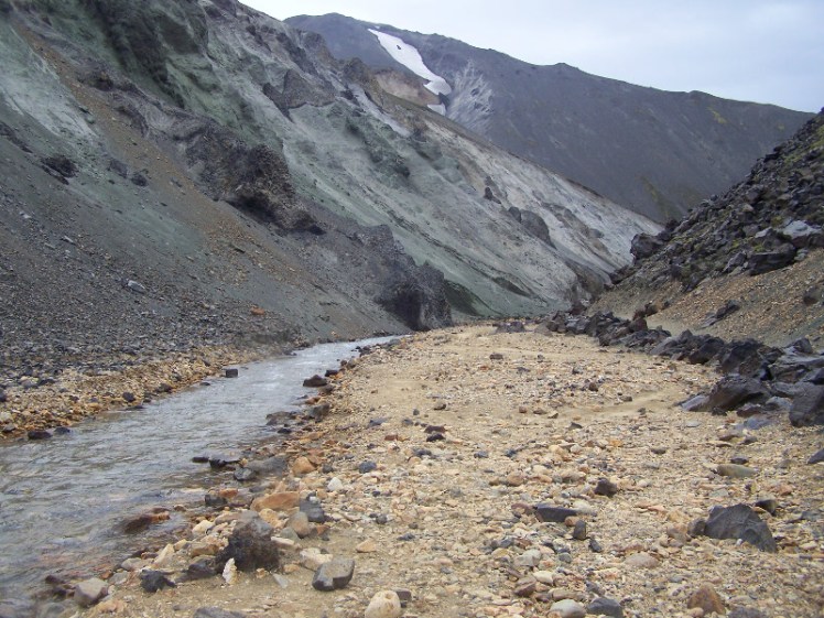
The first thing that catches your eye about Grænagil is the entrance. It’s half-blocked by a huge boulder of emerald green rhyolite. It’s an extraordinary colour, especially surrounded by orangey-white streaked rocks. I just can’t capture the otherworldly hue on my camera but it’s one of these colours that makes your eyes readjust what it thinks other colours look like. The canyon is further blocked by a step and this step is obsidian. Raw, natural obsidian.
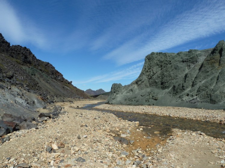
Inside, the canyon is a less startling shade of green and has a cheerful stream bubbling through it. I followed the stream. I followed it for far enough to occur to me that I had no idea where I was going. Was I in fact on my way along the Laugavegur trail? Was I going to be returning to Landmannalaugar? Why hadn’t I brought anything with me? Still, if need be I could just turn back.
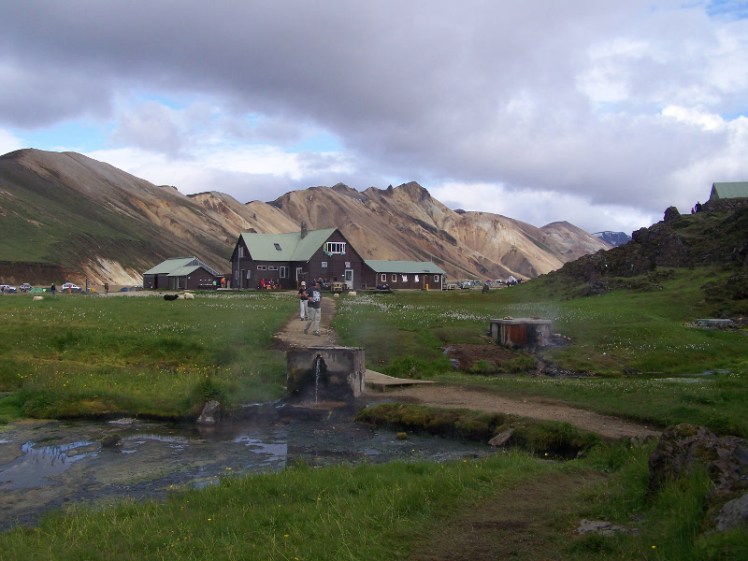
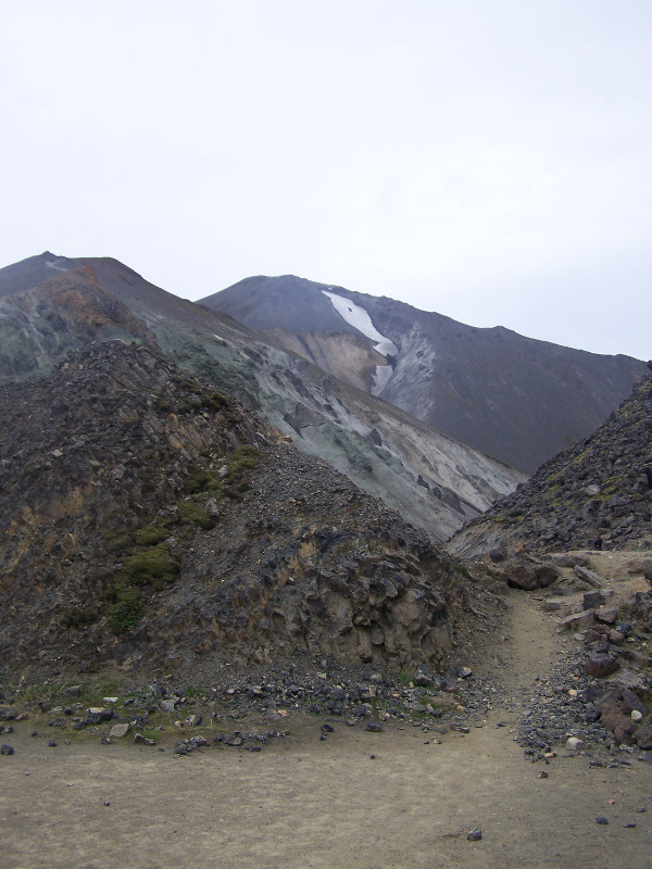
I reached the end of the canyon. The way out seemed to be by scrambling up onto the lava field. This lava field is over five hundred years old, laid down by Bárðarbunga (whose system last erupted in 2014/15, laying down another colossal lava field) and it’s still hot enough to boil the water in the spring underneath it. That’s where the bathing pool at Landmannalaugar comes from.
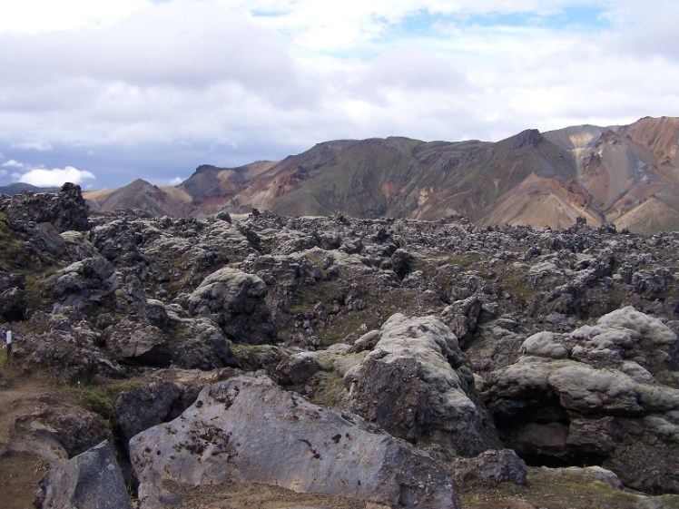
The path, marked by pegs, was pretty easy to follow in real life and it continually amazes me that you can see no sign of it in pictures. It looks impassable. It’s not.

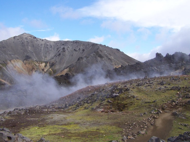
I climbed off the lava field onto the Laugavegur trail. There was an active geothermal field here, complete with steam and solfataras, white-encrusted open wounds in the Earth’s surface, where the heat of the ground can destroy flesh and bone and actual brimstone forms on the surface. I lingered here, my own private geopark.
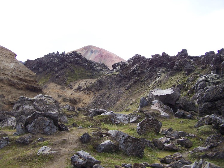
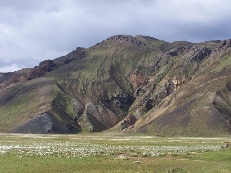
From there I found a signpost pointing down the path to the right to Landmannalaugar. A pretty easy path, with views across valleys and meadows, pastel-streaked mountains, more lava. This is the first hour or so of the 55km Laugavegur trail and I checked with someone going the other way whether Landmannalaugar was too far. No, not too far.
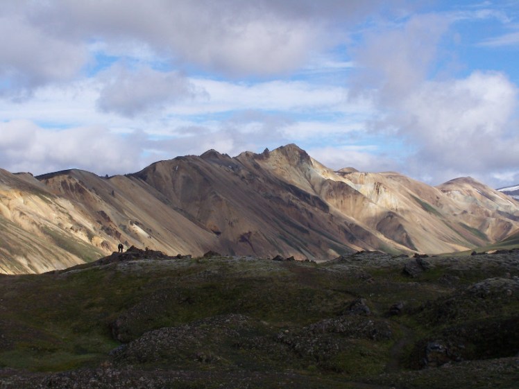
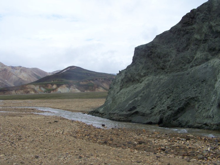
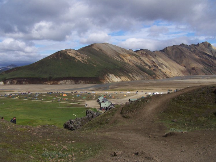
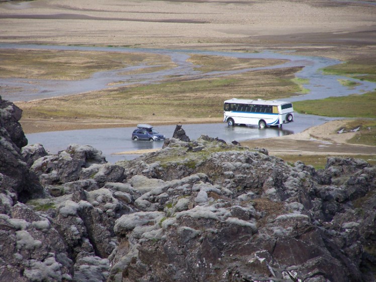
The path crosses back onto the top of the lava field. There’s a cairn and a viewpoint and I sat up there for a while, surveying Landmannalaugar, the campsite, the floodplain and watching vehicles cross the final ford. I climbed down the side of the lava field and there I was, just a little north of the bathing pool.
I’d survived my unplanned unequipped walk. I’d learned not to do something so stupid again. And I went to the warden’s hut to buy a map so I could try to figure out where I’d been. Armed with some supplies I’d do it again – it’s a great walk that really shows off some of the variety you get in the Highlands and I’d definitely go and gaze at that chunk of emerald rock again.