This is another Instagram vs reality. Stokksnes and Vestrahorn are a little corner of the south coast of Iceland. Stokksnes is the headland – -nes is a headland in Icelandic – and Vestrahorn is the lump of mountain attaching it to the mainland. It’s another place to scamper around looking beautiful, more commonly in pristine outdoors clothing rather than long dresses because you go there for the reflection of the mountain in the vast wet beach and long dresses dragging through wet sand is not aesthetic.

This one’s not as bad as Stuðlagil in terms of misrepresenting the reality. It just laser-focuses on the mountain and the beach and doesn’t mention anything else, so here I am to fill in the bigger picture.
Stokksnes is a 5-10 minute drive down a gravel road from the Ring Road. If you’re coming from the west, as most people are, doing the Ring Road anti-clockwise, it’s on the right immediately before a tunnel that cuts through the mountain. If you’re coming from the east and adventuring clockwise, it’s on the left immediately after the tunnel. You’ll drive down a gravel road for five or ten minutes, with only the occasional sign for the Viking cafe to reassure you that you haven’t strayed onto a farm track.
At the end of the gravel road, as promised by the signs, is the Viking cafe and guesthouse, the gatehouse to Stokksnes. Park outside and buy your ticket. This is private land and it has an entry fee. If it helps, think of it as a parking fee just like you’ll encounter at pretty much any other tourist site in the country, except that you also need to pay it if you intend to leave the car here and stroll down on foot. It’s 1100kr, which translates to £6.60 / €7.65 / $8.93 per person, which is not an unreasonable fee to pay for entry to a bit of spectacular scenery – and more! There’s a ticket machine on the wall outside or you can go inside during opening hours and pay at the bar. You’ll get a ticket with a QR code on it. Behind the cafe, the end pointing at the gravel road back to the Ring Road, there’s a barrier with a QR scanner next to it. Scan the QR code on your ticket and it will open. On the way back, it’ll detect your vehicle and open automatically.

A couple of hundred yards down, on the left, is the first car park. This is where you park if you just want to go down on the beach. If all you want to do is go to beach, to be honest, it’s less than ten minutes to just walk from the Viking cafe and save the effort of moving the car, leaning out of the window to reach the scanner and so on. This is where you’ll see Vestrahorn, the big craggy lump of mountain reflecting in the wet black sand of the beach.

I didn’t get the perfect sunny day nor the moody blue hour light but the reflections and Vestrahorn were none the worse for that. The clump of mountains to the left of it had a little candy floss puff of cloud lingering over its summit, adding a bit of shadow and drama to its green-grey flanks. It’s maybe not quite Insta-perfect but it’s spectacular enough.

I got out of my van and scrambled down onto the black sand beach. The reason it reflects so well is that even though the open sea is a good few hundred metres away, it’s permanently wet. In places, the uneven sand poked above the layer of water to make little islands that you can hop between and in others, it came halfway up my foot. In sandals, that was no problem. Even in decent sturdy shoes, you probably won’t get your feet very wet. What surprised me was how warm the water was. The North Atlantic is not famed for being toasty but this is very shallow water sitting on black sand and the sun had been out for a few days. I don’t say it would have been warm enough to enjoy bathing in, had it been a bit deeper, but it was very pleasant on my feet.

I wandered the beach, taking my photos, experimenting with reflections on the wet sand vs on actual water, enjoying how I, in my sandals, could get different angles to the people trying to keep their feet dry, and a a good distance from the waves crashing half a mile away. Other than that it’s black and backed by mountains, Vestrahorn’s beach is a lot like North Devon. I don’t think I’ve ever seen such a massive beach in Iceland. I didn’t know they existed quite like this.
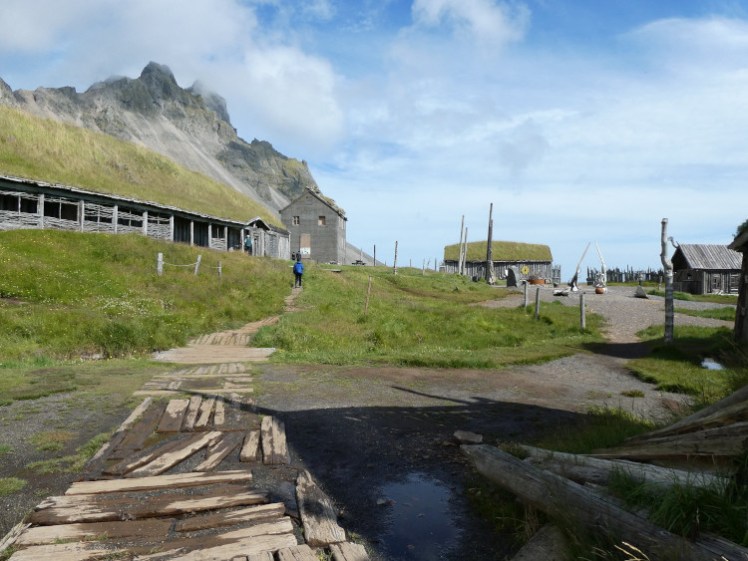
When you’re done with the views, there’s a Viking village half a kilometre down the shore with a longship moored in the pond. Well, it’s not a real Viking village, obviously. It was built for a film that was then never made, and also features a very non-Viking three-storey concrete house with a half-collapsed roof. There are a few Viking buildings including a longhouse inside the village walls, all very pretty until you venture inside. According to the Internet, you’re not supposed to go inside but there are no signs telling you this at the village itself and all the doors are propped open as if to invite you in. Don’t bother, honestly. The longhouse is basically a workshop, its beams propped up with scaffolding, and although the concrete house is furnished and looks ready for visitors, even in broad daylight on a summer afternoon, it’s incredibly creepy. Enjoy it as if you were walking around a real village, where you wouldn’t even think of just walking into a random house.

I then went back to the van and drove along the causeway towards the radar station in the distance. The road is pretty rough and sand blowing across it making miniature dunes really doesn’t help. There are two places along here where you can stop and enjoy views right across the wet black beach to the craggy mountain but if you’ve already pranced around on the sand, you probably don’t need extra photos from just a bit further away. Instead, I parked down at the far end and went to the shore to look for seals.
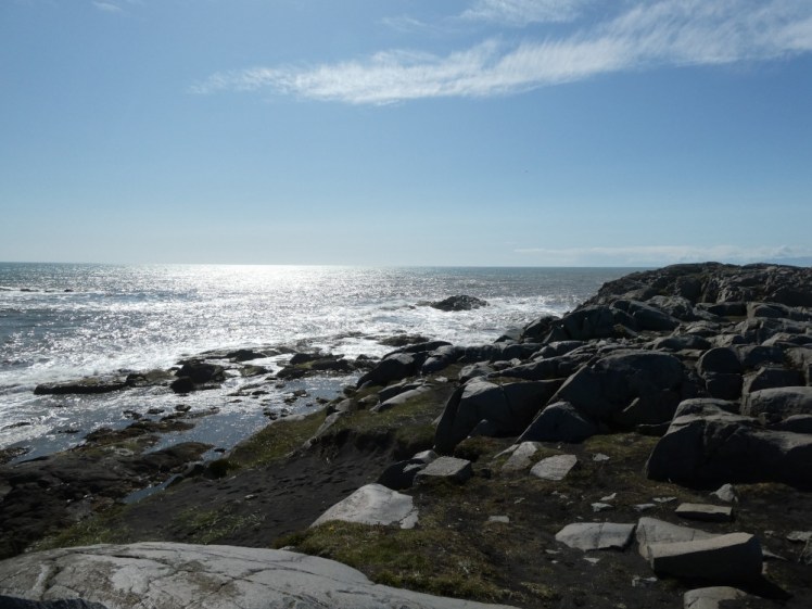
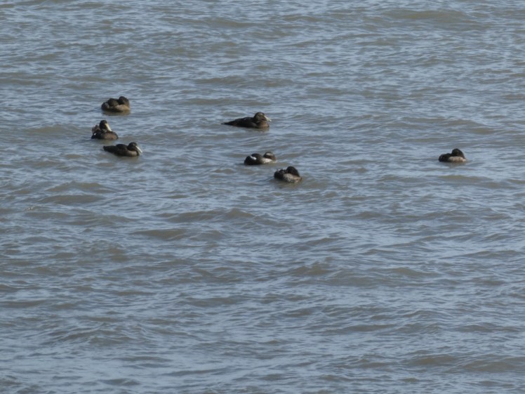
I say “shore”. What I really mean is “cliffs with waves crashing against them”. There’s a little cove down here that looks ideal for swimming but, as is usual around much of Iceland, absolutely isn’t. This one is also prone to the sneaker waves that regularly attack unsuspecting tourists at Reynisfjara. If you want to get your feet wet, go back to the beach with the view at the other end of the causeway. Relatively few people make their way all the way down here. They’ve come to Stokksnes for the pictures of the mountain reflecting on the beach; they haven’t come to sit on a rock and hope to see seals in the angry grey water. Nonetheless, I think you should come down here, if for no other reason than to enjoy a bit of Icelandic nature that Instagram hasn’t ordered you to visit. I didn’t see any seals but there were eider ducks bobbing about on the waves.
When I’d had enough of the sea, I walked back via the path through the radar station – another thing I had no idea was here. It’s a Cold War-era site still being used by Iceland’s Air Defence System, which is part of the Coast Guard, to monitor air traffic There are four of these stations still in existence, once at each corner of Iceland – one of them is less than two miles from Keflavik Airport, one up in the Westfjords and the fourth is up in the north-east corner where few tourists venture. Being an active military zone, you can’t go near it but it’s an interesting and very unnatural thing to have plonked in an area of natural beauty like this.

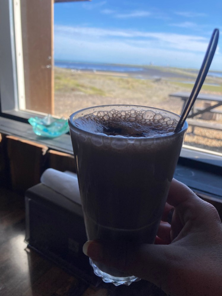
I went back to the Viking cafe. I wanted to fiddle with my phone before I left – can’t remember what I wanted to do – and so I sat in the cafe, next to a window overlooking the beach, with a very good hot chocolate and the free wifi. I didn’t really want a hot drink, I wanted something cold and wet but somehow I was persuaded to change my mind while I waited and, having sampled some truly dire hot chocolates over the years, I was quite impressed by this one.
And then back in the van, trundle along the gravel road and before you know it, you’re back on the Ring Road and on to your next adventure, which, for me, was camping at Höfn, which is on the other side of the bay and is actually so close that you can see Vestrahorn perfectly clearly from the campsite. But that’s another story.
