At eight o’clock in the morning, having packed up my tent and hauled it across the campsite, I was on a bus. By one o’clock, with an hour’s detour to walk up a canyon formed in Iceland’s most productive eruption in history, I was at Landmannalaugar, an oasis and campsite in the Highlands. The plan was to be on the bus again to head for the north coast by eight o’clock the next morning so this afternoon was not to be wasted.

I staggered under the weight of my luggage – lightweight camping is not a skill of mine – as far as I could across the gravelly campsite and found a single patch of grass exactly the shape and size of my one-man tent to make my little home on and then it was time to set out. The big, obvious draw of Landmannalaugar is the hot spring but in the afternoon, it’s flooded with tourists and I knew it would be much quieter in the evening when the dozen or so coaches had made their way back to Reykjavik so my destination for the afternoon was to be Green Canyon.

I’d been a tourist here only a year earlier on a glorious summer day. I’d bathed in the hot spring and then, afraid of missing the coach back, I’d gone for a quick amble on the gravel floodplain while I waited to be called back to the coach and in that quick amble, I’d spied a green canyon. I hadn’t had time to venture much further than the entrance but now I was back for an overnight stay, this was definitely something I wanted to look at.

I was an idiot. I had my camera, I had my phone in a pocket and since the sky was threatening to drizzle a little bit, I took my full waterproofs and that was it. Nothing to drink, no map, no idea whatsoever that I was setting out on a walk that would take a good couple of hours via some pretty inhospitable terrain. Also, the drizzle dried up very quickly and I had to carry the hot and heavy waterproofs under a boiling sun.
Later, I picked up a hiking map from the warden’s office – it’s quite vague but I think I accidentally did the Brennisteinsalda which is 6.5km (just over 4 miles) and takes 2-3 hours. Compared to most of the routes drawn on the map, the Brennisteinsalda is a teeny-tiny walk but given that I didn’t have the map at the time and just followed my nose, I was very lucky not to end up halfway to Þórsmörk on the four-day Laugavegur trail.
So, having impressed on you what a foolish thing I did, I’d also like to say that it’s quite possibly my favourite walk that I’ve ever done and so beautiful.
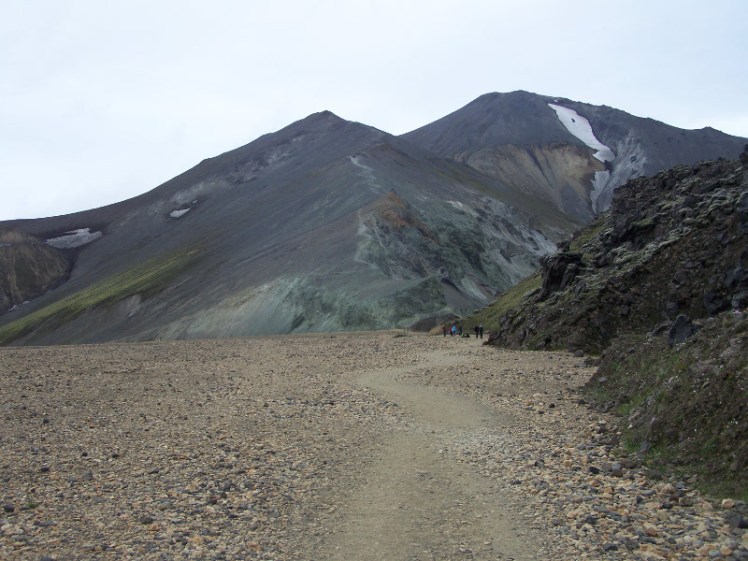
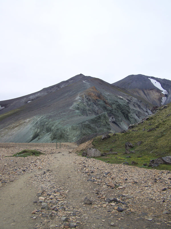
This is the entrance to the canyon, an enormous slab of green rock with a raw obsidian step. I took so many photos, trying to capture the otherwordly shade of of green but it just doesn’t come across properly. It’s the sort of green that makes the rest of the world look gaudy and weird and wrong. It’s formed of rhyolite, a kind of silica-rich form of granite which comes in so many colours – it’s what gives the mountains around Landmannalaugar their distinctive look.

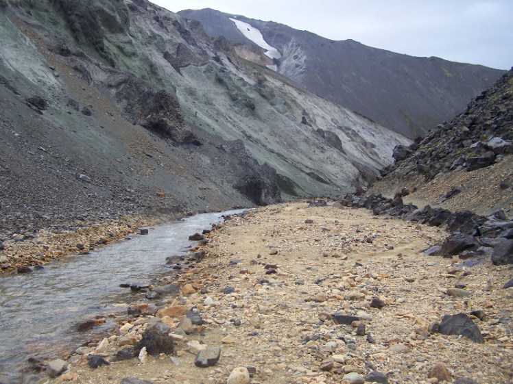
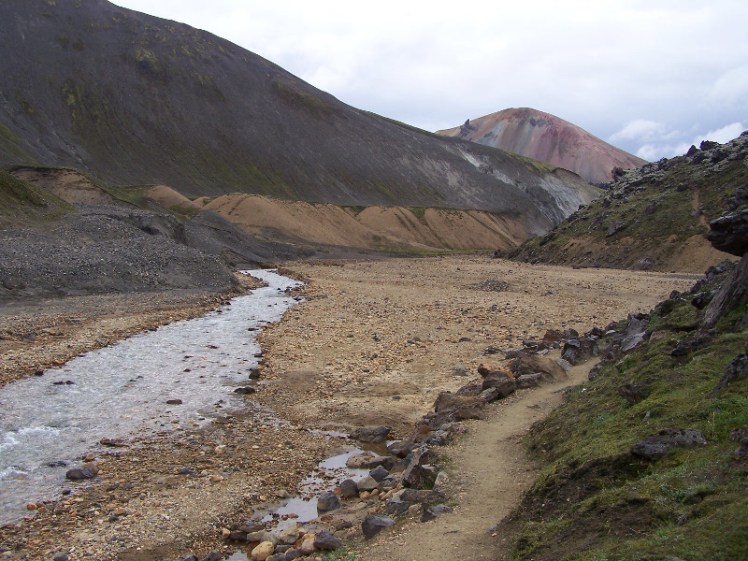
Inside, the canyon is predominantly orange – that is, the gravelly beach-like floor is orange. The stream is shallow but bubbly and it looks like the sort of stream I’d want to paddle in, if I didn’t know that this is almost definitely a glacial stream and therefore as cold as the cold side of Neptune.

Overlooking the canyon was a gorgeous grey and orange and pink striped mountain with some big black creepy eyes watching me.


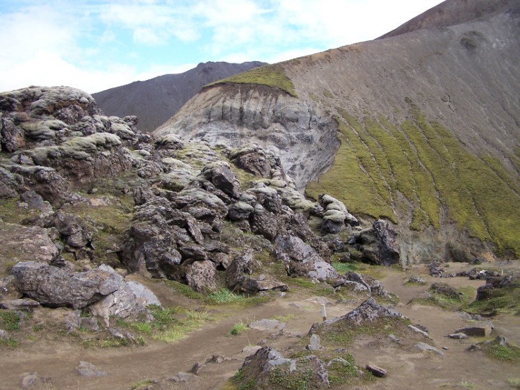
At the top of the canyon is a slightly awkward scramble up over the stream and then eventually onto the lava field. The view down the canyon was amazing and I was so tempted to carry on down there but that’s not where the path goes and besides, it’s not like the view across the lava field to the meadows and Highlands beyond.
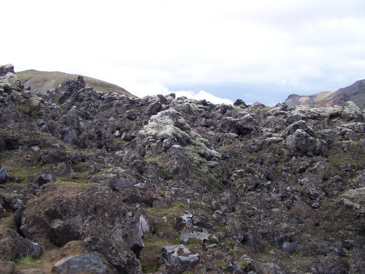


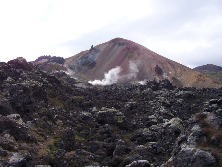
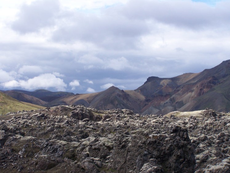

Looking at the photos, you’d hardly believe there’s a marked path across the lava field but it’s there, marked by wooden pegs with coloured stripes around them.


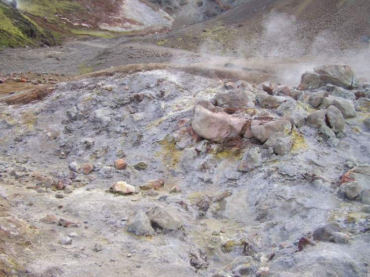

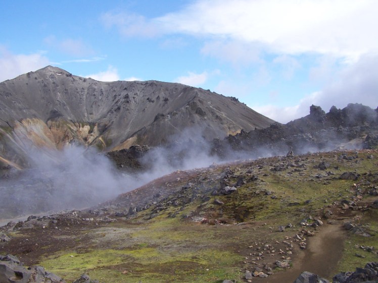
When you’ve picked your way across the lava field, you come out in a solfatara field, where great open wounds in the landscape steam, crusted with orange and white crumbly sulphur. They stink and yet they’re so magical – geothermal areas like this are fairly common in Iceland but I’d never ever experienced having one totally to myself with no tourists or cars anywhere in sight.


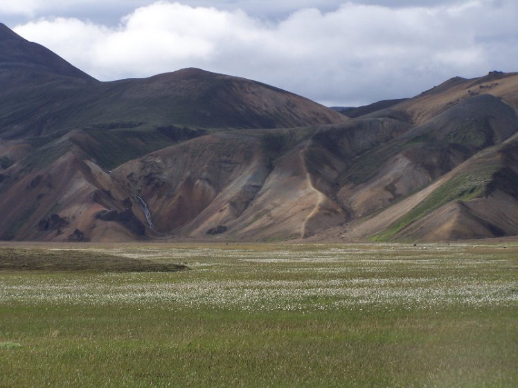
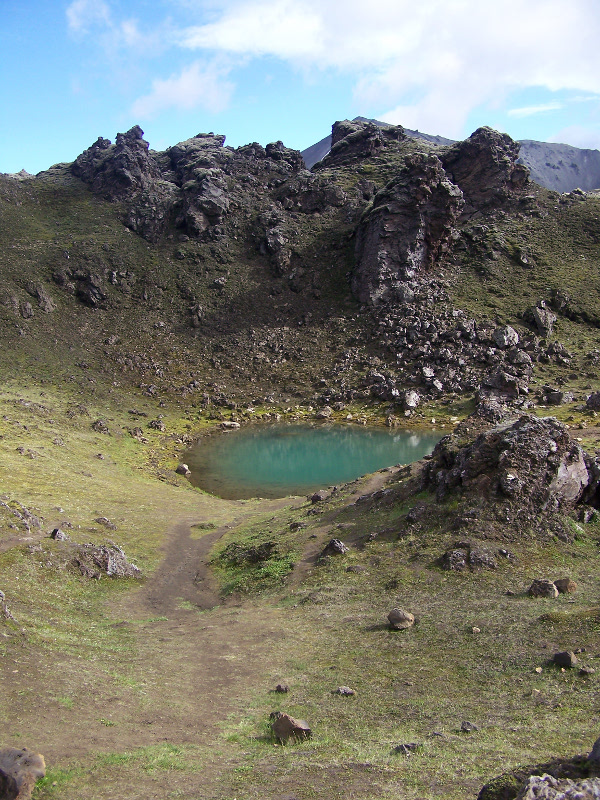
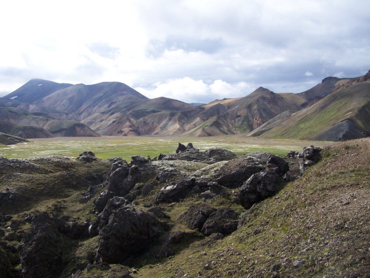
The next bit was a nice serene walk down beside the lava field, alongside flower-strewn meadows that I didn’t realise existed in the Highlands. But the area around Landmannalaugar isn’t typical of the Interior – this is a bright and colourful area prone to strong winds, rather than a cold grey desert prone to heavy rains and fogs.
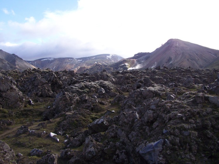
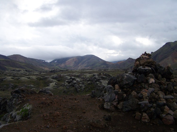


The last leg was back onto the lava field to have a look at the views again before climbing down the side of it and emerging back into the campsite just behind the hot spring. The timestamps on the photos suggest it took me about two hours to complete the walk.


That evening, with the tourists gone, I took to the hot spring, then went to the Mountain Shop and made myself a cup of hot chocolate before bed.
Today’s question for the comments: Tell me about something lovely you stumbled upon by accident – did you go for a walk you were unprepared for and come across a hidden jewel? Did you get off a bus or train in the wrong place?
One thought on “Landmannalaugar circular walk”